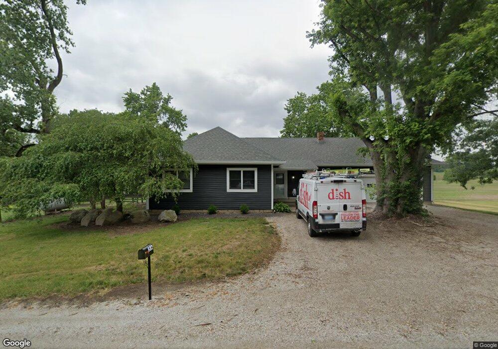
682 N County Road 450 W Frankfort, IN 46041
Estimated Value: $401,000 - $558,721
2
Beds
2
Baths
1,559
Sq Ft
$308/Sq Ft
Est. Value
About This Home
This home is located at 682 N County Road 450 W, Frankfort, IN 46041 and is currently estimated at $479,861, approximately $307 per square foot. 682 N County Road 450 W is a home located in Clinton County with nearby schools including Clinton Prairie Elementary School and Clinton Prairie Junior/Senior High School.
Ownership History
Date
Name
Owned For
Owner Type
Purchase Details
Closed on
Mar 14, 2013
Sold by
Kelley Barbara
Bought by
Kelley Matthew L
Current Estimated Value
Purchase Details
Closed on
Feb 9, 2013
Sold by
Kelley Barbara
Bought by
Kelley Matthew L
Purchase Details
Closed on
Apr 22, 2011
Sold by
Thompson Samuel S and Kelley Barbara
Bought by
Kelley Matthew L
Purchase Details
Closed on
Mar 23, 2009
Sold by
Thompson Blanche B
Bought by
Thompson Samuel S and Kelley Barbara
Create a Home Valuation Report for This Property
The Home Valuation Report is an in-depth analysis detailing your home's value as well as a comparison with similar homes in the area
Home Values in the Area
Average Home Value in this Area
Purchase History
| Date | Buyer | Sale Price | Title Company |
|---|---|---|---|
| Kelley Matthew L | -- | None Available | |
| Kelley Matthew L | -- | The Farmers Bank | |
| Kelley Matthew L | $2,000 | Title Insurance Services Inc | |
| Kelley Matthew L | -- | None Available | |
| Thompson Samuel S | -- | Barnes & Thornburg Llp |
Source: Public Records
Tax History Compared to Growth
Tax History
| Year | Tax Paid | Tax Assessment Tax Assessment Total Assessment is a certain percentage of the fair market value that is determined by local assessors to be the total taxable value of land and additions on the property. | Land | Improvement |
|---|---|---|---|---|
| 2024 | $6,169 | $460,900 | $275,900 | $185,000 |
| 2023 | $5,323 | $374,900 | $234,800 | $140,100 |
| 2022 | $5,086 | $331,600 | $191,400 | $140,200 |
| 2021 | $4,749 | $293,000 | $168,700 | $124,300 |
| 2020 | $4,894 | $292,600 | $167,600 | $125,000 |
| 2019 | $4,664 | $297,800 | $197,900 | $99,900 |
| 2018 | $4,620 | $303,200 | $203,300 | $99,900 |
| 2017 | $4,781 | $334,300 | $229,300 | $105,000 |
| 2016 | $4,635 | $353,100 | $249,900 | $103,200 |
| 2014 | $5,023 | $352,000 | $249,900 | $102,100 |
Source: Public Records
Map
Nearby Homes
- 4654 W County Road 200 N
- 5478 W State Road 28
- 5418 W Gas Line Rd
- 5809 W Gas Line Rd
- 6767 W Gas Line Rd
- 7255 W Mulberry Jefferson Rd
- 707 Blinn Ave
- 1432 S County Road 200 W
- 1258 Magnolia Ave
- 1401 W Morrison St
- 1750 S County Road 200 W
- 1300 Myrtle Ave
- 2718 S County Road 450 W
- 5979 State Route 38
- 951 W Paris St
- 907 Rowe St
- 902 Rossville Ave
- 356 S 7th St
- 5778 W County Road 300 S
- 450 W Green St
- 637 N County Road 450 W
- 4313 W 100 N
- 4874 W County Road 100 N
- 4965 W County Road 100 N
- 1206 N County Road 450 W
- 1302 450 W
- 5005 W County Road 100 N
- 187 N County Road 450 W
- 1475 N County Road 450 W
- 50 N County Road 450 W
- 27 N County Road 450 W
- 4388 W County Road 0 Ns
- 4440 W County Road 0 Ns
- 5281 W County Road 100 N
- 96 S County Road 450 W
- 1335 N County Road 530 W
- 4280 W County Road 0 Ns
- 220 S County Road 450 W
- 1755 N County Road 450 W