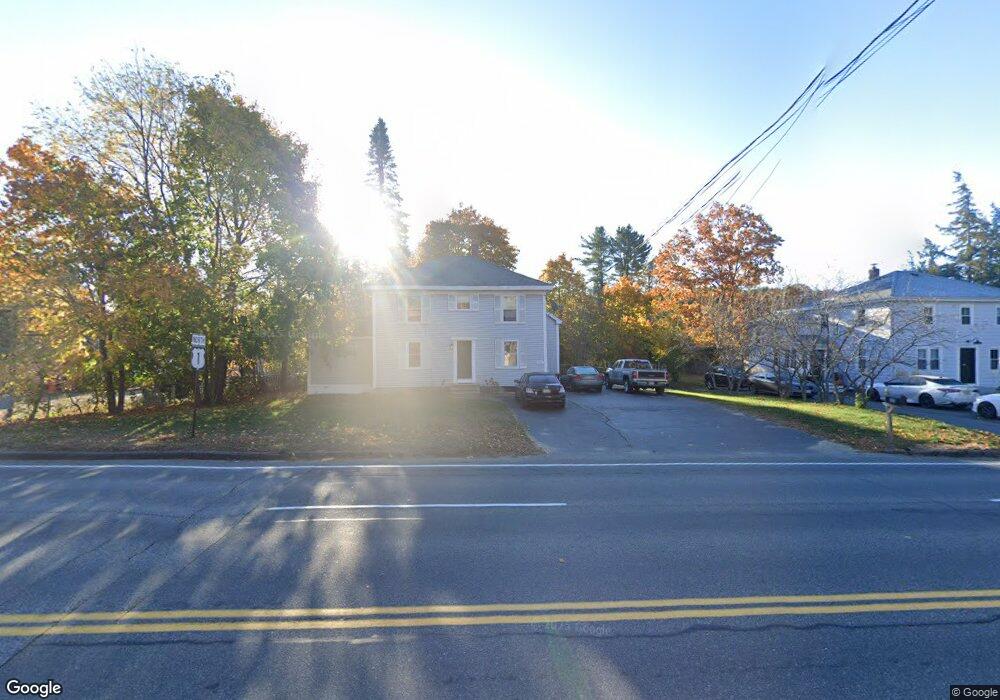
682 Us Route One Scarborough, ME 04074
Estimated Value: $428,000 - $754,000
2
Beds
2
Baths
1,938
Sq Ft
$302/Sq Ft
Est. Value
About This Home
This home is located at 682 Us Route One, Scarborough, ME 04074 and is currently estimated at $585,568, approximately $302 per square foot. 682 Us Route One is a home located in Cumberland County with nearby schools including Scarborough High School and Cornerstone Baptist Academy.
Ownership History
Date
Name
Owned For
Owner Type
Purchase Details
Closed on
Mar 31, 2021
Sold by
Kilmartin Properties Llc
Bought by
Kilmartin Michael J
Current Estimated Value
Home Financials for this Owner
Home Financials are based on the most recent Mortgage that was taken out on this home.
Original Mortgage
$241,000
Outstanding Balance
$216,888
Interest Rate
2.8%
Mortgage Type
Purchase Money Mortgage
Estimated Equity
$368,680
Purchase Details
Closed on
Sep 9, 2019
Sold by
Us Bank Na Tr
Bought by
Kilmartin Properties Llc
Home Financials for this Owner
Home Financials are based on the most recent Mortgage that was taken out on this home.
Original Mortgage
$235,000
Interest Rate
3.6%
Mortgage Type
New Conventional
Create a Home Valuation Report for This Property
The Home Valuation Report is an in-depth analysis detailing your home's value as well as a comparison with similar homes in the area
Home Values in the Area
Average Home Value in this Area
Purchase History
| Date | Buyer | Sale Price | Title Company |
|---|---|---|---|
| Kilmartin Michael J | -- | None Available | |
| Kilmartin Properties Llc | $227,500 | -- |
Source: Public Records
Mortgage History
| Date | Status | Borrower | Loan Amount |
|---|---|---|---|
| Open | Kilmartin Michael J | $241,000 | |
| Previous Owner | Kilmartin Properties Llc | $235,000 |
Source: Public Records
Tax History Compared to Growth
Tax History
| Year | Tax Paid | Tax Assessment Tax Assessment Total Assessment is a certain percentage of the fair market value that is determined by local assessors to be the total taxable value of land and additions on the property. | Land | Improvement |
|---|---|---|---|---|
| 2024 | $4,322 | $395,400 | $141,900 | $253,500 |
| 2023 | $4,593 | $287,600 | $93,400 | $194,200 |
| 2022 | $4,426 | $287,600 | $93,400 | $194,200 |
| 2021 | $4,320 | $287,600 | $93,400 | $194,200 |
| 2020 | $4,274 | $287,600 | $93,400 | $194,200 |
| 2019 | $4,228 | $287,600 | $93,400 | $194,200 |
| 2017 | $2,782 | $168,700 | $66,300 | $102,400 |
| 2016 | $2,686 | $168,700 | $66,300 | $102,400 |
| 2015 | $2,613 | $168,700 | $66,300 | $102,400 |
| 2014 | $2,547 | $168,700 | $66,300 | $102,400 |
| 2013 | $2,492 | $168,700 | $66,300 | $102,400 |
Source: Public Records
Map
Nearby Homes
- 10 Foxwell Dr
- 19 Paulsen Dr
- 9 Paulsen Dr
- 38 Church St
- 31 Old Blue Point Rd
- 626 Us Route 1
- 1 Griffin Rd
- 192 Stewart Dr
- 36 Pine Point Rd
- 149 Stewart Dr
- 153 Stewart Dr
- 159 Stewart Dr
- Lot 5 Jean's Way
- 90 Broadturn Rd Unit 9
- 4 Lodge Dr
- 46 Payne Rd
- 79 Creeks Edge Dr
- 81 Creeks Edge Dr
- 96C Broadturn Rd
- 77 Creeks Edge Dr
- 682 Us Route 1
- 682 U S 1
- 680 Us Route 1
- 684 Us Route 1
- 684 U S 1
- 686 U S Route One
- 686 Us Route 1
- 686 Us Route 1
- LOT 4-A Old Blue Point Rd
- 683 Us Route 1
- 7 Old Blue Point Rd
- 681 Us Route 1
- 685 Us Route 1
- 676 Us Route 1
- 6 Old Blue Point Rd
- Lot23 Sea Ridge
- Lot 50 Sea Ridge
- 674 Us Route 1
- 687 Us Route 1
- 9 Old Blue Point Rd