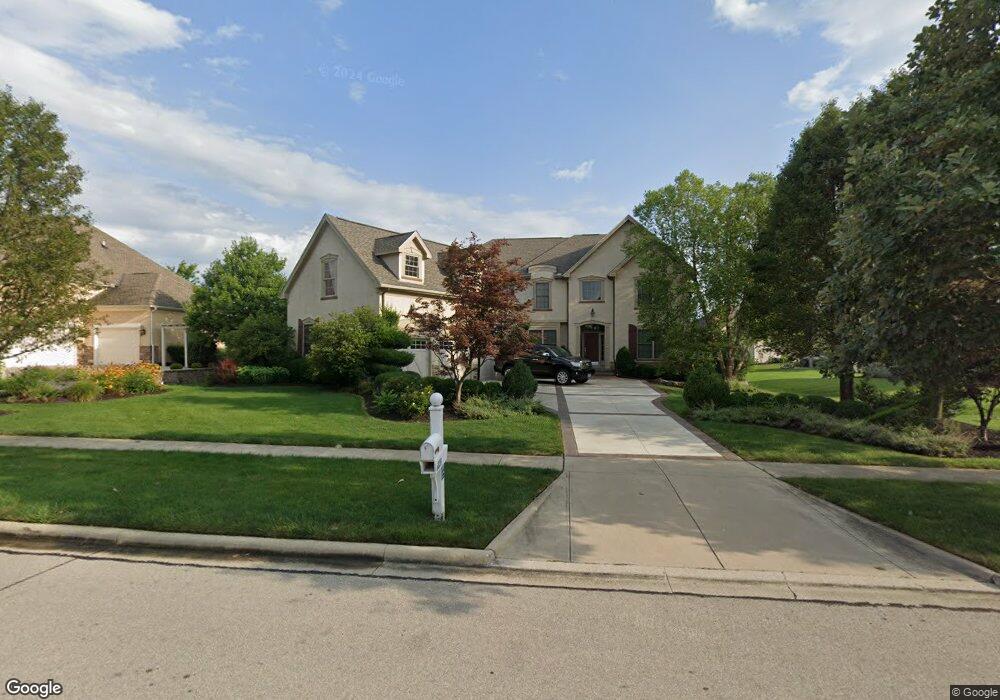
6820 Rob Roy Dr Dublin, OH 43017
Concord NeighborhoodEstimated Value: $1,003,481 - $1,172,000
5
Beds
4
Baths
4,660
Sq Ft
$240/Sq Ft
Est. Value
About This Home
This home is located at 6820 Rob Roy Dr, Dublin, OH 43017 and is currently estimated at $1,116,370, approximately $239 per square foot. 6820 Rob Roy Dr is a home located in Delaware County with nearby schools including Eli Pinney Elementary School, Willard Grizzell Middle School, and Dublin Jerome High School.
Ownership History
Date
Name
Owned For
Owner Type
Purchase Details
Closed on
Nov 10, 2006
Sold by
Truberry Group Inc
Bought by
Rahman Rezaur and Nahar Shamsun
Current Estimated Value
Home Financials for this Owner
Home Financials are based on the most recent Mortgage that was taken out on this home.
Original Mortgage
$91,518
Outstanding Balance
$55,019
Interest Rate
6.41%
Mortgage Type
Unknown
Estimated Equity
$1,061,351
Purchase Details
Closed on
Mar 21, 2006
Sold by
Nhg Development Group Ltd
Bought by
Truberry Group Inc
Home Financials for this Owner
Home Financials are based on the most recent Mortgage that was taken out on this home.
Original Mortgage
$5,730,000
Interest Rate
6.34%
Mortgage Type
Credit Line Revolving
Create a Home Valuation Report for This Property
The Home Valuation Report is an in-depth analysis detailing your home's value as well as a comparison with similar homes in the area
Home Values in the Area
Average Home Value in this Area
Purchase History
| Date | Buyer | Sale Price | Title Company |
|---|---|---|---|
| Rahman Rezaur | $610,200 | Stewart Title | |
| Truberry Group Inc | $93,000 | Stewart Title Agency Of Ohio |
Source: Public Records
Mortgage History
| Date | Status | Borrower | Loan Amount |
|---|---|---|---|
| Open | Rahman Rezaur | $91,518 | |
| Open | Rahman Rezaur | $488,096 | |
| Closed | Truberry Group Inc | $5,730,000 |
Source: Public Records
Tax History Compared to Growth
Tax History
| Year | Tax Paid | Tax Assessment Tax Assessment Total Assessment is a certain percentage of the fair market value that is determined by local assessors to be the total taxable value of land and additions on the property. | Land | Improvement |
|---|---|---|---|---|
| 2024 | $17,300 | $306,640 | $48,340 | $258,300 |
| 2023 | $17,222 | $306,640 | $48,340 | $258,300 |
| 2022 | $14,455 | $239,790 | $36,750 | $203,040 |
| 2021 | $14,698 | $239,790 | $36,750 | $203,040 |
| 2020 | $14,745 | $239,790 | $36,750 | $203,040 |
| 2019 | $15,859 | $230,130 | $36,750 | $193,380 |
| 2018 | $16,017 | $230,130 | $36,750 | $193,380 |
| 2017 | $14,483 | $206,050 | $34,230 | $171,820 |
| 2016 | $13,783 | $206,050 | $34,230 | $171,820 |
| 2015 | $13,724 | $206,050 | $34,230 | $171,820 |
| 2014 | $13,873 | $206,050 | $34,230 | $171,820 |
| 2013 | $13,856 | $201,040 | $34,230 | $166,810 |
Source: Public Records
Map
Nearby Homes
- 0 Sunset Dr
- 6512 Harriott Rd
- 7022 Brodie Blvd
- 60 Buckeye Dr
- 0 N Park Place W Unit 225035823
- 5681 Morlich Square
- 5640 Morlich Square
- 0 Dublin Rd Unit 225011118
- 35 E Muskingum Dr
- 35 E Pawnee Dr
- Verona Plan at The Courtyards on Concord
- Torino Plan at The Courtyards on Concord
- Provenance Plan at The Courtyards on Concord
- Promenade Plan at The Courtyards on Concord
- 9190 Leith Dr
- 9366 Muirkirk Dr
- 9280 Leith Dr
- 7931 Tillinghast Dr
- 5514 Loch More Ct E
- 10007 Allen Dr
- 6844 Rob Roy Dr
- 6600 Brodie Blvd
- 6580 Brodie Blvd
- 6864 Rob Roy Dr
- 6560 Brodie Blvd
- 6829 Rob Roy Dr
- 6787 Rob Roy Dr
- 6544 Brodie Blvd
- 6884 Rob Roy Dr
- 9789 Macdonald Dr
- 9772 Macdonald Dr
- 6530 Brodie Blvd
- 6650 Brodie Blvd
- 6605 Brodie Blvd
- 6605 Brodie Blvd Unit 505
- 6589 Brodie Blvd
- 6910 Rob Roy Dr
- 6573 Brodie Blvd
- 6619 Brodie Blvd
- 9790 Macdonald Dr