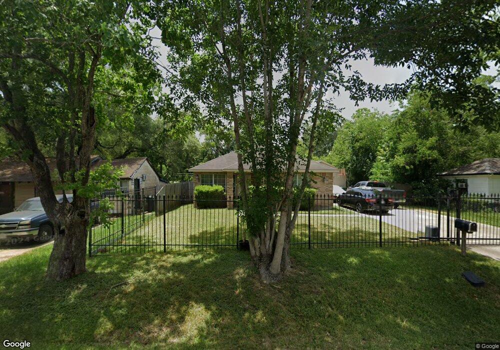
6820 Sherwood Dr Houston, TX 77021
OST-South Union NeighborhoodEstimated Value: $232,000 - $262,000
3
Beds
2
Baths
1,305
Sq Ft
$189/Sq Ft
Est. Value
About This Home
This home is located at 6820 Sherwood Dr, Houston, TX 77021 and is currently estimated at $247,256, approximately $189 per square foot. 6820 Sherwood Dr is a home located in Harris County with nearby schools including Marcellus Elliot Foster Elementary, Cullen Middle School, and Yates High School.
Ownership History
Date
Name
Owned For
Owner Type
Purchase Details
Closed on
Aug 8, 2014
Sold by
Nauls Stanford
Bought by
Gayle Jimmy
Current Estimated Value
Purchase Details
Closed on
Dec 1, 2005
Sold by
Ross Vada M and White Arrine
Bought by
Nauls Inc
Purchase Details
Closed on
Apr 27, 1998
Sold by
Khera Tirath S
Bought by
Scott Tracy and Jordan Scott Filliane M
Home Financials for this Owner
Home Financials are based on the most recent Mortgage that was taken out on this home.
Original Mortgage
$61,950
Interest Rate
7.09%
Create a Home Valuation Report for This Property
The Home Valuation Report is an in-depth analysis detailing your home's value as well as a comparison with similar homes in the area
Home Values in the Area
Average Home Value in this Area
Purchase History
| Date | Buyer | Sale Price | Title Company |
|---|---|---|---|
| Gayle Jimmy | -- | None Available | |
| Nauls Inc | $10,600 | -- | |
| Scott Tracy | -- | American Title Co |
Source: Public Records
Mortgage History
| Date | Status | Borrower | Loan Amount |
|---|---|---|---|
| Previous Owner | Scott Tracy | $61,950 |
Source: Public Records
Tax History Compared to Growth
Tax History
| Year | Tax Paid | Tax Assessment Tax Assessment Total Assessment is a certain percentage of the fair market value that is determined by local assessors to be the total taxable value of land and additions on the property. | Land | Improvement |
|---|---|---|---|---|
| 2025 | $1,766 | $266,385 | $120,920 | $145,465 |
| 2024 | $1,766 | $268,233 | $120,920 | $147,313 |
| 2023 | $1,766 | $268,495 | $108,828 | $159,667 |
| 2022 | $2,859 | $216,076 | $84,644 | $131,432 |
| 2021 | $2,751 | $190,359 | $54,414 | $135,945 |
| 2020 | $2,598 | $155,162 | $36,276 | $118,886 |
| 2019 | $2,468 | $150,388 | $30,230 | $120,158 |
| 2018 | $1,502 | $98,543 | $21,161 | $77,382 |
| 2017 | $2,038 | $84,295 | $15,115 | $69,180 |
| 2016 | $1,853 | $84,295 | $15,115 | $69,180 |
| 2015 | $1,573 | $73,658 | $15,115 | $58,543 |
| 2014 | $1,573 | $61,200 | $15,115 | $46,085 |
Source: Public Records
Map
Nearby Homes
- 4405 Ward St
- 4510 Ward St
- 4508 Ward St
- 4616 Ward St
- 6725 Saint Augustine St
- 6807 Saint Augustine St
- 6719 Saint Augustine St
- 6721 Saint Augustine St
- 6717 Saint Augustine St
- 4019 Ward St
- 4017 Ward St
- 4110 Ward St
- 6715 Saint Augustine St
- 4015 Ward St
- 4013 Ward St
- 4011 Ward St
- 6805 Conley St
- 6809 Conley St Unit C
- 6802 England St
- 6701 Conley St
- 6816 Sherwood Dr
- 6824 Sherwood Dr
- 6821 Beachwood St
- 6825 Beachwood
- 6817 Beachwood St
- 6812 Sherwood Dr
- 6829 Sherwood Dr
- 6821 Sherwood Dr
- 6815 Beachwood St Unit 4
- 6815 Beachwood St
- 6815 Beachwood St Unit 3
- 6815 Beachwood St Unit 2
- 6815 Beachwood St Unit 1
- 6817 Sherwood Dr
- 6825 Sherwood Dr
- 6832 Sherwood Dr
- 6813 Sherwood Dr
- 6833 Beachwood St
- 3942 Ward St
- 3938 Ward St