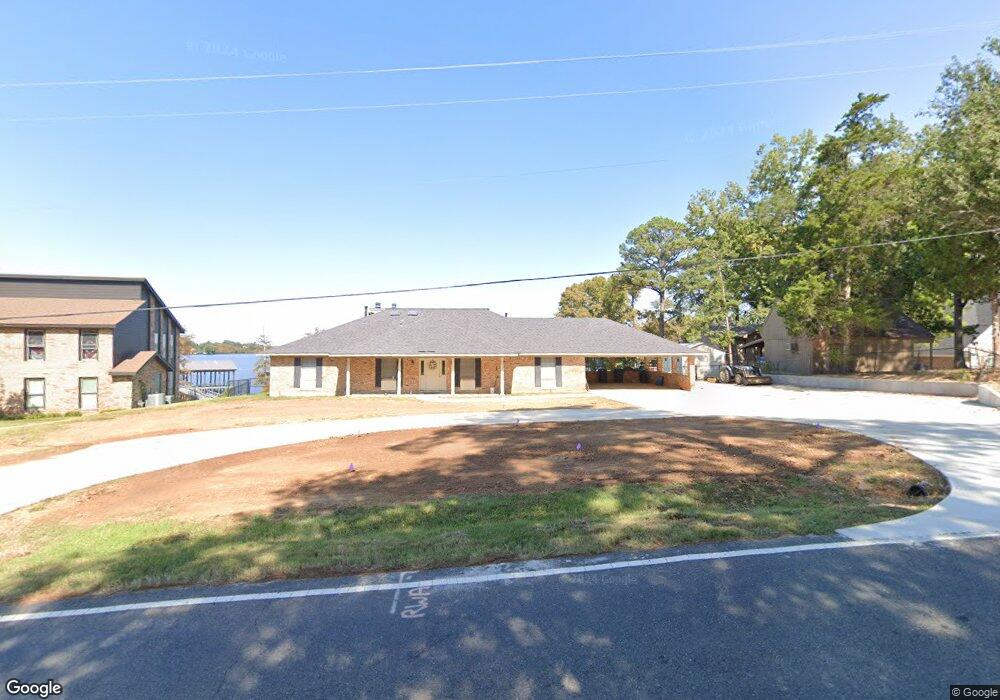
6822 S Lakeshore Dr Shreveport, LA 71119
Western Hills-Yarborough NeighborhoodEstimated Value: $325,000 - $572,000
3
Beds
2
Baths
3,144
Sq Ft
$132/Sq Ft
Est. Value
About This Home
This home is located at 6822 S Lakeshore Dr, Shreveport, LA 71119 and is currently estimated at $416,389, approximately $132 per square foot. 6822 S Lakeshore Dr is a home located in Caddo Parish with nearby schools including Judson Fundamental Elementary School, Fairfield Magnet School, and Claiborne Fundamental Elementary School.
Ownership History
Date
Name
Owned For
Owner Type
Purchase Details
Closed on
Feb 25, 2021
Sold by
Roach Louis Glenn and Roach Debra Ann
Bought by
Roach Trust
Current Estimated Value
Purchase Details
Closed on
Sep 14, 2016
Sold by
Holtsclaw Patricia Purnell
Bought by
Roach Louis G and Roach Debra M
Home Financials for this Owner
Home Financials are based on the most recent Mortgage that was taken out on this home.
Original Mortgage
$175,000
Interest Rate
3.43%
Mortgage Type
New Conventional
Create a Home Valuation Report for This Property
The Home Valuation Report is an in-depth analysis detailing your home's value as well as a comparison with similar homes in the area
Home Values in the Area
Average Home Value in this Area
Purchase History
| Date | Buyer | Sale Price | Title Company |
|---|---|---|---|
| Roach Trust | -- | None Available | |
| Roach Louis G | $375,000 | Multiple |
Source: Public Records
Mortgage History
| Date | Status | Borrower | Loan Amount |
|---|---|---|---|
| Previous Owner | Roach Louis G | $175,000 |
Source: Public Records
Tax History Compared to Growth
Tax History
| Year | Tax Paid | Tax Assessment Tax Assessment Total Assessment is a certain percentage of the fair market value that is determined by local assessors to be the total taxable value of land and additions on the property. | Land | Improvement |
|---|---|---|---|---|
| 2024 | $5,868 | $37,641 | $15,834 | $21,807 |
| 2023 | $5,648 | $35,436 | $15,080 | $20,356 |
| 2022 | $5,648 | $35,436 | $15,080 | $20,356 |
| 2021 | $5,562 | $35,436 | $15,080 | $20,356 |
| 2020 | $5,562 | $35,436 | $15,080 | $20,356 |
| 2019 | $5,805 | $35,894 | $15,080 | $20,814 |
| 2018 | $4,622 | $35,894 | $15,080 | $20,814 |
| 2017 | $5,897 | $35,894 | $15,080 | $20,814 |
| 2015 | $3,498 | $34,490 | $15,080 | $19,410 |
| 2014 | $3,525 | $34,490 | $15,080 | $19,410 |
| 2013 | -- | $34,490 | $15,080 | $19,410 |
Source: Public Records
Map
Nearby Homes
- TBD Shorewood Dr
- 6701 Long Timbers Dr
- 0 Bonnieview Rd Unit 25791588
- 7334 Saybrook Cir
- 2918 Bonnieview Rd
- 2912 Brookline Dr
- 7780 S Lakeshore Dr
- 7206 S Lakeshore Dr
- 3020 Pines Rd
- 3073 Risinger Dr
- 0 Kingfish Dr
- 6259 S Lakeshore Dr
- 3053 Pines Rd
- 3045 Risinger Dr
- 6144 S Lakeshore Dr
- 3030 Duncan Dr
- 0 Duncan Dr
- 414 Cross Ridge Ct
- 0 Bird Island Ln Unit 2512911
- 0 Bird Island Unit 20998098
- 6820 S Lakeshore Dr
- 6824 S Lakeshore Dr
- 6808 S Lakeshore Dr
- 2948 Moss Point Dr
- 2948 Moss Point Dr
- 6910 S Lakeshore Dr
- 6914 S Lakeshore Dr
- 2934 Moss Point Dr
- 6918 S Lakeshore Dr
- 2945 Moss Point Dr
- 6909 S Lakeshore Dr
- 2929 Moss Point Dr
- 2924 Moss Point Dr
- 6926 S Lakeshore Dr
- 6915 S Lakeshore Dr
- 2933 Moss Point Dr
- 6930 S Lakeshore Dr
- 2949 Moss Point Dr
- 6923 S Lakeshore Dr
- 2914 Moss Point Dr