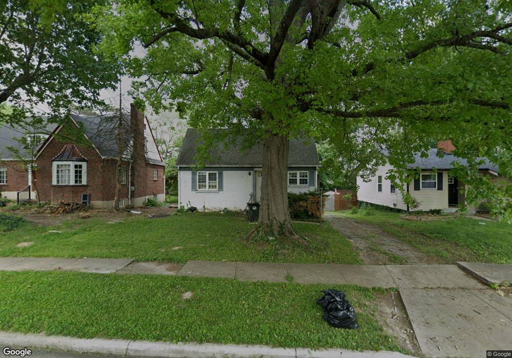
6822 Sampson Ln Cincinnati, OH 45236
Estimated Value: $180,707 - $213,000
1
Bed
1
Bath
752
Sq Ft
$255/Sq Ft
Est. Value
About This Home
This home is located at 6822 Sampson Ln, Cincinnati, OH 45236 and is currently estimated at $191,427, approximately $254 per square foot. 6822 Sampson Ln is a home located in Hamilton County with nearby schools including Silverton Paideia Elementary School, Shroder High School, and Clark Montessori High School.
Ownership History
Date
Name
Owned For
Owner Type
Purchase Details
Closed on
Mar 18, 1996
Sold by
Johnson Jane D and Johnson Robert
Bought by
Cress Beve
Current Estimated Value
Home Financials for this Owner
Home Financials are based on the most recent Mortgage that was taken out on this home.
Original Mortgage
$43,600
Outstanding Balance
$1,715
Interest Rate
7.06%
Estimated Equity
$189,712
Create a Home Valuation Report for This Property
The Home Valuation Report is an in-depth analysis detailing your home's value as well as a comparison with similar homes in the area
Home Values in the Area
Average Home Value in this Area
Purchase History
| Date | Buyer | Sale Price | Title Company |
|---|---|---|---|
| Cress Beve | $54,500 | -- |
Source: Public Records
Mortgage History
| Date | Status | Borrower | Loan Amount |
|---|---|---|---|
| Open | Cress Beve | $43,600 |
Source: Public Records
Tax History Compared to Growth
Tax History
| Year | Tax Paid | Tax Assessment Tax Assessment Total Assessment is a certain percentage of the fair market value that is determined by local assessors to be the total taxable value of land and additions on the property. | Land | Improvement |
|---|---|---|---|---|
| 2024 | $2,053 | $35,907 | $12,170 | $23,737 |
| 2023 | $2,098 | $35,907 | $12,170 | $23,737 |
| 2022 | $1,537 | $22,250 | $9,156 | $13,094 |
| 2021 | $1,497 | $22,250 | $9,156 | $13,094 |
| 2020 | $1,520 | $22,250 | $9,156 | $13,094 |
| 2019 | $1,656 | $21,816 | $8,978 | $12,838 |
| 2018 | $1,658 | $21,816 | $8,978 | $12,838 |
| 2017 | $1,585 | $21,816 | $8,978 | $12,838 |
| 2016 | $1,634 | $22,093 | $8,082 | $14,011 |
| 2015 | $1,478 | $22,093 | $8,082 | $14,011 |
| 2014 | $1,487 | $22,093 | $8,082 | $14,011 |
| 2013 | $1,679 | $24,546 | $8,978 | $15,568 |
Source: Public Records
Map
Nearby Homes
- 6733 Stoll Ln
- 6724 Elwynne Dr
- 6829 Alpine Ave
- 6705 Elwynne Dr
- 4248 South Ave
- 3913 E Gatewood Ln
- 3910 E Gatewood Ln
- 3908 E Gatewood Ln
- 6566 Stewart Rd
- 5780 Woodsway Dr
- 3842 S Broadlawn Cir
- 3849 Oak Crest Ave
- 6535 Highland Ave
- 6914 Montgomery Rd
- 7195 Maryland Ave
- 7215 Maryland Ave
- 6773 Siebern Ave
- 7620 Montgomery Rd
- 7225 Virginia Ave
- 7237 Virginia Ave
- 6818 Sampson Ln
- 6826 Sampson Ln
- 6812 Sampson Ln
- 6830 Sampson Ln
- 6812 Samspon Ln
- 6819 Elwynne Dr
- 6808 Sampson Ln
- 6827 Elwynne Dr
- 6834 Sampson Ln
- 6815 Elwynne Dr
- 6831 Elwynne Dr
- 4123 Saint James Ave
- 4123 Saint James Ave Unit 2
- 6838 Sampson Ln
- 6804 Sampson Ln
- 6811 Elwynne Dr
- 6835 Elwynne Dr
- 4119 Saint James Ave
- 6807 Elwynne Dr
- 6839 Elwynne Dr