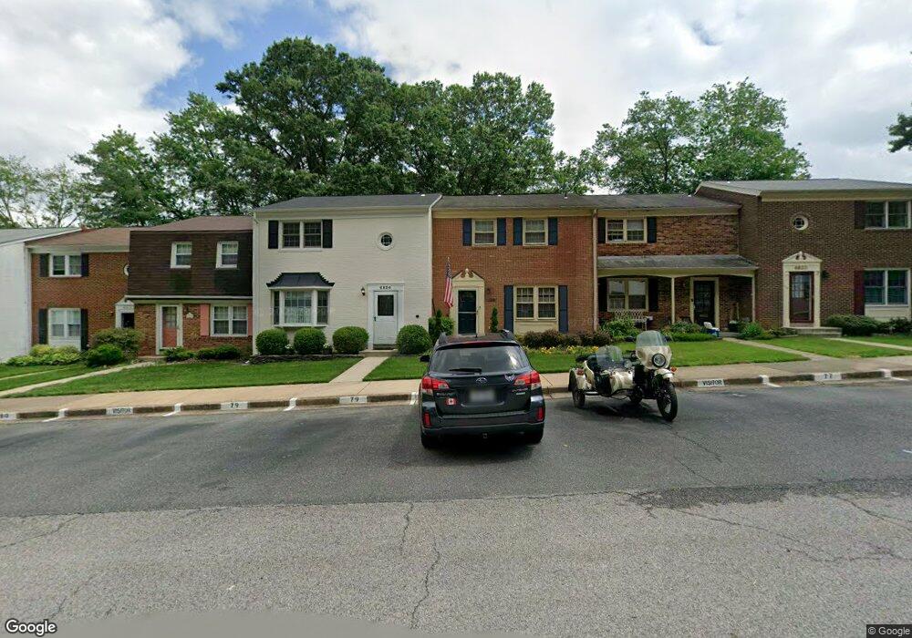
6826 Brian Michael Ct Springfield, VA 22153
Estimated Value: $568,580 - $607,000
3
Beds
4
Baths
1,408
Sq Ft
$416/Sq Ft
Est. Value
About This Home
This home is located at 6826 Brian Michael Ct, Springfield, VA 22153 and is currently estimated at $585,145, approximately $415 per square foot. 6826 Brian Michael Ct is a home located in Fairfax County with nearby schools including Orange Hunt Elementary School, Irving Middle School, and West Springfield High School.
Ownership History
Date
Name
Owned For
Owner Type
Purchase Details
Closed on
Jul 26, 2022
Sold by
Hagenow Andrew R
Bought by
Andrew And Patricia Hagenow Family Trust
Current Estimated Value
Purchase Details
Closed on
Mar 29, 2001
Sold by
Plaag Constance R
Bought by
Hagenow Andrew R
Home Financials for this Owner
Home Financials are based on the most recent Mortgage that was taken out on this home.
Original Mortgage
$145,000
Interest Rate
6.96%
Purchase Details
Closed on
Feb 11, 1997
Sold by
Plaag Constance R and Plaag Hugo W
Bought by
Constance R Plaag Lv Tr
Create a Home Valuation Report for This Property
The Home Valuation Report is an in-depth analysis detailing your home's value as well as a comparison with similar homes in the area
Home Values in the Area
Average Home Value in this Area
Purchase History
| Date | Buyer | Sale Price | Title Company |
|---|---|---|---|
| Andrew And Patricia Hagenow Family Trust | -- | None Listed On Document | |
| Hagenow Andrew R | $152,800 | -- | |
| Constance R Plaag Lv Tr | -- | -- |
Source: Public Records
Mortgage History
| Date | Status | Borrower | Loan Amount |
|---|---|---|---|
| Previous Owner | Hagenow Andrew R | $145,000 |
Source: Public Records
Tax History
| Year | Tax Paid | Tax Assessment Tax Assessment Total Assessment is a certain percentage of the fair market value that is determined by local assessors to be the total taxable value of land and additions on the property. | Land | Improvement |
|---|---|---|---|---|
| 2025 | $5,842 | $522,490 | $165,000 | $357,490 |
| 2024 | $5,842 | $504,250 | $150,000 | $354,250 |
| 2023 | $5,396 | $478,200 | $150,000 | $328,200 |
| 2022 | $5,241 | $458,330 | $145,000 | $313,330 |
| 2021 | $4,913 | $418,700 | $130,000 | $288,700 |
| 2020 | $4,690 | $396,300 | $110,000 | $286,300 |
| 2019 | $4,509 | $380,970 | $110,000 | $270,970 |
| 2018 | $4,199 | $365,100 | $100,000 | $265,100 |
| 2017 | $4,239 | $365,100 | $100,000 | $265,100 |
| 2016 | $4,059 | $350,360 | $90,000 | $260,360 |
| 2015 | $3,641 | $326,220 | $80,000 | $246,220 |
| 2014 | $3,184 | $285,980 | $70,000 | $215,980 |
Source: Public Records
Map
Nearby Homes
- 9121 Donna Dean Dr
- 9101 Old Keene Mill Rd
- 9429 Goldfield Ln
- 6515 Field Master Dr
- 8967 Omega Ct
- 8905 Side Saddle Rd
- 7121 Red Horse Tavern Ln
- 6901 Huntsman Blvd
- 6360 Draco St
- 7140 Hamor Ln
- 7200 Beachway Ct
- 6607 Grey Fox Dr
- 6622 Crayford St
- 6319 Fenestra Ct Unit 138A
- 9202 Rockefeller Ln
- 6606 Huntsman Blvd
- 6352 Shaundale Dr
- 9712 Klimt Ct
- 9512 Meadow Grove Ct
- 9022 Gavelwood Ct
- 6824 Brian Michael Ct
- 6828 Brian Michael Ct
- 6822 Brian Michael Ct
- 6830 Brian Michael Ct
- 6832 Brian Michael Ct
- 6820 Brian Michael Ct
- 6834 Brian Michael Ct
- 6806 Brian Michael Ct
- 9100 Conservation Way
- 6827 Brian Michael Ct
- 6829 Brian Michael Ct
- 6825 Brian Michael Ct
- 6844 Brian Michael Ct
- 9102 Conservation Way
- 6831 Brian Michael Ct
- 6823 Brian Michael Ct
- 6802 Brian Michael Ct
- 6821 Brian Michael Ct
- 6846 Brian Michael Ct
- 6833 Brian Michael Ct
Your Personal Tour Guide
Ask me questions while you tour the home.