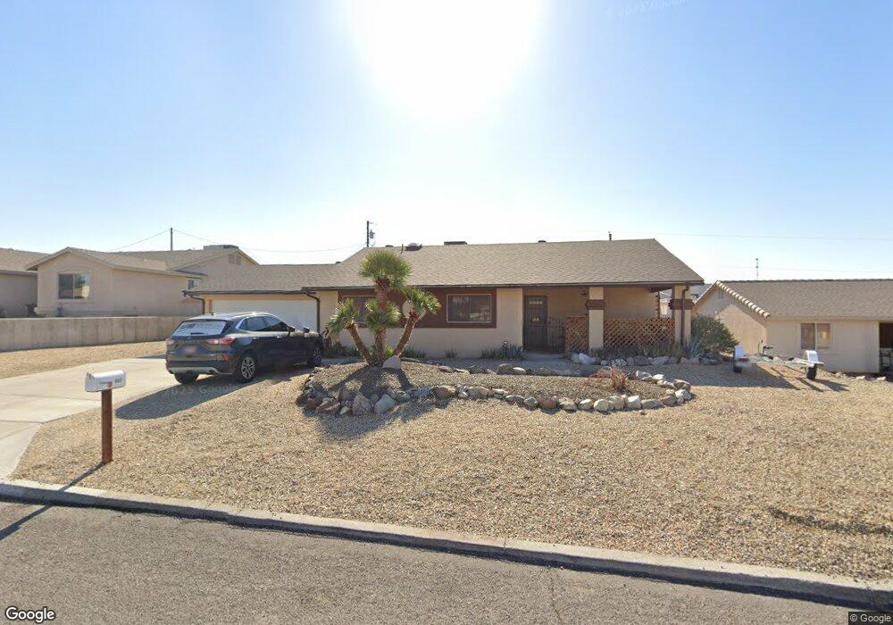
683 Apache Dr Lake Havasu City, AZ 86406
Estimated Value: $386,306 - $508,000
3
Beds
2
Baths
1,560
Sq Ft
$295/Sq Ft
Est. Value
About This Home
This home is located at 683 Apache Dr, Lake Havasu City, AZ 86406 and is currently estimated at $460,577, approximately $295 per square foot. 683 Apache Dr is a home located in Mohave County with nearby schools including Starline Elementary School, Thunderbolt Middle School, and Lake Havasu High School.
Ownership History
Date
Name
Owned For
Owner Type
Purchase Details
Closed on
Apr 17, 2009
Sold by
Deutsche Bank National Trust Company
Bought by
Hines Andrea L and Levings Adam J
Current Estimated Value
Home Financials for this Owner
Home Financials are based on the most recent Mortgage that was taken out on this home.
Original Mortgage
$161,519
Outstanding Balance
$101,446
Interest Rate
4.82%
Mortgage Type
FHA
Estimated Equity
$359,131
Purchase Details
Closed on
Feb 13, 2009
Sold by
Nash Brian A and Nash Kimberly L
Bought by
Deutsche Bank National Trust Company
Create a Home Valuation Report for This Property
The Home Valuation Report is an in-depth analysis detailing your home's value as well as a comparison with similar homes in the area
Home Values in the Area
Average Home Value in this Area
Purchase History
| Date | Buyer | Sale Price | Title Company |
|---|---|---|---|
| Hines Andrea L | $164,500 | First American Title Ins Co | |
| Deutsche Bank National Trust Company | $150,884 | Chicago Title Ins Co |
Source: Public Records
Mortgage History
| Date | Status | Borrower | Loan Amount |
|---|---|---|---|
| Open | Hines Andrea L | $161,519 |
Source: Public Records
Tax History Compared to Growth
Tax History
| Year | Tax Paid | Tax Assessment Tax Assessment Total Assessment is a certain percentage of the fair market value that is determined by local assessors to be the total taxable value of land and additions on the property. | Land | Improvement |
|---|---|---|---|---|
| 2026 | $560 | -- | -- | -- |
| 2025 | $1,133 | $34,821 | $0 | $0 |
| 2024 | $1,133 | $37,298 | $0 | $0 |
| 2023 | $1,133 | $30,736 | $0 | $0 |
| 2022 | $1,091 | $23,228 | $0 | $0 |
| 2021 | $1,274 | $21,293 | $0 | $0 |
| 2019 | $1,212 | $17,916 | $0 | $0 |
| 2018 | $1,173 | $16,413 | $0 | $0 |
| 2017 | $1,154 | $15,471 | $0 | $0 |
| 2016 | $1,027 | $13,990 | $0 | $0 |
| 2015 | $1,001 | $11,950 | $0 | $0 |
Source: Public Records
Map
Nearby Homes
- 2970 War Eagle Dr
- 3135 Cotati Dr
- 532 Roanoke Dr
- 2910 Coconino Dr
- 700 Apache Dr
- 786 Powder Dr
- 3150 Star Dr
- 3066 Star Dr
- 3040 Gypsy Dr
- 680 Yosemite Dr
- 2951 Saddleback Dr
- 2997 Edgewood Dr
- 815 Rolling Hills Plaza N
- 2890 Yuma Dr
- 691 Rolling Hills Dr
- 2876 Plaza Del Oro
- 670 Avenida Laredo
- 850 Thunderbolt Ave
- 3261 Thundercloud Dr
- 2820 Indian Springs Dr