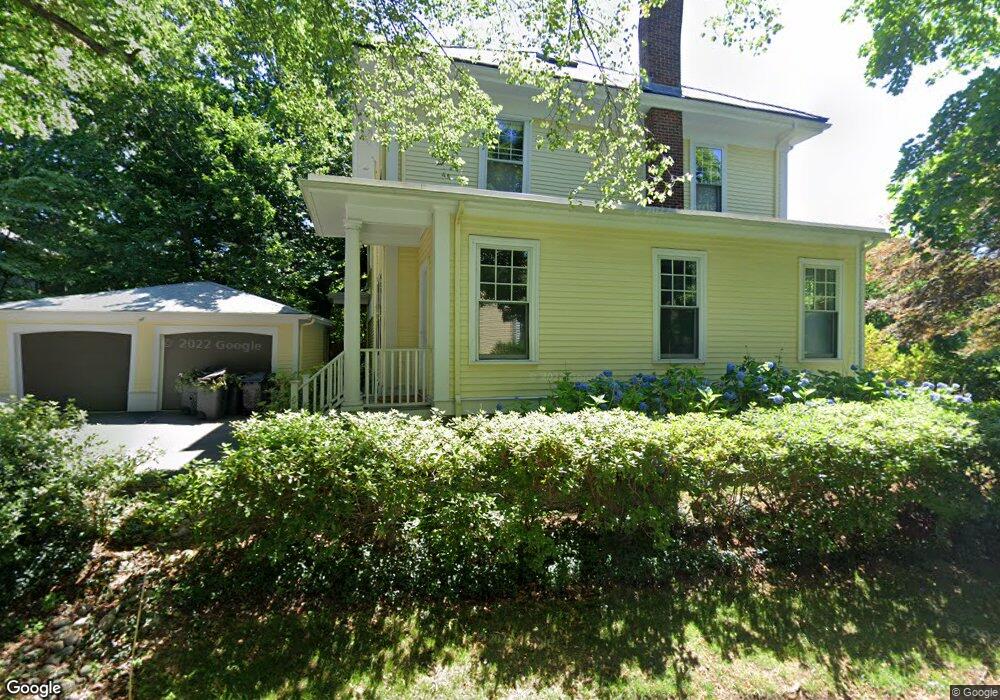
683 Commonwealth Ave Newton Center, MA 02459
Newton Centre NeighborhoodEstimated Value: $2,289,000 - $2,552,000
6
Beds
4
Baths
3,497
Sq Ft
$683/Sq Ft
Est. Value
About This Home
This home is located at 683 Commonwealth Ave, Newton Center, MA 02459 and is currently estimated at $2,390,127, approximately $683 per square foot. 683 Commonwealth Ave is a home located in Middlesex County with nearby schools including Mason Rice Elementary School, Charles E Brown Middle School, and Newton North High School.
Ownership History
Date
Name
Owned For
Owner Type
Purchase Details
Closed on
Aug 16, 2006
Sold by
Sallop Linda J and Fenlon Michael N
Bought by
Frank Samuel B and Glickman Bonnie
Current Estimated Value
Home Financials for this Owner
Home Financials are based on the most recent Mortgage that was taken out on this home.
Original Mortgage
$417,000
Outstanding Balance
$251,988
Interest Rate
6.88%
Mortgage Type
Purchase Money Mortgage
Estimated Equity
$2,138,139
Create a Home Valuation Report for This Property
The Home Valuation Report is an in-depth analysis detailing your home's value as well as a comparison with similar homes in the area
Home Values in the Area
Average Home Value in this Area
Purchase History
| Date | Buyer | Sale Price | Title Company |
|---|---|---|---|
| Frank Samuel B | $1,190,000 | -- |
Source: Public Records
Mortgage History
| Date | Status | Borrower | Loan Amount |
|---|---|---|---|
| Open | Frank Samuel B | $417,000 |
Source: Public Records
Tax History Compared to Growth
Tax History
| Year | Tax Paid | Tax Assessment Tax Assessment Total Assessment is a certain percentage of the fair market value that is determined by local assessors to be the total taxable value of land and additions on the property. | Land | Improvement |
|---|---|---|---|---|
| 2025 | $19,170 | $1,956,100 | $1,233,400 | $722,700 |
| 2024 | $18,535 | $1,899,100 | $1,197,500 | $701,600 |
| 2023 | $17,699 | $1,738,600 | $927,700 | $810,900 |
| 2022 | $16,935 | $1,609,800 | $859,000 | $750,800 |
| 2021 | $12,435 | $1,518,700 | $810,400 | $708,300 |
| 2020 | $15,855 | $1,518,700 | $810,400 | $708,300 |
| 2019 | $11,595 | $1,474,500 | $786,800 | $687,700 |
| 2018 | $11,637 | $1,368,000 | $703,100 | $664,900 |
| 2017 | $14,351 | $1,290,600 | $663,300 | $627,300 |
| 2016 | $13,700 | $1,203,900 | $619,900 | $584,000 |
| 2015 | $12,831 | $1,105,200 | $579,300 | $525,900 |
Source: Public Records
Map
Nearby Homes
- 1004 Centre St
- 73 Elmore St
- Lot 3 Chapin Rd
- Lot 2 Chapin Rd
- Lots 2 & 3 Chapin Rd
- 44 Irving St
- 21 Francis St Unit 21A
- 23 Francis St Unit 23-1
- 3 Cedar St
- 59 Charlotte Rd
- 887 Commonwealth Ave
- 34 Morton Rd
- 173-175 Warren St
- 92 Grant Ave
- 31 W Boulevard Rd
- 145 Warren St Unit 4
- 9 Ripley St Unit 1
- 54 Garland Rd
- 9 The Ledges Rd
- 154 Langley Rd Unit 1
- 667 Commonwealth Ave
- 15 Ransom Rd
- 693 Commonwealth Ave Unit 2
- 693 Commonwealth Ave Unit 1
- 19 Ransom Rd
- 19 Ransom Rd Unit 2
- 19 Ransom Rd Unit 1
- 14 Ransom Rd Unit 16
- 661 Commonwealth Ave
- 21 Ransom Rd
- 20 Ransom Rd
- 707 Commonwealth Ave
- 684 Commonwealth Ave
- 47 Grafton St
- 47 Grafton St Unit 47
- 47 Grafton St
- 47 Grafton St Unit 3rd Floor
- 647 Commonwealth Ave
- 692 Commonwealth Ave
- 37 Nathan Rd