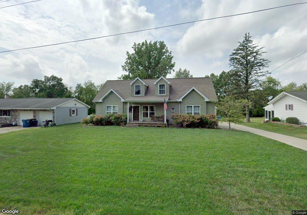
683 Langs Dr Jonesville, MI 49250
Estimated Value: $246,000 - $312,162
3
Beds
1
Bath
1,536
Sq Ft
$178/Sq Ft
Est. Value
About This Home
This home is located at 683 Langs Dr, Jonesville, MI 49250 and is currently estimated at $273,541, approximately $178 per square foot. 683 Langs Dr is a home located in Hillsdale County with nearby schools including Williams Elementary School, Jonesville Middle School, and Jonesville High School.
Ownership History
Date
Name
Owned For
Owner Type
Purchase Details
Closed on
May 7, 2004
Sold by
The Estate Of Lawrence D Lambright Sr
Bought by
Cosier Linda
Current Estimated Value
Home Financials for this Owner
Home Financials are based on the most recent Mortgage that was taken out on this home.
Original Mortgage
$67,600
Outstanding Balance
$29,452
Interest Rate
4.5%
Mortgage Type
Unknown
Estimated Equity
$244,089
Purchase Details
Closed on
Mar 18, 2002
Sold by
Laser Annette A
Bought by
Lambright Lawrence D
Purchase Details
Closed on
Apr 15, 1991
Sold by
Langs Craig W
Bought by
Risk Annette A
Create a Home Valuation Report for This Property
The Home Valuation Report is an in-depth analysis detailing your home's value as well as a comparison with similar homes in the area
Home Values in the Area
Average Home Value in this Area
Purchase History
| Date | Buyer | Sale Price | Title Company |
|---|---|---|---|
| Cosier Linda | $84,500 | -- | |
| Lambright Lawrence D | $87,000 | -- | |
| Risk Annette A | $53,000 | -- |
Source: Public Records
Mortgage History
| Date | Status | Borrower | Loan Amount |
|---|---|---|---|
| Open | Cosier Linda | $67,600 |
Source: Public Records
Tax History Compared to Growth
Tax History
| Year | Tax Paid | Tax Assessment Tax Assessment Total Assessment is a certain percentage of the fair market value that is determined by local assessors to be the total taxable value of land and additions on the property. | Land | Improvement |
|---|---|---|---|---|
| 2025 | $3,893 | $147,200 | $0 | $0 |
| 2024 | $2,383 | $141,000 | $0 | $0 |
| 2023 | $2,270 | $124,200 | $0 | $0 |
| 2022 | $3,538 | $112,700 | $0 | $0 |
| 2021 | $3,229 | $97,300 | $0 | $0 |
| 2020 | $3,172 | $77,600 | $0 | $0 |
| 2019 | $3,076 | $72,000 | $0 | $0 |
| 2018 | $2,964 | $67,200 | $0 | $0 |
| 2017 | $1,476 | $60,600 | $0 | $0 |
| 2016 | $2,099 | $45,640 | $0 | $0 |
| 2015 | $1,111 | $45,640 | $0 | $0 |
Source: Public Records
Map
Nearby Homes
- 400 Parkwood Dr
- 409 Evans St
- 321 North St
- 463 E Chicago St
- 205 Maumee St
- 207 Maumee St
- 211 West St
- 215 West St
- 509 Crest Ln
- 331 Jonesville Rd
- 410 Clinton St
- 417 Clinton St
- 341 Murphy St
- 309 Highland St
- 509 W Chicago St
- V/L W Carleton Rd
- 0 Oakridge Dr
- 1477 E Hastings Lake Rd
- 3714 W Hastings Lake Rd
- 3911 W Carleton Rd