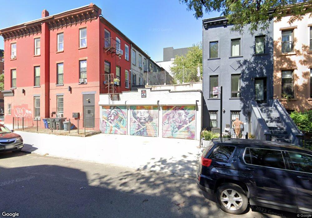
683 Madison St Unit 2 Brooklyn, NY 11221
Bed-Stuy NeighborhoodEstimated Value: $985,000 - $1,534,518
2
Beds
--
Bath
1,902
Sq Ft
$718/Sq Ft
Est. Value
About This Home
This home is located at 683 Madison St Unit 2, Brooklyn, NY 11221 and is currently estimated at $1,366,130, approximately $718 per square foot. 683 Madison St Unit 2 is a home located in Kings County with nearby schools including P.S. 309 George E. Wibecan Preparatory Academy, La Cima Charter School, and Ember Charter School.
Ownership History
Date
Name
Owned For
Owner Type
Purchase Details
Closed on
Jan 10, 2020
Sold by
Burns Casey and Burns Marlene
Bought by
Lo Cascio Francesco and Neufeld Sarah
Current Estimated Value
Purchase Details
Closed on
Jun 20, 2014
Sold by
Holloway Dustin
Bought by
Burns Casey M and Burns Marlene
Home Financials for this Owner
Home Financials are based on the most recent Mortgage that was taken out on this home.
Original Mortgage
$584,000
Interest Rate
4.16%
Mortgage Type
New Conventional
Purchase Details
Closed on
Aug 30, 2012
Sold by
Anchor Development Group Inc
Bought by
Holloway Dustin
Home Financials for this Owner
Home Financials are based on the most recent Mortgage that was taken out on this home.
Original Mortgage
$543,192
Interest Rate
3.66%
Mortgage Type
New Conventional
Purchase Details
Closed on
Jan 10, 2012
Sold by
8510 Ave M Inc
Bought by
Anchor Development Group Inc
Purchase Details
Closed on
Dec 28, 2011
Sold by
King Henry
Bought by
8510 Ave M Inc
Purchase Details
Closed on
Sep 25, 2006
Sold by
Alston Walter
Bought by
King Henry
Home Financials for this Owner
Home Financials are based on the most recent Mortgage that was taken out on this home.
Original Mortgage
$120,000
Interest Rate
6.54%
Purchase Details
Closed on
Nov 3, 2005
Sold by
Mcclellan Shakema
Bought by
Little Noreen
Home Financials for this Owner
Home Financials are based on the most recent Mortgage that was taken out on this home.
Original Mortgage
$480,000
Interest Rate
6.07%
Mortgage Type
Purchase Money Mortgage
Create a Home Valuation Report for This Property
The Home Valuation Report is an in-depth analysis detailing your home's value as well as a comparison with similar homes in the area
Home Values in the Area
Average Home Value in this Area
Purchase History
| Date | Buyer | Sale Price | Title Company |
|---|---|---|---|
| Lo Cascio Francesco | $1,320,000 | -- | |
| Lo Cascio Francesco | $1,320,000 | -- | |
| Burns Casey M | $730,000 | -- | |
| Burns Casey M | $730,000 | -- | |
| Holloway Dustin | $553,450 | -- | |
| Holloway Dustin | $553,450 | -- | |
| Anchor Development Group Inc | -- | -- | |
| Anchor Development Group Inc | -- | -- | |
| 8510 Ave M Inc | $167,500 | -- | |
| 8510 Ave M Inc | $167,500 | -- | |
| King Henry | $600,000 | -- | |
| King Henry | $600,000 | -- | |
| Alston Walter | $425,000 | -- | |
| Little Noreen | $600,000 | -- | |
| Little Noreen | $600,000 | -- |
Source: Public Records
Mortgage History
| Date | Status | Borrower | Loan Amount |
|---|---|---|---|
| Previous Owner | Burns Casey M | $584,000 | |
| Previous Owner | Holloway Dustin | $543,192 | |
| Previous Owner | King Henry | $120,000 | |
| Previous Owner | King Henry | $0 | |
| Previous Owner | Alston Walter | $480,000 | |
| Previous Owner | Little Noreen | $120,000 | |
| Previous Owner | Little Noreen | $480,000 |
Source: Public Records
Tax History
| Year | Tax Paid | Tax Assessment Tax Assessment Total Assessment is a certain percentage of the fair market value that is determined by local assessors to be the total taxable value of land and additions on the property. | Land | Improvement |
|---|---|---|---|---|
| 2025 | $3,742 | $96,900 | $17,040 | $79,860 |
| 2024 | $3,742 | $92,640 | $17,040 | $75,600 |
| 2023 | $1,370 | $102,000 | $17,040 | $84,960 |
| 2022 | $1,038 | $83,460 | $17,040 | $66,420 |
| 2021 | $3,589 | $77,880 | $17,040 | $60,840 |
| 2020 | $3,484 | $80,700 | $17,040 | $63,660 |
| 2019 | $3,248 | $79,260 | $17,040 | $62,220 |
| 2018 | $2,986 | $14,649 | $3,142 | $11,507 |
| 2017 | $2,913 | $14,290 | $4,133 | $10,157 |
| 2016 | $2,857 | $14,290 | $5,029 | $9,261 |
| 2015 | $1,141 | $13,738 | $5,445 | $8,293 |
| 2014 | $1,141 | $13,216 | $6,289 | $6,927 |
Source: Public Records
Map
Nearby Homes
- 726 Madison St Unit 4A
- 738A Madison St
- 697 Monroe St Unit 4
- 843 Putnam Ave
- 129 Malcolm x Blvd Unit 2
- 129 Malcolm x Blvd Unit 4
- 129 Malcolm x Blvd Unit GDN
- 129 Malcolm x Blvd Unit 3
- 929 Gates Ave
- 726 Jefferson Ave
- 720 Quincy St
- 725 Quincy St
- 731 Putnam Ave
- 147 Patchen Ave
- 654 Jefferson Ave Unit 2B
- 654 Jefferson Ave Unit 3A
- 654 Jefferson Ave Unit 2A
- 654 Jefferson Ave Unit 4A
- 654 Jefferson Ave Unit 1B
- 654 Jefferson Ave Unit 3B
- 683 Madison St
- 685 Madison St
- 685 Madison St Unit GARDEN
- 687 Madison St
- 175 Malcolm x Blvd
- 681 Madison St Unit 2
- 681 Madison St Unit 1
- 681 Madison St
- 177 Malcolm x Blvd
- 173 Malcolm x Blvd
- 169 Malcolm x Blvd
- 171 Malcolm x Blvd
- 691 Madison St
- 167 Malcolm x Blvd
- 693 Madison St
- 179 Malcolm x Blvd
- 165 Malcolm x Blvd
- 165 Malcolm x Blvd Unit 2 B
- 165 Malcolm x Blvd Unit 3 B
- 165 Malcolm x Blvd Unit PENTHOUSE
Your Personal Tour Guide
Ask me questions while you tour the home.