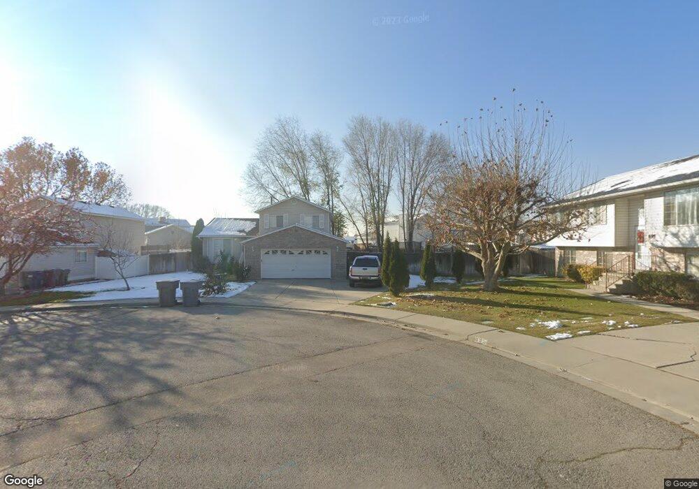
683 N 1370 W Pleasant Grove, UT 84062
Estimated Value: $481,242 - $502,000
4
Beds
2
Baths
1,460
Sq Ft
$335/Sq Ft
Est. Value
About This Home
This home is located at 683 N 1370 W, Pleasant Grove, UT 84062 and is currently estimated at $489,561, approximately $335 per square foot. 683 N 1370 W is a home located in Utah County with nearby schools including Mount Mahogany School, Pleasant Grove Junior High School, and Pleasant Grove High School.
Ownership History
Date
Name
Owned For
Owner Type
Purchase Details
Closed on
May 9, 2024
Sold by
Manzo Veronica
Bought by
Manzo Veronica and Chavez Jorge Manzo
Current Estimated Value
Home Financials for this Owner
Home Financials are based on the most recent Mortgage that was taken out on this home.
Original Mortgage
$170,000
Outstanding Balance
$153,410
Interest Rate
6.79%
Mortgage Type
New Conventional
Estimated Equity
$336,151
Purchase Details
Closed on
Nov 2, 2004
Sold by
Pulley Ronald A and Pulley Deborah Jayne
Bought by
Manzo Veronica
Home Financials for this Owner
Home Financials are based on the most recent Mortgage that was taken out on this home.
Original Mortgage
$133,000
Interest Rate
7.75%
Mortgage Type
Purchase Money Mortgage
Purchase Details
Closed on
Oct 31, 2004
Sold by
Pulley Kathy Ann
Bought by
Pulley Ronald A and Pulley Deborah Jayne
Home Financials for this Owner
Home Financials are based on the most recent Mortgage that was taken out on this home.
Original Mortgage
$133,000
Interest Rate
7.75%
Mortgage Type
Purchase Money Mortgage
Purchase Details
Closed on
Sep 20, 1999
Sold by
Moore Michael L
Bought by
Pulley Andrew and Pulley Kathy Ann
Home Financials for this Owner
Home Financials are based on the most recent Mortgage that was taken out on this home.
Original Mortgage
$131,600
Interest Rate
8.87%
Purchase Details
Closed on
Dec 23, 1998
Sold by
Boxer Construction Llc
Bought by
Moore Michael L
Home Financials for this Owner
Home Financials are based on the most recent Mortgage that was taken out on this home.
Original Mortgage
$148,000
Interest Rate
6.86%
Purchase Details
Closed on
Dec 1, 1998
Sold by
Moore Michael L and Moore Heather N
Bought by
Moore Michael L
Home Financials for this Owner
Home Financials are based on the most recent Mortgage that was taken out on this home.
Original Mortgage
$148,000
Interest Rate
6.86%
Create a Home Valuation Report for This Property
The Home Valuation Report is an in-depth analysis detailing your home's value as well as a comparison with similar homes in the area
Home Values in the Area
Average Home Value in this Area
Purchase History
| Date | Buyer | Sale Price | Title Company |
|---|---|---|---|
| Manzo Veronica | -- | Monument Title | |
| Manzo Veronica | -- | Access Title Company | |
| Pulley Ronald A | -- | Equity Title | |
| Pulley Andrew | -- | Titlewriters Inc | |
| Moore Michael L | -- | Timp Title Insurance Agency | |
| Moore Michael L | -- | Sundance Title Insurance |
Source: Public Records
Mortgage History
| Date | Status | Borrower | Loan Amount |
|---|---|---|---|
| Open | Manzo Veronica | $170,000 | |
| Previous Owner | Manzo Veronica | $133,000 | |
| Previous Owner | Pulley Andrew | $131,600 | |
| Previous Owner | Moore Michael L | $148,000 | |
| Closed | Pulley Andrew | $38,000 |
Source: Public Records
Tax History Compared to Growth
Tax History
| Year | Tax Paid | Tax Assessment Tax Assessment Total Assessment is a certain percentage of the fair market value that is determined by local assessors to be the total taxable value of land and additions on the property. | Land | Improvement |
|---|---|---|---|---|
| 2025 | $1,770 | $222,200 | $182,600 | $221,400 |
| 2024 | $1,770 | $211,310 | $0 | $0 |
| 2023 | $1,759 | $214,940 | $0 | $0 |
| 2022 | $1,856 | $225,665 | $0 | $0 |
| 2021 | $1,602 | $296,600 | $131,000 | $165,600 |
| 2020 | $1,474 | $267,500 | $117,000 | $150,500 |
| 2019 | $1,365 | $256,200 | $106,000 | $150,200 |
| 2018 | $1,292 | $229,300 | $98,700 | $130,600 |
| 2017 | $1,149 | $108,515 | $0 | $0 |
| 2016 | $1,064 | $97,020 | $0 | $0 |
| 2015 | $1,109 | $95,810 | $0 | $0 |
| 2014 | $1,025 | $87,670 | $0 | $0 |
Source: Public Records
Map
Nearby Homes
- 1443 W 1010 N
- 1491 W 1010 N
- 1515 W 1010 St N
- 1598 W 220 N
- 1065 N 1420 W
- 1541 W 1060 N
- 1096 N 1420 St W Unit 27
- 1498 W 1060 N Unit 5
- 1130 W State Rd
- Lytham Plan at Grove Acres
- 295 N 1580 W
- 1525 W 300 N
- 293 N 1630 W
- 854 N 1010 W
- 1171 N 1430 W
- 1541 W 250 N
- 1593 W 220 N
- 150 N 1300 W
- 1542 W 110 N
- 1879 W 1100 N