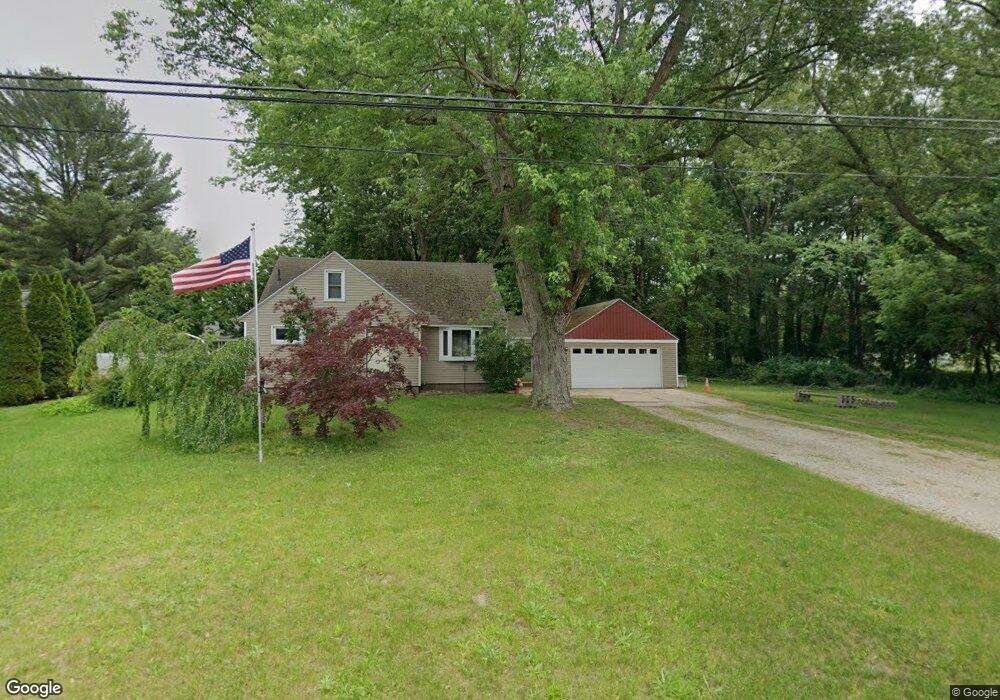
683 Whitman Ave Holland, MI 49423
Estimated Value: $343,958 - $374,000
4
Beds
2
Baths
1,860
Sq Ft
$193/Sq Ft
Est. Value
About This Home
This home is located at 683 Whitman Ave, Holland, MI 49423 and is currently estimated at $358,740, approximately $192 per square foot. 683 Whitman Ave is a home located in Ottawa County with nearby schools including Holland High School, Vanderbilt Charter Academy, and Calvary Schools of Holland - Plasman Campus.
Ownership History
Date
Name
Owned For
Owner Type
Purchase Details
Closed on
Apr 14, 2021
Sold by
Martinez Melissa A and Martinez Melissa Ann
Bought by
Martinez Daniel and Martinez Daniel Max
Current Estimated Value
Home Financials for this Owner
Home Financials are based on the most recent Mortgage that was taken out on this home.
Original Mortgage
$124,900
Outstanding Balance
$112,950
Interest Rate
3.1%
Mortgage Type
New Conventional
Estimated Equity
$245,790
Purchase Details
Closed on
May 9, 2016
Sold by
Kortman Roszella Rayetta and Kortman Henry A
Bought by
Martinez Daniel Max and Martinez Melissa Ann
Create a Home Valuation Report for This Property
The Home Valuation Report is an in-depth analysis detailing your home's value as well as a comparison with similar homes in the area
Home Values in the Area
Average Home Value in this Area
Purchase History
| Date | Buyer | Sale Price | Title Company |
|---|---|---|---|
| Martinez Daniel | -- | Lighthouse Title Inc | |
| Martinez Daniel Max | $25,000 | None Available |
Source: Public Records
Mortgage History
| Date | Status | Borrower | Loan Amount |
|---|---|---|---|
| Open | Martinez Daniel | $124,900 |
Source: Public Records
Tax History Compared to Growth
Tax History
| Year | Tax Paid | Tax Assessment Tax Assessment Total Assessment is a certain percentage of the fair market value that is determined by local assessors to be the total taxable value of land and additions on the property. | Land | Improvement |
|---|---|---|---|---|
| 2025 | $1,787 | $128,300 | $0 | $0 |
| 2024 | $1,167 | $116,600 | $0 | $0 |
| 2023 | $1,119 | $105,100 | $0 | $0 |
| 2022 | $1,600 | $91,100 | $0 | $0 |
| 2021 | $2,200 | $80,200 | $0 | $0 |
| 2020 | $2,241 | $79,200 | $0 | $0 |
| 2019 | $2,313 | $73,000 | $0 | $0 |
| 2018 | $2,219 | $60,200 | $0 | $0 |
| 2017 | $2,244 | $60,200 | $0 | $0 |
| 2016 | $2,270 | $55,000 | $0 | $0 |
| 2015 | -- | $52,900 | $0 | $0 |
| 2014 | -- | $50,800 | $0 | $0 |
Source: Public Records
Map
Nearby Homes
- 1704 Summit St
- 1761 S Shore Dr
- 645 Harrington Ave
- 1933 S Shore Dr
- 1981 N Shorewood Ln Unit 6
- 1982 S Shore Dr Unit 2
- 1992 S Shore Dr Unit 2
- 1992 S Shore Dr Unit 3
- 1991 N Shorewood Ln Unit 4
- The Andover 3 Plan at Shorewood Lane
- The Andover 2 Plan at Shorewood Lane
- Andover Plan at Shorewood Lane
- 1995 N Shorewood Ln Unit 2
- 1504 S Shore Dr
- 6579 Partridge Ln
- 1337 Heather Dr
- 4732 Northern Ct Unit 18
- 1331 Bayview Dr
- 1329 Bayview Dr
- 634 Blackbass Ave
- 677 Whitman Ave
- 670 Steketee Ave
- 678 Whitman Ave
- 1716 Virginia Place
- 671 Whitman Ave
- 674 Whitman Ave
- 660 Steketee Ave
- 1748 Virginia Place
- 675 Steketee Ave
- 662 Whitman Ave
- 1728 Virginia Place
- 702 Whitman Ave
- 1796 S Shore Dr
- 669 Steketee Ave
- 654 Steketee Ave
- 656 Whitman Ave
- 696 Whitman Ave
- 1754 Virginia Place
- 1731 Wolverine St
- 655 Steketee Ave