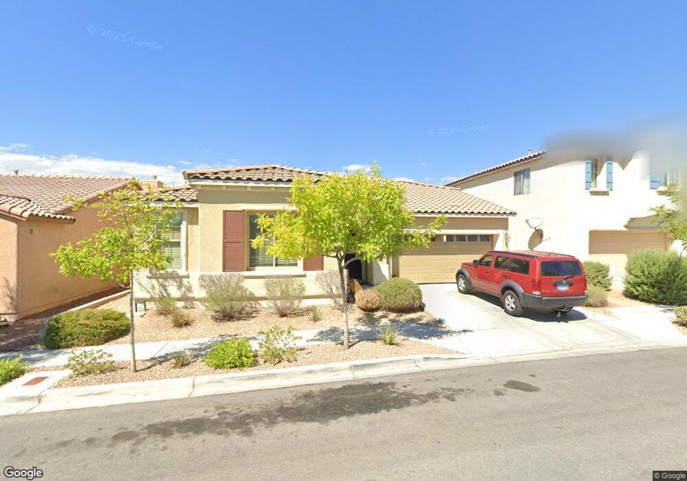
6831 Rolling Boulder St Las Vegas, NV 89149
Centennial Hills Town Center NeighborhoodEstimated Value: $433,864 - $459,000
3
Beds
2
Baths
1,752
Sq Ft
$258/Sq Ft
Est. Value
About This Home
This home is located at 6831 Rolling Boulder St, Las Vegas, NV 89149 and is currently estimated at $451,216, approximately $257 per square foot. 6831 Rolling Boulder St is a home located in Clark County with nearby schools including Marshall C. Darnell Elementary School, Edmundo "Eddie" Escobedo, Sr. Middle School, and Centennial High School.
Ownership History
Date
Name
Owned For
Owner Type
Purchase Details
Closed on
Feb 20, 2013
Sold by
County Of Clark
Bought by
Sfr Investments Poop 1 Llc
Current Estimated Value
Purchase Details
Closed on
Apr 3, 2006
Sold by
Pardee Homes Of Nevada
Bought by
Morgan Polly
Home Financials for this Owner
Home Financials are based on the most recent Mortgage that was taken out on this home.
Original Mortgage
$290,080
Interest Rate
6.37%
Mortgage Type
Purchase Money Mortgage
Create a Home Valuation Report for This Property
The Home Valuation Report is an in-depth analysis detailing your home's value as well as a comparison with similar homes in the area
Home Values in the Area
Average Home Value in this Area
Purchase History
| Date | Buyer | Sale Price | Title Company |
|---|---|---|---|
| Sfr Investments Poop 1 Llc | $16,100 | None Available | |
| Morgan Polly | $362,600 | Land Title Of Nevada |
Source: Public Records
Mortgage History
| Date | Status | Borrower | Loan Amount |
|---|---|---|---|
| Previous Owner | Morgan Polly | $290,080 |
Source: Public Records
Tax History Compared to Growth
Tax History
| Year | Tax Paid | Tax Assessment Tax Assessment Total Assessment is a certain percentage of the fair market value that is determined by local assessors to be the total taxable value of land and additions on the property. | Land | Improvement |
|---|---|---|---|---|
| 2025 | $2,534 | $119,889 | $33,950 | $85,939 |
| 2024 | $2,347 | $119,889 | $33,950 | $85,939 |
| 2023 | $2,347 | $116,448 | $35,700 | $80,748 |
| 2022 | $2,173 | $104,670 | $31,150 | $73,520 |
| 2021 | $2,012 | $97,532 | $27,650 | $69,882 |
| 2020 | $1,866 | $95,095 | $25,900 | $69,195 |
| 2019 | $1,748 | $91,734 | $23,800 | $67,934 |
| 2018 | $1,668 | $85,288 | $19,950 | $65,338 |
| 2017 | $2,510 | $76,565 | $15,750 | $60,815 |
| 2016 | $1,562 | $68,430 | $15,050 | $53,380 |
| 2015 | $1,559 | $56,966 | $11,550 | $45,416 |
| 2014 | $1,510 | $44,693 | $7,000 | $37,693 |
Source: Public Records
Map
Nearby Homes
- 9412 Teton Ridge Ave
- 6750 Quapaw St
- 0 N Chieftain St
- 7030 Royal Antelope St
- 9421 Wisdom Valley Ave
- 7040 Royal Antelope St
- 9205 Hampstead Hills Ave
- 9230 Horseshoe Basin Ave
- 6695 N Grand Canyon Dr
- 9710 Summer Bliss Ave
- 9429 Quiet Valley Ave
- 6864 Armistead St
- 9214 Avon Park Ave
- 6622 Colorado Spruce St
- 9148 Patrick Henry Ave
- 9129 Patrick Henry Ave
- 9157 Fish Tail Ave Unit 101
- 6527 Adrian Ridge Ct
- 9177 Dazzle Accent Ct
- 6519 Adrian Ridge Ct
- 6835 Rolling Boulder St
- 6827 Rolling Boulder St
- 6828 Dayton Flyer St
- 6823 Rolling Boulder St
- 6832 Dayton Flyer St
- 6824 Dayton Flyer St
- 9433 Highview Rock Ct
- 6839 Rolling Boulder St
- 6836 Dayton Flyer St
- 6820 Dayton Flyer St
- 9432 Teton Ridge Ave
- 9429 Highview Rock Ct
- 6820 Rolling Boulder St
- 9440 Highview Rock Ct
- 9436 Highview Rock Ct
- 6840 Dayton Flyer St
- 6816 Dayton Flyer St
- 6815 Rolling Boulder St
- 9511 Desert Dog Ct
- 9428 Teton Ridge Ave