Estimated Value: $305,000 - $360,000
About This Home
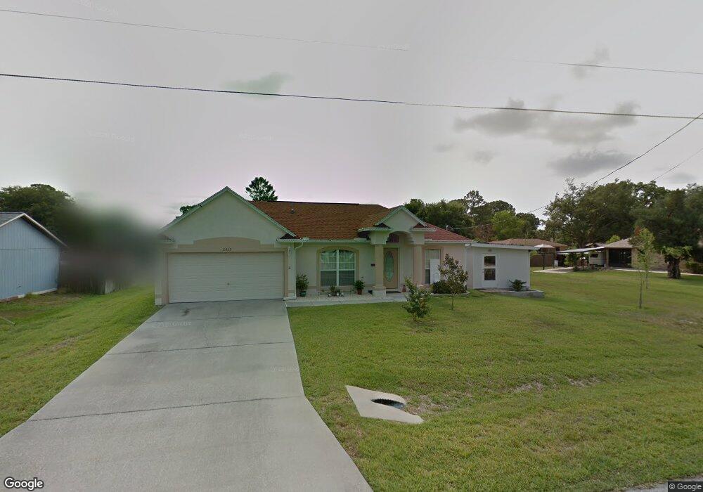
This home is located at 6833 Buxton Ave, Cocoa, FL 32927 and is currently estimated at $337,805, approximately $237 per square foot. 6833 Buxton Ave is a home located in Brevard County with nearby schools including Atlantis Elementary School, Space Coast Junior/Senior High School, and Sculptor Charter School.
Ownership History
We collect this data history from publicly available records. To have your information removed, we recommend requesting removal directly through your county’s website.
Purchase Details
Home Financials for this Owner
Home Financials are based on the most recent Mortgage that was taken out on this home.Purchase Details
Purchase Details
Purchase Details
Home Values in the Area
Average Home Value in this Area
Purchase History
We collect this data history from publicly available records. To have your information removed, we recommend requesting removal directly through your county’s website.
| Date | Buyer | Sale Price | Title Company |
|---|---|---|---|
| $185,000 | Landamerica Gulfatlantic Tit | ||
| $127,700 | B-D-R Title | ||
| $22,000 | -- | ||
| $12,000 | -- |
Mortgage History
We collect this data history from publicly available records. To have your information removed, we recommend requesting removal directly through your county’s website.
| Date | Status | Borrower | Loan Amount |
|---|---|---|---|
| Open | $148,000 |
Tax History
We collect this data history from publicly available records. To have your information removed, we recommend requesting removal directly through your county’s website.
| Year | Tax Paid | Tax Assessment Tax Assessment Total Assessment is a certain percentage of the fair market value that is determined by local assessors to be the total taxable value of land and additions on the property. | Land | Improvement |
|---|---|---|---|---|
| 2025 | $1,678 | $129,640 | -- | -- |
| 2024 | $1,641 | $125,990 | -- | -- |
| 2023 | $1,641 | $122,330 | $0 | $0 |
| 2022 | $1,530 | $118,770 | $0 | $0 |
| 2021 | $1,542 | $115,320 | $0 | $0 |
| 2020 | $1,495 | $113,730 | $0 | $0 |
| 2019 | $1,434 | $111,180 | $0 | $0 |
| 2018 | $1,431 | $109,110 | $0 | $0 |
| 2017 | $1,432 | $106,870 | $0 | $0 |
| 2016 | $1,440 | $104,680 | $27,000 | $77,680 |
| 2015 | $1,464 | $103,960 | $22,500 | $81,460 |
| 2014 | $1,467 | $103,140 | $16,500 | $86,640 |
Map
- 5135 Market St
- 5145 Carter St
- 5160 Carter St
- 5075 Carter St
- 5155 Mayflower St
- 5070 Curtis Blvd
- 5165 Patricia St
- 4991 Falcon Blvd
- 5170 Andover St
- 4824 Curtis Blvd
- 4845 Hawley Rd
- 6601 Cedar Ave
- 5555 Brandon St
- 00 Unknown
- 6615 Dock Ave
- 6965 Hundred Acre Dr
- 0000 Grissom Pkwy
- 7170 Whitney Ave
- 6450 Ember Ave
- 6560 Dock Ave
- 6860 Harp Ave
- 5145 Market St
- 6849 Buxton Ave
- 5130 Market St
- 5140 Market St
- 6875 Harp Ave Unit 7
- 6875 Harp Ave
- 6850 Harp Ave
- 6865 Harp Ave
- 5120 Market St
- 6841 Buxton Ave
- 6873 Buxton Ave
- 6855 Harp Ave
- 5110 Market St
- 6840 Harp Ave
- 6860 Dill Ave
- 6864 Buxton Ave
- 6845 Harp Ave
- 6848 Buxton Ave
- 5100 Market St
Ask me questions while you tour the home.