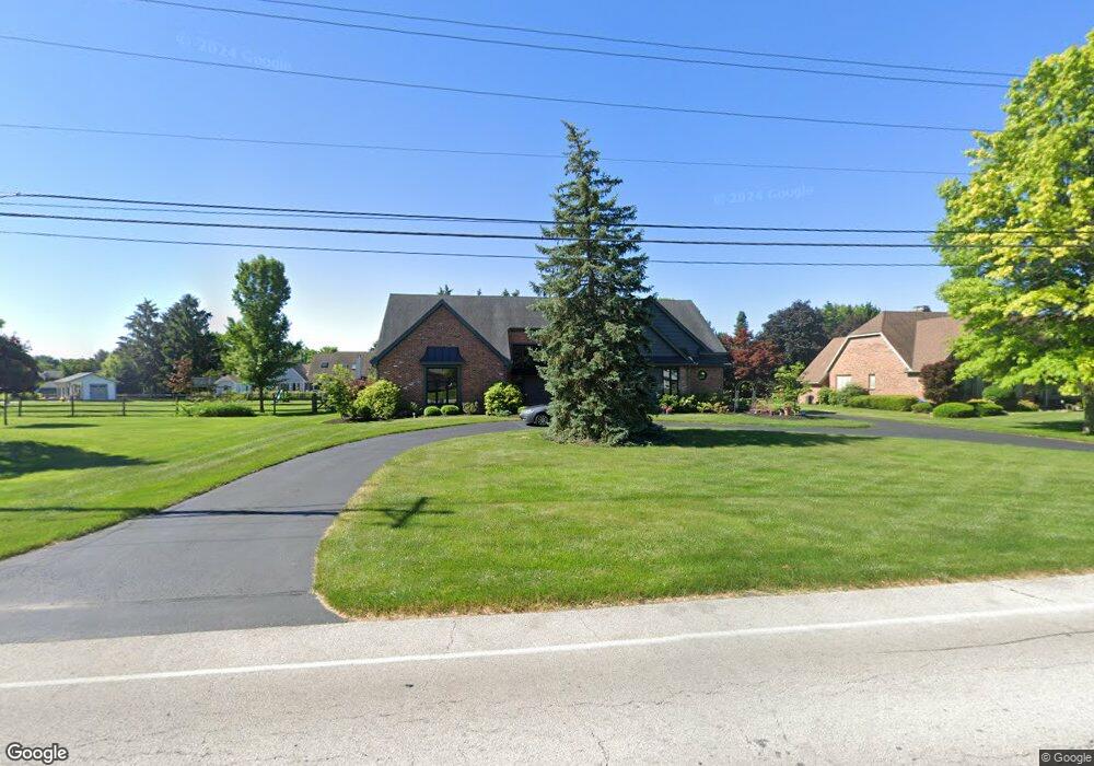
6833 Pilliod Rd Holland, OH 43528
Estimated Value: $479,000 - $504,000
4
Beds
4
Baths
3,937
Sq Ft
$125/Sq Ft
Est. Value
About This Home
This home is located at 6833 Pilliod Rd, Holland, OH 43528 and is currently estimated at $493,551, approximately $125 per square foot. 6833 Pilliod Rd is a home located in Lucas County with nearby schools including Holloway Elementary School, Springfield Middle School, and Springfield High School.
Ownership History
Date
Name
Owned For
Owner Type
Purchase Details
Closed on
Feb 18, 2004
Sold by
Holly Michael S
Bought by
Holly Alison R and Alison R Holly Trust
Current Estimated Value
Purchase Details
Closed on
Sep 12, 2001
Sold by
Holly Michael S and Holly Alison R
Bought by
Holly Michael S and Holly Alison R
Purchase Details
Closed on
Mar 14, 1995
Sold by
Culler Rodney R
Bought by
Holly Michael S and Holly Alison R
Home Financials for this Owner
Home Financials are based on the most recent Mortgage that was taken out on this home.
Original Mortgage
$246,000
Interest Rate
8.13%
Mortgage Type
New Conventional
Purchase Details
Closed on
Jan 4, 1993
Purchase Details
Closed on
Oct 3, 1988
Sold by
Nix Curtis W and Nix Dinah G
Create a Home Valuation Report for This Property
The Home Valuation Report is an in-depth analysis detailing your home's value as well as a comparison with similar homes in the area
Home Values in the Area
Average Home Value in this Area
Purchase History
| Date | Buyer | Sale Price | Title Company |
|---|---|---|---|
| Holly Alison R | -- | -- | |
| Holly Michael S | -- | -- | |
| Holly Michael S | $307,500 | -- | |
| -- | $185,000 | -- | |
| -- | $38,500 | -- |
Source: Public Records
Mortgage History
| Date | Status | Borrower | Loan Amount |
|---|---|---|---|
| Closed | Holly Michael S | $246,000 |
Source: Public Records
Tax History Compared to Growth
Tax History
| Year | Tax Paid | Tax Assessment Tax Assessment Total Assessment is a certain percentage of the fair market value that is determined by local assessors to be the total taxable value of land and additions on the property. | Land | Improvement |
|---|---|---|---|---|
| 2024 | $4,173 | $137,795 | $19,320 | $118,475 |
| 2023 | $8,891 | $128,625 | $17,395 | $111,230 |
| 2022 | $8,895 | $128,625 | $17,395 | $111,230 |
| 2021 | $8,360 | $128,625 | $17,395 | $111,230 |
| 2020 | $8,058 | $112,455 | $14,525 | $97,930 |
| 2019 | $7,870 | $112,455 | $14,525 | $97,930 |
| 2018 | $7,411 | $112,455 | $14,525 | $97,930 |
| 2017 | $7,019 | $93,380 | $18,900 | $74,480 |
| 2016 | $7,083 | $266,800 | $54,000 | $212,800 |
| 2015 | $7,070 | $266,800 | $54,000 | $212,800 |
| 2014 | $6,301 | $89,780 | $18,170 | $71,610 |
| 2013 | $6,301 | $89,780 | $18,170 | $71,610 |
Source: Public Records
Map
Nearby Homes
- 6620 Pilliod Rd
- 6666 Inglewood Rd
- 6949 Nightingale Dr
- 6833 Greentree Ln
- 6917 Greentree Ln
- 2425 Winding Creek Dr
- 2021 Old Planke Rd
- 6705 Garden Rd Unit 6705
- 6524 Glenhurst Dr
- 2001 Perrysburg Holland Rd Unit 118
- 6652 Sue Ln
- 6505 Airport Hwy
- 8939 Airport Hwy
- 6325 Millbrook Rd
- 6696 Embassy Ct Unit C11
- 6716 Embassy Ct Unit 8
- 7040 Country Creek Rd
- 6627 Embassy Ct Unit I38
- 1705 Henthorne Dr
- 1421 Maumee St
- 6845 Pilliod Rd
- 6819 Pilliod Rd
- 6830 Wynnbrook Ct
- 6842 Wynnbrook Ct
- 2058 Heritage Green
- 6820 Wynnbrook Ct
- 6857 Pilliod Rd
- 6859 Sunridge Ln
- 2050 Heritage Green
- 6865 Sunridge Ln
- 6810 Wynnbrook Ct
- 2059 Heritage Green
- 6846 Wynnbrook Ct
- 6853 Sunridge Ln
- 2042 Heritage Green
- 6871 Sunridge Ln
- 2049 Heritage Green
- 6825 Wynnbrook Ct
- 2117 Longacre Ln
- 2056 Brent Valley Rd