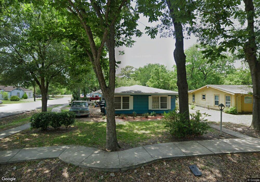
6836 Beachwood St Houston, TX 77021
OST-South Union NeighborhoodEstimated Value: $160,000 - $246,000
3
Beds
2
Baths
1,809
Sq Ft
$119/Sq Ft
Est. Value
About This Home
This home is located at 6836 Beachwood St, Houston, TX 77021 and is currently estimated at $215,891, approximately $119 per square foot. 6836 Beachwood St is a home located in Harris County with nearby schools including Marcellus Elliot Foster Elementary, Cullen Middle School, and Yates High School.
Ownership History
Date
Name
Owned For
Owner Type
Purchase Details
Closed on
Apr 23, 1999
Sold by
Cole Mary
Bought by
Lamark Gloria J Allen
Current Estimated Value
Home Financials for this Owner
Home Financials are based on the most recent Mortgage that was taken out on this home.
Original Mortgage
$40,500
Interest Rate
6.74%
Purchase Details
Closed on
Mar 15, 1999
Sold by
Bradford Louise F
Bought by
Brennan Christopher
Home Financials for this Owner
Home Financials are based on the most recent Mortgage that was taken out on this home.
Original Mortgage
$40,500
Interest Rate
6.74%
Purchase Details
Closed on
Dec 24, 1998
Sold by
Snyder Thomas A
Bought by
Stoll Edward L and Stoll Darlene
Home Financials for this Owner
Home Financials are based on the most recent Mortgage that was taken out on this home.
Original Mortgage
$66,000
Interest Rate
6.92%
Mortgage Type
Seller Take Back
Create a Home Valuation Report for This Property
The Home Valuation Report is an in-depth analysis detailing your home's value as well as a comparison with similar homes in the area
Home Values in the Area
Average Home Value in this Area
Purchase History
| Date | Buyer | Sale Price | Title Company |
|---|---|---|---|
| Lamark Gloria J Allen | -- | -- | |
| Brennan Christopher | -- | Alamo Title 77 | |
| Stoll Edward L | -- | -- |
Source: Public Records
Mortgage History
| Date | Status | Borrower | Loan Amount |
|---|---|---|---|
| Closed | Brennan Christopher | $40,500 | |
| Previous Owner | Stoll Edward L | $66,000 | |
| Closed | Stoll Edward L | $9,000 |
Source: Public Records
Tax History Compared to Growth
Tax History
| Year | Tax Paid | Tax Assessment Tax Assessment Total Assessment is a certain percentage of the fair market value that is determined by local assessors to be the total taxable value of land and additions on the property. | Land | Improvement |
|---|---|---|---|---|
| 2025 | $1,617 | $151,255 | $115,510 | $35,745 |
| 2024 | $1,617 | $151,255 | $115,510 | $35,745 |
| 2023 | $1,617 | $163,304 | $103,959 | $59,345 |
| 2022 | $1,606 | $143,111 | $80,857 | $62,254 |
| 2021 | $1,546 | $114,922 | $51,980 | $62,942 |
| 2020 | $1,460 | $77,819 | $34,653 | $43,166 |
| 2019 | $1,387 | $72,044 | $28,878 | $43,166 |
| 2018 | $0 | $55,562 | $20,214 | $35,348 |
| 2017 | $1,145 | $45,300 | $14,439 | $30,861 |
| 2016 | $1,115 | $45,300 | $14,439 | $30,861 |
| 2015 | -- | $40,102 | $14,439 | $25,663 |
| 2014 | -- | $37,110 | $14,439 | $22,671 |
Source: Public Records
Map
Nearby Homes
- 6807 Saint Augustine St
- 7012 Saint Augustine St
- 4616 Ward St
- 4405 Ward St
- 4510 Ward St
- 4508 Ward St
- 7014 Saint Augustine St
- 7005 Saint Augustine St Unit A/B
- 6725 Saint Augustine St
- 4110 Ward St
- 6719 Saint Augustine St
- 7004 Conley St
- 4019 Ward St
- 6721 Saint Augustine St
- 6717 Saint Augustine St
- 4017 Ward St
- 6715 Saint Augustine St
- 4015 Ward St
- 6809 Conley St Unit C
- 7016 Conley St
- 6832 Beachwood St
- 6837 Driftwood St
- 6828 Beachwood St
- 6833 Driftwood St
- 3928 Idaho St
- 3924 Idaho St
- 6829 Driftwood St
- 3920 Idaho St
- 6833 Beachwood St
- 6824 Beachwood St
- 3916 Idaho St
- 6903 Beachwood St
- 6825 Driftwood St
- 6825 Beachwood
- 6820 Beachwood St
- 6821 Driftwood St
- 6821 Beachwood St
- 6907 Beachwood St
- 6838 Driftwood St
- 6832 Sherwood Dr