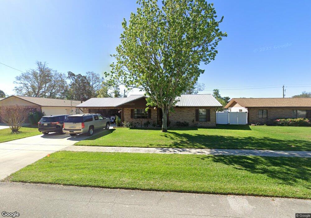
684 Branch Dr Port Orange, FL 32127
Port Orange West NeighborhoodEstimated Value: $290,884 - $326,000
3
Beds
2
Baths
1,414
Sq Ft
$215/Sq Ft
Est. Value
About This Home
This home is located at 684 Branch Dr, Port Orange, FL 32127 and is currently estimated at $303,971, approximately $214 per square foot. 684 Branch Dr is a home located in Volusia County with nearby schools including Sweetwater Elementary School, Creekside Middle School, and Spruce Creek High School.
Ownership History
Date
Name
Owned For
Owner Type
Purchase Details
Closed on
Nov 19, 1999
Sold by
Deranger Joseph F and Deranger Barbara J
Bought by
Deranger Michael S and Deranger Constance
Current Estimated Value
Purchase Details
Closed on
Oct 15, 1985
Bought by
Deranger Michael S
Purchase Details
Closed on
May 15, 1983
Bought by
Deranger Michael S
Purchase Details
Closed on
Apr 15, 1983
Bought by
Deranger Michael S
Purchase Details
Closed on
Aug 15, 1982
Bought by
Deranger Michael S
Create a Home Valuation Report for This Property
The Home Valuation Report is an in-depth analysis detailing your home's value as well as a comparison with similar homes in the area
Home Values in the Area
Average Home Value in this Area
Purchase History
| Date | Buyer | Sale Price | Title Company |
|---|---|---|---|
| Deranger Michael S | $22,200 | -- | |
| Deranger Michael S | $55,000 | -- | |
| Deranger Michael S | $22,800 | -- | |
| Deranger Michael S | $100 | -- | |
| Deranger Michael S | $40,000 | -- |
Source: Public Records
Tax History Compared to Growth
Tax History
| Year | Tax Paid | Tax Assessment Tax Assessment Total Assessment is a certain percentage of the fair market value that is determined by local assessors to be the total taxable value of land and additions on the property. | Land | Improvement |
|---|---|---|---|---|
| 2025 | $1,074 | $101,931 | -- | -- |
| 2024 | $1,074 | $99,059 | -- | -- |
| 2023 | $1,074 | $96,174 | $0 | $0 |
| 2022 | $1,016 | $93,373 | $0 | $0 |
| 2021 | $1,020 | $90,653 | $0 | $0 |
| 2020 | $991 | $89,401 | $0 | $0 |
| 2019 | $952 | $87,391 | $0 | $0 |
| 2018 | $943 | $85,762 | $0 | $0 |
| 2017 | $936 | $83,998 | $0 | $0 |
| 2016 | $918 | $82,270 | $0 | $0 |
| 2015 | $940 | $81,698 | $0 | $0 |
| 2014 | $939 | $81,050 | $0 | $0 |
Source: Public Records
Map
Nearby Homes
- 771 Tumblebrook Dr
- 653 Sweetwood Dr
- 761 Tumblebrook Dr
- 769 Osprey Dr
- 749 Tumblebrook Dr
- 714 Hawks Ridge Rd
- 5949 Kendrew Dr
- 5836 Spruce Creek Woods Dr
- 5936 Boggs Ford Rd
- 823 Bayridge Ln
- 5953 Boggs Ford Rd
- 5822 Spruce Creek Woods Dr
- 740 English Oaks Dr
- 5994 Seminole Woods Dr
- 739 English Oaks Dr
- 783 Highgarden Dr
- 732 English Oaks Dr
- 725 English Oaks Dr
- 5800 Spruce Creek Woods Dr
- 6012 Sawgrass Point Dr
- 682 Branch Dr
- 686 Branch Dr
- 747 Hawks Ridge Rd
- 745 Hawks Ridge Rd
- 688 Branch Dr
- 749 Hawks Ridge Rd
- 683 Branch Dr
- 743 Hawks Ridge Rd
- 687 Branch Dr
- 681 Branch Dr
- 678 Branch Dr
- 741 Hawks Ridge Rd
- 690 Branch Dr
- 751 Hawks Ridge Rd
- 691 Branch Dr
- 775 Tumblebrook Dr
- 746 Hawks Ridge Rd
- 676 Branch Dr
- 739 Hawks Ridge Rd
- 742 Hawks Ridge Rd