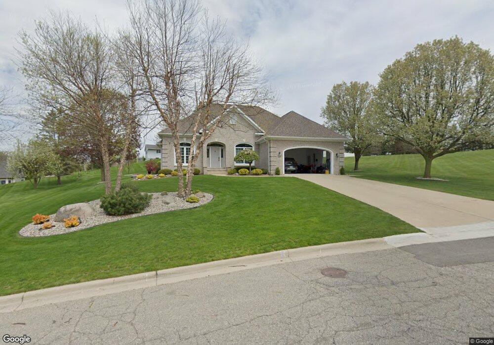
684 Stonecrest Adrian, MI 49221
Estimated Value: $400,759 - $440,000
3
Beds
3
Baths
2,321
Sq Ft
$184/Sq Ft
Est. Value
About This Home
This home is located at 684 Stonecrest, Adrian, MI 49221 and is currently estimated at $427,690, approximately $184 per square foot. 684 Stonecrest is a home located in Lenawee County with nearby schools including Adrian High School, Lenawee Christian School, and Berean Baptist Academy.
Ownership History
Date
Name
Owned For
Owner Type
Purchase Details
Closed on
Apr 24, 2017
Sold by
Chase Charles E and Chase Linda K
Bought by
Chase Charles E and Chase Linda K
Current Estimated Value
Home Financials for this Owner
Home Financials are based on the most recent Mortgage that was taken out on this home.
Original Mortgage
$252,000
Interest Rate
4.23%
Mortgage Type
New Conventional
Purchase Details
Closed on
Jul 9, 2013
Sold by
Chase Charles E and Chase Linda K
Bought by
Chase Charles E and Chase Linda K
Create a Home Valuation Report for This Property
The Home Valuation Report is an in-depth analysis detailing your home's value as well as a comparison with similar homes in the area
Home Values in the Area
Average Home Value in this Area
Purchase History
| Date | Buyer | Sale Price | Title Company |
|---|---|---|---|
| Chase Charles E | -- | None Available | |
| Chase Charles E | -- | None Available |
Source: Public Records
Mortgage History
| Date | Status | Borrower | Loan Amount |
|---|---|---|---|
| Closed | Chase Charles E | $252,000 |
Source: Public Records
Tax History
| Year | Tax Paid | Tax Assessment Tax Assessment Total Assessment is a certain percentage of the fair market value that is determined by local assessors to be the total taxable value of land and additions on the property. | Land | Improvement |
|---|---|---|---|---|
| 2025 | $5,166 | $192,700 | $0 | $0 |
| 2024 | $43 | $179,200 | $0 | $0 |
| 2023 | $4,951 | $158,900 | $0 | $0 |
| 2022 | $4,529 | $144,100 | $0 | $0 |
| 2021 | $4,446 | $132,800 | $0 | $0 |
| 2020 | $4,431 | $128,000 | $0 | $0 |
| 2019 | $286,024 | $141,100 | $0 | $0 |
| 2018 | $4,284 | $175,208 | $0 | $0 |
| 2017 | $4,148 | $144,781 | $0 | $0 |
| 2016 | $4,115 | $131,737 | $0 | $0 |
| 2014 | -- | $98,900 | $0 | $0 |
Source: Public Records
Map
Nearby Homes
- 1325 Country Club Rd
- 1100 Country Club Rd Unit 1100 blk Country Clu
- 520 Meadowbrook Dr
- 4250 Evergreen Rd
- 1544 Brookfield Ct
- 4274 Evergreen Rd Unit 14
- 4173 Evergreen Rd
- 4157 Evergreen Rd
- 1351 University Ave
- 3917 Spielman Rd
- Lot B Windcrest Ct
- Lot A Windcrest Ct
- 2499 Crestwood Dr
- 1144 W Maumee St
- 770 Lakeshire Trail Unit 201 West
- 710 Lakeshire Trail Unit 201E
- 107 Renfrew Ave
- 559 Northwestern Dr
- 146 Budlong St
- 914 W Maumee St
- 680 Stonecrest
- 690 Stoneridge Dr
- 682 Stoneridge Dr
- 694 Stoneridge Dr
- 677 Stonecrest
- 3911 Country Club Rd
- 678 Stoneridge Dr
- 685 Stoneridge Dr
- 679 Stoneridge Dr
- 1278 Scott Ridge Dr
- 672 Stonecrest
- 673 Stonecrest
- 1279 Scott Ridge Dr
- 695 Stoneridge Dr
- 674 Stoneridge Dr
- 668 Stonecrest
- 3845 Country Club Rd
- 697 Stoneridge Dr
- 675 Stoneridge Dr
- 1268 Scott Ridge Dr
Your Personal Tour Guide
Ask me questions while you tour the home.