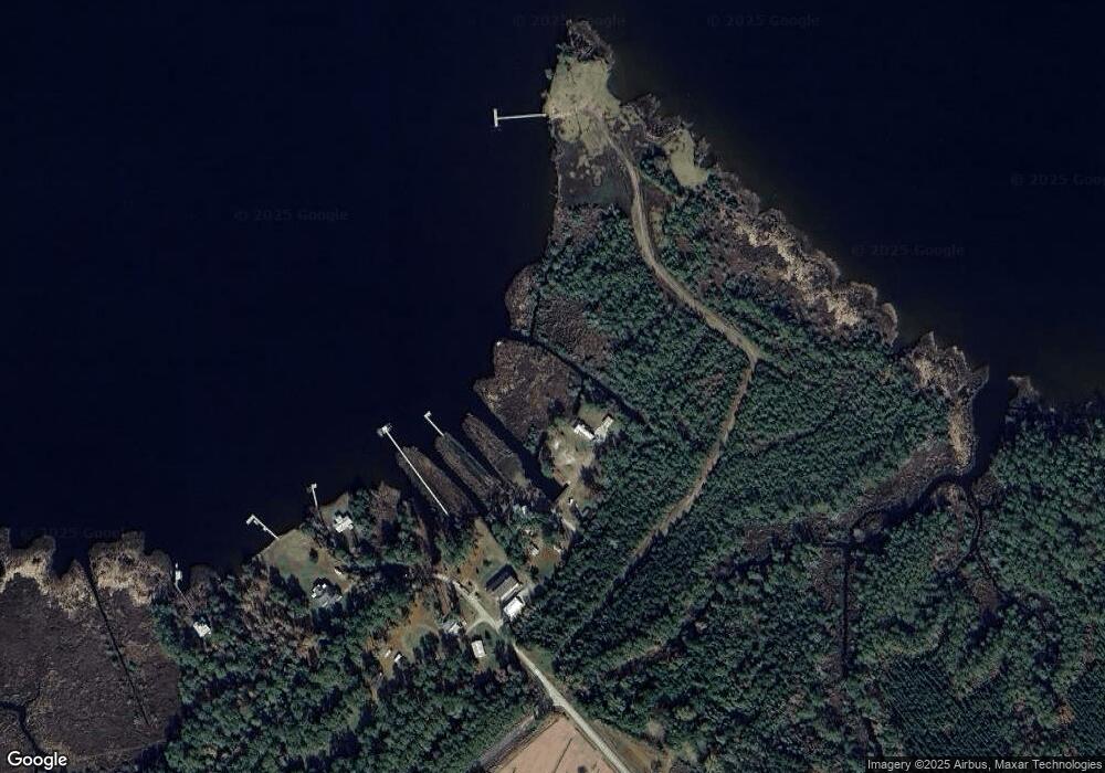
684 Weaver Camp Rd Merritt, NC 28556
Estimated Value: $123,000 - $347,000
3
Beds
2
Baths
1,120
Sq Ft
$190/Sq Ft
Est. Value
About This Home
This home is located at 684 Weaver Camp Rd, Merritt, NC 28556 and is currently estimated at $213,333, approximately $190 per square foot. 684 Weaver Camp Rd is a home located in Pamlico County with nearby schools including Pamlico County Primary School, Fred A. Anderson Elementary School, and Pamlico County Middle School.
Ownership History
Date
Name
Owned For
Owner Type
Purchase Details
Closed on
Mar 12, 2018
Sold by
Wetherington Edward E and Wetherington Cynthia S
Bought by
Johnson Keith R and Johnson Amy
Current Estimated Value
Home Financials for this Owner
Home Financials are based on the most recent Mortgage that was taken out on this home.
Original Mortgage
$70,000
Outstanding Balance
$59,899
Interest Rate
4.32%
Mortgage Type
New Conventional
Estimated Equity
$153,434
Purchase Details
Closed on
Jan 21, 1999
Bought by
Wetherington Edward E
Create a Home Valuation Report for This Property
The Home Valuation Report is an in-depth analysis detailing your home's value as well as a comparison with similar homes in the area
Home Values in the Area
Average Home Value in this Area
Purchase History
| Date | Buyer | Sale Price | Title Company |
|---|---|---|---|
| Johnson Keith R | $70,000 | -- | |
| Wetherington Edward E | -- | -- |
Source: Public Records
Mortgage History
| Date | Status | Borrower | Loan Amount |
|---|---|---|---|
| Open | Johnson Keith R | $70,000 |
Source: Public Records
Tax History Compared to Growth
Tax History
| Year | Tax Paid | Tax Assessment Tax Assessment Total Assessment is a certain percentage of the fair market value that is determined by local assessors to be the total taxable value of land and additions on the property. | Land | Improvement |
|---|---|---|---|---|
| 2025 | $559 | $79,186 | $54,300 | $24,886 |
| 2024 | $559 | $79,186 | $54,300 | $24,886 |
| 2023 | $543 | $79,186 | $54,300 | $24,886 |
| 2022 | $543 | $79,186 | $54,300 | $24,886 |
| 2021 | $543 | $79,186 | $54,300 | $24,886 |
| 2020 | $543 | $79,186 | $54,300 | $24,886 |
| 2019 | $522 | $76,078 | $71,680 | $4,398 |
| 2018 | $522 | $0 | $0 | $0 |
| 2017 | $522 | $0 | $0 | $0 |
| 2016 | $522 | $0 | $0 | $0 |
| 2015 | $522 | $76,078 | $71,680 | $4,398 |
| 2014 | $522 | $76,078 | $71,680 | $4,398 |
Source: Public Records
Map
Nearby Homes
- 242 Castaway
- 278 Mason Bay Rd
- 286 Mason Bay
- 304 Mason Bay Rd
- 26 Mason Ln
- 87 Mason Ln
- 901 Murphy Farm Rd
- 517 Arant Farm
- 61 Arant Farm Rd
- 60 Arant Farm Rd
- 880 Arant Farm Rd
- 3733 Florence Rd
- 543 Florence Rd
- 0 Florence Rd Unit 100491420
- 413 Alligator Loop
- 413 Alligator Loop Unit LotWP002
- 413 Alligator Loop Unit LotWP001
- 804 Murphy Farm Rd
- 137
- 0 Seawell Loop Rd
- 670 Weaver Camp Rd
- 678 Weaver Camp Rd
- 682 Weaver Camp Rd
- 786 Weaver Camp Rd
- 520 Weaver Camp Rd
- 844 Weaver Camp Rd
- 484 Weaver Camp Rd
- 177 Castaway
- 36 Windjammer Ln W
- 36 Windjammer Ln W
- 292 Castaway Rd
- 368 Castaway Rd
- 56 Windjammer Ln W
- 41 Windjammer
- 1739 Weaver Camp Rd
- 114 Windjammer Ln W
- 114 Windjammer Ln W
- 272 Castaway Rd
- 145 Windjammer Ln W
- 330 Castaway
