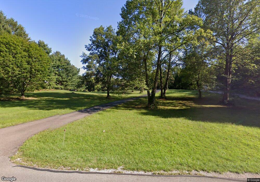
6840 Coonpath Rd Carroll, OH 43112
Bloom NeighborhoodEstimated Value: $532,000 - $704,000
3
Beds
4
Baths
1,547
Sq Ft
$378/Sq Ft
Est. Value
About This Home
This home is located at 6840 Coonpath Rd, Carroll, OH 43112 and is currently estimated at $584,871, approximately $378 per square foot. 6840 Coonpath Rd is a home located in Fairfield County with nearby schools including Bloom Carroll Primary School, Bloom Carroll Intermediate School, and Bloom-Carroll Middle School.
Ownership History
Date
Name
Owned For
Owner Type
Purchase Details
Closed on
May 14, 2014
Sold by
Dale Richard M and Dale Leila E
Bought by
Mcdermott Samuel S and Mcdermott Kathleen E
Current Estimated Value
Home Financials for this Owner
Home Financials are based on the most recent Mortgage that was taken out on this home.
Original Mortgage
$242,521
Outstanding Balance
$184,240
Interest Rate
4.4%
Mortgage Type
FHA
Estimated Equity
$400,631
Purchase Details
Closed on
May 5, 2010
Sold by
Pierce Rachel M
Bought by
Dale Richard M and Dale Leila E
Purchase Details
Closed on
Mar 24, 2010
Sold by
Flowers Joyce A and Flowers Ronald E
Bought by
Pierce Rachel M and Dale Richard M
Purchase Details
Closed on
Mar 3, 1992
Sold by
Flowers Ronald E
Bought by
Flowers Joyce A
Purchase Details
Closed on
Mar 1, 1986
Create a Home Valuation Report for This Property
The Home Valuation Report is an in-depth analysis detailing your home's value as well as a comparison with similar homes in the area
Home Values in the Area
Average Home Value in this Area
Purchase History
| Date | Buyer | Sale Price | Title Company |
|---|---|---|---|
| Mcdermott Samuel S | $247,000 | Attorney | |
| Dale Richard M | -- | None Available | |
| Pierce Rachel M | -- | Talon Title | |
| Flowers Joyce A | -- | -- | |
| -- | $15,300 | -- |
Source: Public Records
Mortgage History
| Date | Status | Borrower | Loan Amount |
|---|---|---|---|
| Open | Mcdermott Samuel S | $242,521 |
Source: Public Records
Tax History
| Year | Tax Paid | Tax Assessment Tax Assessment Total Assessment is a certain percentage of the fair market value that is determined by local assessors to be the total taxable value of land and additions on the property. | Land | Improvement |
|---|---|---|---|---|
| 2024 | $11,344 | $137,670 | $42,050 | $95,620 |
| 2023 | $5,848 | $137,670 | $42,050 | $95,620 |
| 2022 | $5,893 | $137,670 | $42,050 | $95,620 |
| 2021 | $4,723 | $99,700 | $33,640 | $66,060 |
| 2020 | $4,774 | $99,700 | $33,640 | $66,060 |
| 2019 | $4,789 | $99,700 | $33,640 | $66,060 |
| 2018 | $3,952 | $84,590 | $28,250 | $56,340 |
| 2017 | $3,725 | $83,250 | $26,910 | $56,340 |
| 2016 | $3,669 | $83,250 | $26,910 | $56,340 |
Source: Public Records
Map
Nearby Homes
- 7985 Lithopolis Rd NW
- 4400 Kauffman Rd NW
- 1975 Lamb Rd NW
- 6920 Winchester Rd NW
- 2155 Carroll-Southern Rd NW
- 8322 Benson Rd
- 52 W Canal St
- 5840 High St NW
- 7835 E Ohio State Ln NW
- 5560 Amanda Northern Rd NW
- 55 Betz Rd SW
- 5840 Amanda Northern Rd NW
- 7545 Royalton Rd SW
- 10 Mount Zion Rd NW
- 8667 Mount Union Ct NW
- 3355 Old Columbus Rd NW
- 8642 Water St
- 681 Mount Zion Rd SW
- 3076 Lithopolis Rd NW
- 8245 Royalton Rd SW
- 6840 Coonpath Rd
- 6880 Coonpath Rd
- 6740 Coonpath Rd
- 6940 Coonpath Rd
- 6996 Coonpath Rd
- 6730 Coonpath Rd
- 7000 Coonpath Rd
- 7000 Coonpath Rd NW
- 7007 Coonpath Rd
- 7110 Coonpath Rd
- 6649 Coonpath Rd
- 6610 Coonpath Rd
- 6679 Coonpath Rd
- 7105 Coonpath Rd
- 6589 Coonpath Rd
- 6545 Coonpath Rd
- 6520 Coonpath Rd
- 7204 Coonpath Rd
- 6485 Coonpath Rd
- 7205 Coonpath Rd
