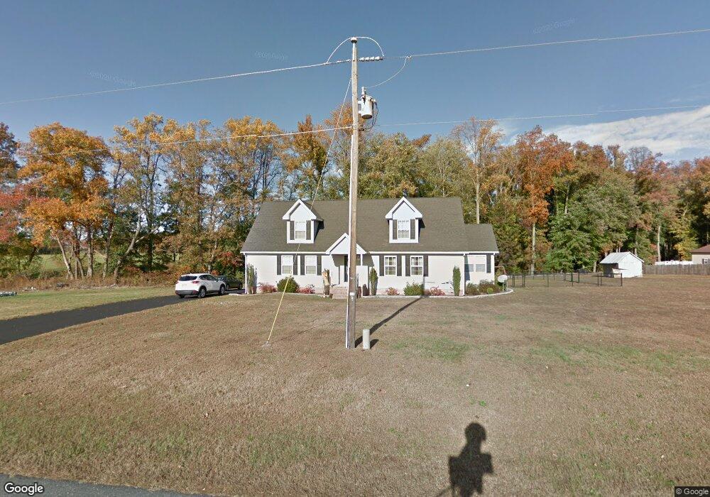
6841 Gravel Branch Rd Hurlock, MD 21643
Estimated Value: $342,069 - $390,000
--
Bed
2
Baths
2,492
Sq Ft
$147/Sq Ft
Est. Value
About This Home
This home is located at 6841 Gravel Branch Rd, Hurlock, MD 21643 and is currently estimated at $366,767, approximately $147 per square foot. 6841 Gravel Branch Rd is a home located in Dorchester County with nearby schools including Hurlock Elementary School, North Dorchester Middle School, and North Dorchester High School.
Ownership History
Date
Name
Owned For
Owner Type
Purchase Details
Closed on
Jan 30, 2007
Sold by
Hoffman Jeffrey W and Hoffman Joan L
Bought by
Spear Gene C and Spear Karen L
Current Estimated Value
Home Financials for this Owner
Home Financials are based on the most recent Mortgage that was taken out on this home.
Original Mortgage
$213,500
Outstanding Balance
$128,303
Interest Rate
6.22%
Mortgage Type
Purchase Money Mortgage
Estimated Equity
$238,464
Purchase Details
Closed on
Jan 25, 2007
Sold by
Hoffman Jeffrey W and Hoffman Joan L
Bought by
Spear Gene C and Spear Karen L
Home Financials for this Owner
Home Financials are based on the most recent Mortgage that was taken out on this home.
Original Mortgage
$213,500
Outstanding Balance
$128,303
Interest Rate
6.22%
Mortgage Type
Purchase Money Mortgage
Estimated Equity
$238,464
Purchase Details
Closed on
Sep 25, 1997
Sold by
Hoffman Melvin J and Hoffman Edith
Bought by
Hoffman Jeffrey W and Hoffman Joan L
Create a Home Valuation Report for This Property
The Home Valuation Report is an in-depth analysis detailing your home's value as well as a comparison with similar homes in the area
Home Values in the Area
Average Home Value in this Area
Purchase History
| Date | Buyer | Sale Price | Title Company |
|---|---|---|---|
| Spear Gene C | $50,000 | -- | |
| Spear Gene C | $50,000 | -- | |
| Hoffman Jeffrey W | -- | -- |
Source: Public Records
Mortgage History
| Date | Status | Borrower | Loan Amount |
|---|---|---|---|
| Open | Spear Gene C | $213,500 | |
| Closed | Spear Gene C | $213,500 |
Source: Public Records
Tax History Compared to Growth
Tax History
| Year | Tax Paid | Tax Assessment Tax Assessment Total Assessment is a certain percentage of the fair market value that is determined by local assessors to be the total taxable value of land and additions on the property. | Land | Improvement |
|---|---|---|---|---|
| 2025 | $3,048 | $272,167 | $0 | $0 |
| 2024 | $2,711 | $248,100 | $35,700 | $212,400 |
| 2023 | $2,711 | $238,367 | $0 | $0 |
| 2022 | $5,205 | $228,633 | $0 | $0 |
| 2021 | $2,418 | $218,900 | $30,700 | $188,200 |
| 2020 | $2,418 | $212,033 | $0 | $0 |
| 2019 | $2,341 | $205,167 | $0 | $0 |
| 2018 | $2,265 | $198,300 | $30,700 | $167,600 |
| 2017 | $2,213 | $198,267 | $0 | $0 |
| 2016 | -- | $198,233 | $0 | $0 |
| 2015 | -- | $198,200 | $0 | $0 |
| 2014 | -- | $198,200 | $0 | $0 |
Source: Public Records
Map
Nearby Homes
- 4604 Payne Rd
- 6720 Bobtown Rd
- 0 Gravel Branch Rd Unit MDDO2001942
- 4445 Rolling Acres Dr
- 4308 Blink Horn Rd
- 4907 Payne Rd
- 3345 Gallagher Rd
- 4305 Langrell Rd
- 525 Academy St
- 3485 Gallagher Rd
- 4215 Preston Rd
- 302 Glen Oak Cir
- 6706 Jayar Way
- 405 Collins Ave
- 0 River Rd
- 6539 Cabin Ridge Rd
- 207 Broad St
- 200 Hurlock Ave
- 3675 Seaman Rd
- 207 S Main St
- 6839 Gravel Branch Rd
- 6835 Gravel Branch Rd
- 6831 Gravel Branch Rd
- 6827 Gravel Branch Rd
- 6823 Gravel Branch Rd
- 6819 Gravel Branch Rd
- 6817 Gravel Branch Rd
- 6813 Gravel Branch Rd
- 6811 Gravel Branch Rd
- 6807 Gravel Branch Rd
- 0 W S Gravel Branch Rd Unit MDDO126560
- 6803 Gravel Branch Rd
- 6801 Gravel Branch Rd
- 4600 Payne Rd
- 4601 Payne Rd
- 4605 Williamsburg Church Rd
- 6898 Gravel Branch Rd
- 6723 Gravel Branch Rd
- 4610 Payne Rd
- 4611 Payne Rd