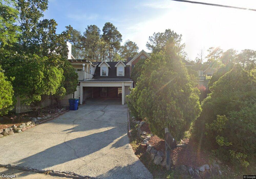
6845 Smoke Ridge Dr Unit 1 Atlanta, GA 30349
Estimated Value: $260,000 - $329,000
4
Beds
3
Baths
2,516
Sq Ft
$116/Sq Ft
Est. Value
About This Home
This home is located at 6845 Smoke Ridge Dr Unit 1, Atlanta, GA 30349 and is currently estimated at $290,790, approximately $115 per square foot. 6845 Smoke Ridge Dr Unit 1 is a home located in Fulton County with nearby schools including S. L. Lewis Elementary School, Bethune Elementary School, and Mcnair Middle School.
Ownership History
Date
Name
Owned For
Owner Type
Purchase Details
Closed on
May 18, 1994
Sold by
Pineland Homes Inc
Bought by
Labi Abdul R
Current Estimated Value
Home Financials for this Owner
Home Financials are based on the most recent Mortgage that was taken out on this home.
Original Mortgage
$95,700
Interest Rate
8.46%
Create a Home Valuation Report for This Property
The Home Valuation Report is an in-depth analysis detailing your home's value as well as a comparison with similar homes in the area
Home Values in the Area
Average Home Value in this Area
Purchase History
| Date | Buyer | Sale Price | Title Company |
|---|---|---|---|
| Labi Abdul R | $100,800 | -- |
Source: Public Records
Mortgage History
| Date | Status | Borrower | Loan Amount |
|---|---|---|---|
| Closed | Labi Abdul R | $95,700 |
Source: Public Records
Tax History Compared to Growth
Tax History
| Year | Tax Paid | Tax Assessment Tax Assessment Total Assessment is a certain percentage of the fair market value that is determined by local assessors to be the total taxable value of land and additions on the property. | Land | Improvement |
|---|---|---|---|---|
| 2025 | $513 | $111,040 | $21,400 | $89,640 |
| 2023 | $3,431 | $121,560 | $26,000 | $95,560 |
| 2022 | $1,395 | $75,280 | $10,000 | $65,280 |
| 2021 | $1,370 | $73,080 | $9,720 | $63,360 |
| 2020 | $1,374 | $72,200 | $9,600 | $62,600 |
| 2019 | $1,347 | $56,960 | $7,200 | $49,760 |
| 2018 | $1,075 | $44,320 | $6,200 | $38,120 |
| 2017 | $1,042 | $42,640 | $5,960 | $36,680 |
| 2016 | $1,040 | $42,640 | $5,960 | $36,680 |
| 2015 | $1,044 | $42,640 | $5,960 | $36,680 |
| 2014 | $484 | $27,640 | $4,760 | $22,880 |
Source: Public Records
Map
Nearby Homes
- 235 Whirlwind Ct Unit 1
- 6808 Merrywood Dr
- 6600 Connell Rd
- 3570 Keels Ln
- 6650 Smoke Ridge Dr
- 1105 Buckhurst Dr
- 6695 Buckhurst Trail
- 3325 Estate Lake Dr
- 6945 Brown Dr S
- 6435 Connell Rd Unit 2
- 6665 Cedar Hurst Trail
- 6410 Buckhurst Trail
- 120 Cainwood Ct W
- 2965 Forestside Ln Unit 4A
- 6940 Cainwood Dr
- 3455 Leisure Ln
- 3480 Estate Lake Dr
- 3065 Keenan Rd
- 3250 Valley Bend Rd
- 3410 Leisure Ln
- 6855 Smoke Ridge Dr Unit 1
- 6835 Smoke Ridge Dr Unit 1
- 6857 Smoke Ridge Dr
- 6825 Smoke Ridge Dr
- 6871 Smoke Ridge Dr
- 6850 Smoke Ridge Dr
- 6865 Smoke Ridge Dr
- 6873 Smoke Ridge Dr
- 6830 Smoke Ridge Dr Unit 1
- 0 Smoke Ridge Dr Unit 7381423
- 00 Smoke Ridge Dr
- 0 Smoke Ridge Dr Unit 5379727
- 0 Smoke Ridge Dr Unit 10244476
- 0 Smoke Ridge Dr Unit 3052621
- 0 Smoke Ridge Dr Unit 8093613
- 0 Smoke Ridge Dr Unit 7573470
- 0 Smoke Ridge Dr Unit 7573466
- 0 Smoke Ridge Dr Unit 7538103
- 0 Smoke Ridge Dr Unit 7275774
- 0 Smoke Ridge Dr Unit 7196737