Estimated Value: $117,000 - $130,000
2
Beds
1
Bath
900
Sq Ft
$137/Sq Ft
Est. Value
About This Home
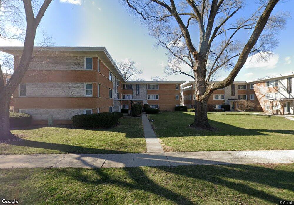
This home is located at 6846 W Lode Dr Unit 68463B, Worth, IL 60482 and is currently estimated at $123,519, approximately $137 per square foot. 6846 W Lode Dr Unit 68463B is a home located in Cook County with nearby schools including Worth Elementary School, Worth Jr High School, and A B Shepard High School.
Ownership History
Date
Name
Owned For
Owner Type
Purchase Details
Closed on
Jul 11, 2018
Sold by
Blount Trevor A
Bought by
Kanan Yasir
Current Estimated Value
Home Financials for this Owner
Home Financials are based on the most recent Mortgage that was taken out on this home.
Original Mortgage
$51,750
Interest Rate
5.75%
Mortgage Type
Commercial
Purchase Details
Closed on
Jan 10, 2008
Sold by
T Blount Investments Llc
Bought by
Blount Trevor A
Purchase Details
Closed on
Oct 8, 2002
Sold by
Blount Trevor and Blount Dorothy G
Bought by
T Blount Investments Llc
Create a Home Valuation Report for This Property
The Home Valuation Report is an in-depth analysis detailing your home's value as well as a comparison with similar homes in the area
Home Values in the Area
Average Home Value in this Area
Purchase History
| Date | Buyer | Sale Price | Title Company |
|---|---|---|---|
| Kanan Yasir | $69,000 | Attorney | |
| Blount Trevor A | -- | None Available | |
| T Blount Investments Llc | -- | -- | |
| T Blount Investments Llc | -- | -- |
Source: Public Records
Mortgage History
| Date | Status | Borrower | Loan Amount |
|---|---|---|---|
| Closed | Kanan Yasir | $51,750 |
Source: Public Records
Tax History Compared to Growth
Tax History
| Year | Tax Paid | Tax Assessment Tax Assessment Total Assessment is a certain percentage of the fair market value that is determined by local assessors to be the total taxable value of land and additions on the property. | Land | Improvement |
|---|---|---|---|---|
| 2024 | $2,920 | $8,158 | $974 | $7,184 |
| 2023 | $2,689 | $8,158 | $974 | $7,184 |
| 2022 | $2,689 | $6,377 | $1,144 | $5,233 |
| 2021 | $2,588 | $6,375 | $1,143 | $5,232 |
| 2020 | $2,530 | $6,375 | $1,143 | $5,232 |
| 2019 | $2,141 | $5,102 | $1,059 | $4,043 |
| 2018 | $2,132 | $5,102 | $1,059 | $4,043 |
| 2017 | $2,131 | $5,102 | $1,059 | $4,043 |
| 2016 | $2,107 | $4,709 | $889 | $3,820 |
| 2015 | $2,069 | $4,709 | $889 | $3,820 |
| 2014 | $2,028 | $4,709 | $889 | $3,820 |
| 2013 | $2,102 | $5,418 | $889 | $4,529 |
Source: Public Records
Map
Nearby Homes
- 6806 W Lode Dr Unit 1B
- 10817 S Oak Park Ave
- 10718 S Worth Ave
- 10930 S Worth Ave Unit 5
- 10940 S Worth Ave Unit 1094011
- 6856 W Crandall Ave
- 10735 S Lloyd Dr
- 10811 S Lloyd Dr Unit 2
- 6737 W Lloyd Dr
- 10815 S 71st Ct
- 7110 W 107th St Unit 16
- 10609 Southwest Hwy Unit 2A
- 7213 W 109th St
- 10504 S Highland Ave Unit 1A
- 10501 S Highland Ave Unit 305
- 7201 W 110th St
- 10528 Ridge Cove Dr Unit 11A
- 10508 Ridge Cove Dr Unit 18D
- 6737 104th Place
- 10512 Ridge Cove Dr Unit 11C
- 6846 W Lode Dr Unit 68462A
- 6846 W Lode Dr Unit 68461B
- 6846 W Lode Dr Unit 68461A
- 6846 W Lode Dr Unit 68463A
- 6846 W Lode Dr Unit 68462B
- 6846 W Lode Dr Unit 3A
- 6846 W Lode Dr Unit 2B
- 6846 W Lode Dr Unit 2A
- 6846 W Lode Dr Unit 1A
- 6846 W Lode Dr Unit 3B
- 6846 W Lode Dr Unit 1B
- 6850 W Lode Dr Unit 3B
- 6850 W Lode Dr Unit 68503B
- 6850 W Lode Dr Unit 68502A
- 6850 W Lode Dr Unit 68502B
- 6850 W Lode Dr Unit 68501A
- 6850 W Lode Dr Unit 68501B
- 6850 W Lode Dr Unit 68503A
- 6850 W Lode Dr Unit 2B
- 6850 W Lode Dr Unit 2A