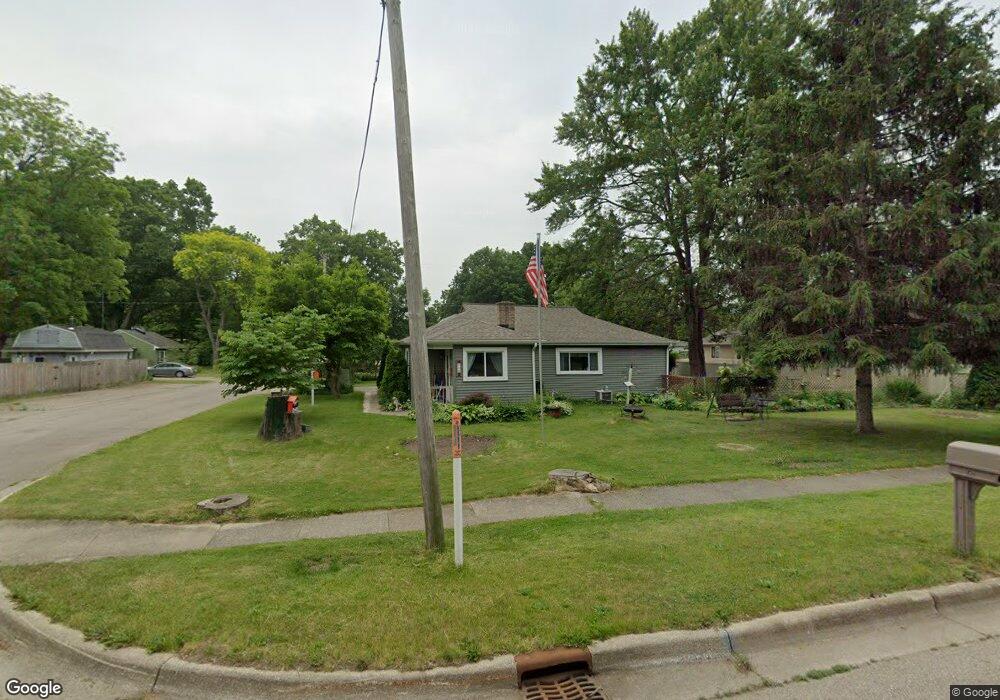
685 W Bridge St Plainwell, MI 49080
Estimated Value: $210,000 - $237,000
3
Beds
1
Bath
1,235
Sq Ft
$180/Sq Ft
Est. Value
About This Home
This home is located at 685 W Bridge St, Plainwell, MI 49080 and is currently estimated at $222,000, approximately $179 per square foot. 685 W Bridge St is a home located in Allegan County with nearby schools including Plainwell High School and Otsego Christian Academy.
Ownership History
Date
Name
Owned For
Owner Type
Purchase Details
Closed on
Nov 14, 2025
Sold by
Jenney Norm and Jenney Norman D
Bought by
Jenney Norman D
Current Estimated Value
Home Financials for this Owner
Home Financials are based on the most recent Mortgage that was taken out on this home.
Original Mortgage
$382,500
Outstanding Balance
$372,746
Interest Rate
6.3%
Mortgage Type
Reverse Mortgage Home Equity Conversion Mortgage
Estimated Equity
-$150,746
Purchase Details
Closed on
Oct 15, 2010
Sold by
Bowman James A
Bought by
Jenney Norm and Jenney Sandra
Home Financials for this Owner
Home Financials are based on the most recent Mortgage that was taken out on this home.
Original Mortgage
$30,000
Interest Rate
4.3%
Mortgage Type
New Conventional
Purchase Details
Closed on
Oct 22, 2001
Sold by
The Estate Of Robert J Foss and Bronson Edward R
Bought by
Bowman James
Create a Home Valuation Report for This Property
The Home Valuation Report is an in-depth analysis detailing your home's value as well as a comparison with similar homes in the area
Home Values in the Area
Average Home Value in this Area
Purchase History
| Date | Buyer | Sale Price | Title Company |
|---|---|---|---|
| Jenney Norman D | -- | None Listed On Document | |
| Jenney Norm | $55,000 | Metro Advantage Title | |
| Bowman James | $95,600 | Devon Title Company |
Source: Public Records
Mortgage History
| Date | Status | Borrower | Loan Amount |
|---|---|---|---|
| Open | Jenney Norman D | $382,500 | |
| Closed | Jenney Norman D | $382,500 | |
| Previous Owner | Jenney Norm | $30,000 |
Source: Public Records
Tax History
| Year | Tax Paid | Tax Assessment Tax Assessment Total Assessment is a certain percentage of the fair market value that is determined by local assessors to be the total taxable value of land and additions on the property. | Land | Improvement |
|---|---|---|---|---|
| 2025 | $1,871 | $68,800 | $14,000 | $54,800 |
| 2024 | $1,686 | $66,000 | $14,000 | $52,000 |
| 2023 | $1,688 | $58,900 | $14,000 | $44,900 |
| 2022 | $1,686 | $54,300 | $14,000 | $40,300 |
| 2021 | $1,620 | $52,900 | $14,000 | $38,900 |
| 2020 | $1,599 | $50,100 | $14,000 | $36,100 |
| 2019 | $1,453 | $47,700 | $14,000 | $33,700 |
| 2018 | $0 | $47,000 | $16,300 | $30,700 |
| 2017 | $0 | $36,400 | $5,700 | $30,700 |
| 2016 | $0 | $31,800 | $4,000 | $27,800 |
| 2015 | -- | $31,800 | $4,000 | $27,800 |
| 2014 | -- | $30,600 | $6,800 | $23,800 |
| 2013 | -- | $30,800 | $6,800 | $24,000 |
Source: Public Records
Map
Nearby Homes
- 320 S Sunset St
- 551 W Bridge St
- 355 12th St
- 1248 Keith St
- 140 W 1st Ave
- 1224 102nd Ave
- V/L Bronson Ave
- 1046 Bronson Ave
- 323 13th St
- 936 James St
- 721 E Bridge St
- 1006 Goodsell St
- 909 Barton St
- 1009 Barton St
- 10809 N 12th St
- 830 Miller Rd Unit 26.98 Acres
- 1038 Allen Ct
- 704 Bayberry Ln
- VL 107th Ave
- V/L N 12th St
- 691 W Bridge St
- 110 Kester St
- 677 W Bridge St
- 705 W Bridge St
- 680 W Bridge St
- 674 W Bridge St
- 120 Kester St
- 111 S Sunset St
- 671 W Bridge St
- 111 Kester St
- 124 Kester St
- 692 W Bridge St
- 123 S Sunset St
- 657 W Bridge St
- 670 W Bridge St
- 715 W Bridge St
- 662 W Bridge St
- 131 S Sunset St
- 132 Kester St
- 714 W Bridge St
Your Personal Tour Guide
Ask me questions while you tour the home.