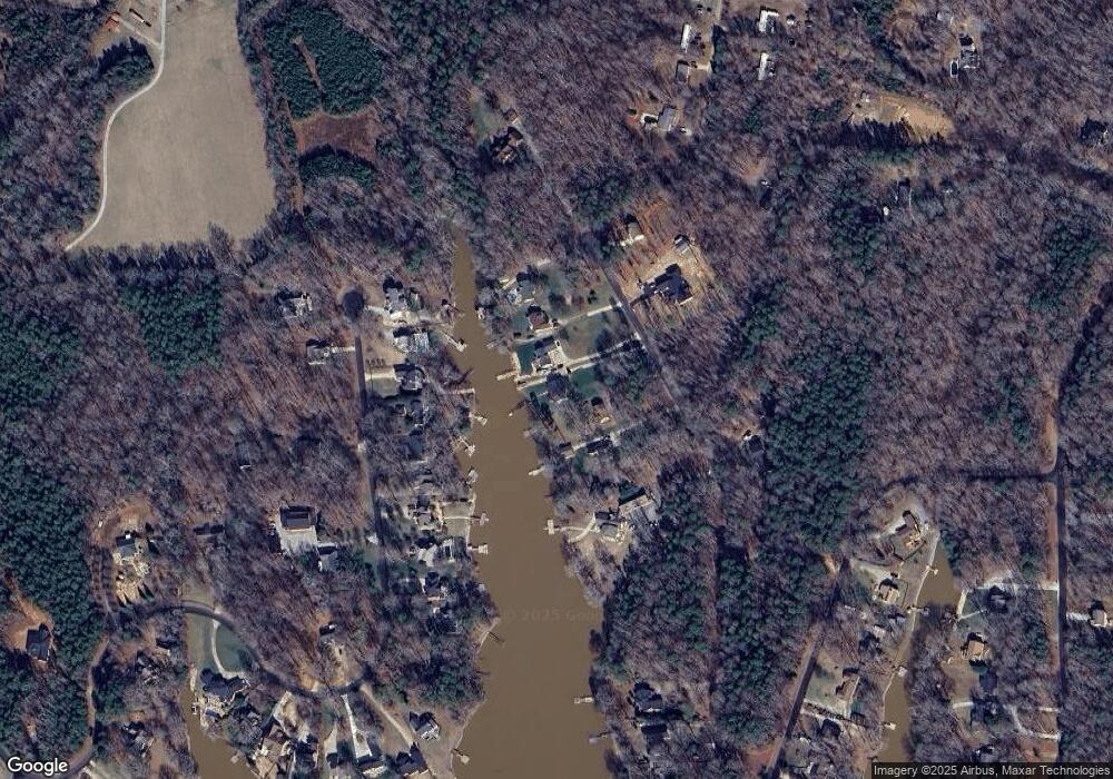
685 White Crane Rd Salisbury, NC 28146
Estimated Value: $516,000 - $717,000
--
Bed
2
Baths
2,325
Sq Ft
$260/Sq Ft
Est. Value
About This Home
This home is located at 685 White Crane Rd, Salisbury, NC 28146 and is currently estimated at $603,788, approximately $259 per square foot. 685 White Crane Rd is a home located in Rowan County with nearby schools including E Hanford Dole Elementary School, North Rowan Middle School, and North Rowan High School.
Ownership History
Date
Name
Owned For
Owner Type
Purchase Details
Closed on
Dec 19, 2003
Sold by
Gregory Andrew F and Gregory Frances D
Bought by
Greene James Kenneth
Current Estimated Value
Home Financials for this Owner
Home Financials are based on the most recent Mortgage that was taken out on this home.
Original Mortgage
$213,500
Outstanding Balance
$111,617
Interest Rate
7.75%
Mortgage Type
Purchase Money Mortgage
Estimated Equity
$492,171
Create a Home Valuation Report for This Property
The Home Valuation Report is an in-depth analysis detailing your home's value as well as a comparison with similar homes in the area
Home Values in the Area
Average Home Value in this Area
Purchase History
| Date | Buyer | Sale Price | Title Company |
|---|---|---|---|
| Greene James Kenneth | $213,500 | -- |
Source: Public Records
Mortgage History
| Date | Status | Borrower | Loan Amount |
|---|---|---|---|
| Open | Greene James Kenneth | $213,500 |
Source: Public Records
Tax History Compared to Growth
Tax History
| Year | Tax Paid | Tax Assessment Tax Assessment Total Assessment is a certain percentage of the fair market value that is determined by local assessors to be the total taxable value of land and additions on the property. | Land | Improvement |
|---|---|---|---|---|
| 2025 | $2,834 | $424,628 | $125,000 | $299,628 |
| 2024 | $2,834 | $424,628 | $125,000 | $299,628 |
| 2023 | $2,834 | $424,628 | $125,000 | $299,628 |
| 2022 | $1,969 | $267,002 | $104,000 | $163,002 |
| 2021 | $1,969 | $267,002 | $104,000 | $163,002 |
| 2020 | $1,969 | $267,002 | $104,000 | $163,002 |
| 2019 | $1,969 | $267,002 | $104,000 | $163,002 |
| 2018 | $1,698 | $232,141 | $93,000 | $139,141 |
| 2017 | $1,698 | $232,141 | $93,000 | $139,141 |
| 2016 | $1,799 | $232,141 | $93,000 | $139,141 |
| 2015 | $1,800 | $232,141 | $93,000 | $139,141 |
| 2014 | $1,735 | $230,367 | $93,000 | $137,367 |
Source: Public Records
Map
Nearby Homes
- 465 White Crane Rd
- 350 River Country Rd
- 260 River Country Rd
- 621 Sunset Pointe Dr
- 453 Sunset Pointe Dr
- 1547 Sunset Pointe Dr
- 1135 Rudder Cir
- 1105 Rudder Cir
- 0 Tidewater Rd
- 1053 Inlet Point Rd
- 1140 Inlet Point Rd
- 1261 Sunset Pointe Dr Unit 60
- 1283 Sunset Pointe Dr
- 5555 Long Ferry Rd
- 238 Bluff Ln
- 1525 Sunset Pointe Dr
- 3445 Long Ferry Rd
- 3420 Long Ferry Rd
- 3425 Long Ferry Rd
- 240 Skysail Rd
- 705 White Crane Rd
- 665 White Crane Rd
- 715 White Crane Rd
- 645 White Crane Rd
- 725 White Crane Rd
- 625 White Crane Rd
- 1125 Pebble Point
- 1135 Pebble Point
- 1035 Pebble Point
- 615 White Crane Rd
- 1225 Pebble Point
- 710 White Crane Rd
- 1025 Pebble Point
- 1235 Pebble Point
- 935 Pebble Point
- 1220 Pebble Point
- 720 White Crane Rd
- 925 Pebble Point
- 610 White Crane Rd
- 555 Charolais Dr
