Estimated Value: $250,405 - $329,000
3
Beds
2
Baths
1,412
Sq Ft
$205/Sq Ft
Est. Value
About This Home
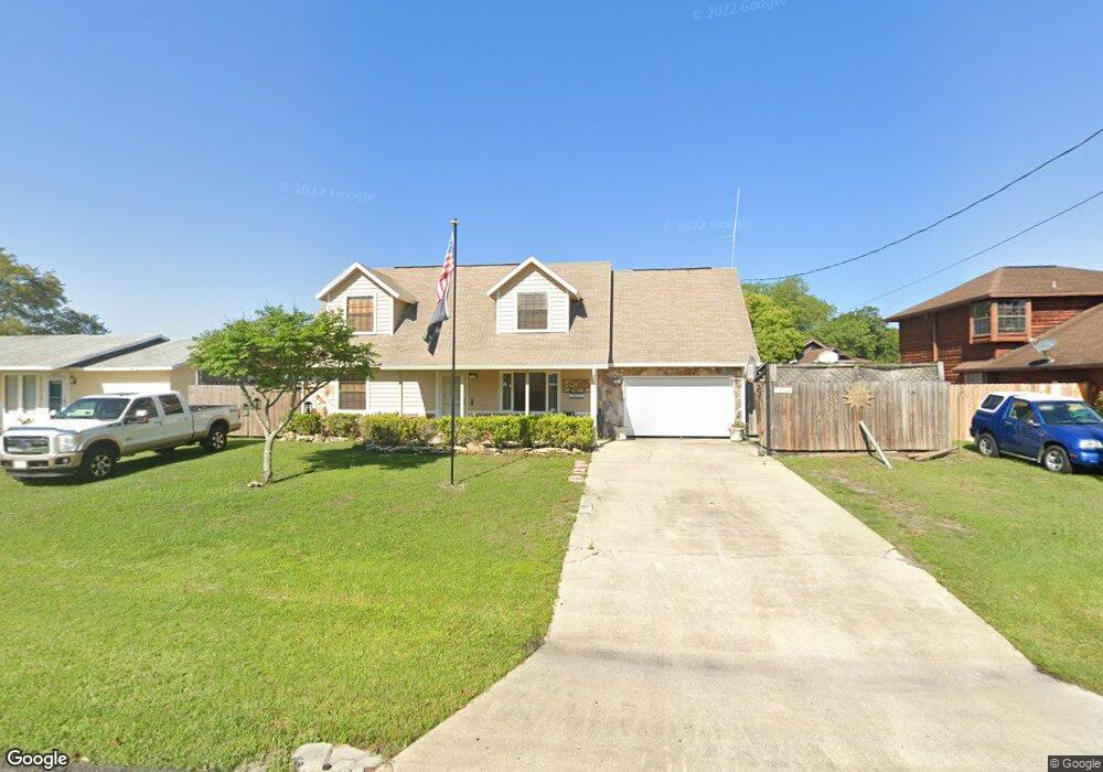
This home is located at 6850 Cairo Rd, Cocoa, FL 32927 and is currently estimated at $289,351, approximately $204 per square foot. 6850 Cairo Rd is a home located in Brevard County with nearby schools including Enterprise Elementary School, Space Coast Junior/Senior High School, and Sculptor Charter School.
Create a Home Valuation Report for This Property
The Home Valuation Report is an in-depth analysis detailing your home's value as well as a comparison with similar homes in the area
Home Values in the Area
Average Home Value in this Area
Tax History
| Year | Tax Paid | Tax Assessment Tax Assessment Total Assessment is a certain percentage of the fair market value that is determined by local assessors to be the total taxable value of land and additions on the property. | Land | Improvement |
|---|---|---|---|---|
| 2025 | $1,087 | $74,960 | -- | -- |
| 2024 | $1,065 | $72,850 | -- | -- |
| 2023 | $1,065 | $70,730 | $0 | $0 |
| 2022 | $1,008 | $68,670 | $0 | $0 |
| 2021 | $1,008 | $66,670 | $0 | $0 |
| 2020 | $950 | $65,750 | $0 | $0 |
| 2019 | $896 | $64,280 | $0 | $0 |
| 2018 | $896 | $63,090 | $0 | $0 |
| 2017 | $895 | $61,800 | $0 | $0 |
| 2016 | $902 | $60,530 | $18,000 | $42,530 |
| 2015 | $908 | $60,110 | $15,000 | $45,110 |
| 2014 | $913 | $59,640 | $11,000 | $48,640 |
Source: Public Records
Map
Nearby Homes
- 6815 Bryant Rd
- 6760 Cairo Rd
- 7065 Hundred Acre Dr
- 6615 Dock Ave
- 5555 Brandon St
- 6990 Bryant Rd
- 5155 Mayflower St
- 5165 Patricia St
- 5075 Carter St
- 00 Unknown
- 6450 Ember Ave
- 6581 Bancroft Ave
- 5080 Mayflower St
- 6643 Emil Ave
- 6620 Grissom Pkwy
- 5680 Brandon St
- 7230 Venus Ave
- 6481 La Brea Ave
- 7045 Grissom Pkwy
- 0000 Grissom Pkwy
Your Personal Tour Guide
Ask me questions while you tour the home.