Estimated Value: $122,655 - $152,000
2
Beds
1
Bath
800
Sq Ft
$164/Sq Ft
Est. Value
About This Home
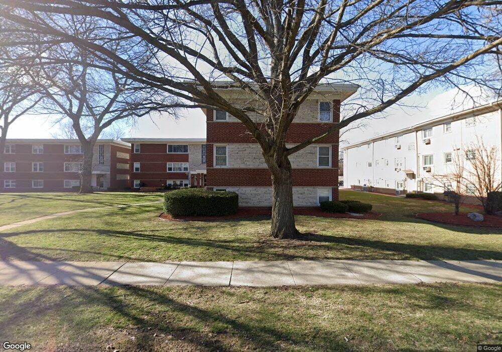
This home is located at 6854 W Lode Dr Unit 68542B, Worth, IL 60482 and is currently estimated at $130,914, approximately $163 per square foot. 6854 W Lode Dr Unit 68542B is a home located in Cook County with nearby schools including Worth Elementary School, Worth Jr High School, and A B Shepard High School.
Ownership History
Date
Name
Owned For
Owner Type
Purchase Details
Closed on
Nov 26, 2014
Sold by
Illinois Housing Development Authority
Bought by
Iwaniec Sebastian
Current Estimated Value
Purchase Details
Closed on
Jun 19, 2014
Sold by
Bowers
Bought by
Illinois Housing Development Authority
Purchase Details
Closed on
Jan 24, 2002
Sold by
Burton Income Properties Iv
Bought by
Bowers Michael J
Home Financials for this Owner
Home Financials are based on the most recent Mortgage that was taken out on this home.
Original Mortgage
$75,600
Interest Rate
7.26%
Create a Home Valuation Report for This Property
The Home Valuation Report is an in-depth analysis detailing your home's value as well as a comparison with similar homes in the area
Home Values in the Area
Average Home Value in this Area
Purchase History
| Date | Buyer | Sale Price | Title Company |
|---|---|---|---|
| Iwaniec Sebastian | -- | Fidelity National Title | |
| Illinois Housing Development Authority | -- | Attorneys Title Guaranty Fun | |
| Bowers Michael J | $77,500 | 1St American Title |
Source: Public Records
Mortgage History
| Date | Status | Borrower | Loan Amount |
|---|---|---|---|
| Previous Owner | Bowers Michael J | $75,600 |
Source: Public Records
Tax History Compared to Growth
Tax History
| Year | Tax Paid | Tax Assessment Tax Assessment Total Assessment is a certain percentage of the fair market value that is determined by local assessors to be the total taxable value of land and additions on the property. | Land | Improvement |
|---|---|---|---|---|
| 2024 | $3,012 | $8,414 | $1,005 | $7,409 |
| 2023 | $2,774 | $8,414 | $1,005 | $7,409 |
| 2022 | $2,774 | $6,577 | $1,180 | $5,397 |
| 2021 | $2,669 | $6,576 | $1,179 | $5,397 |
| 2020 | $2,609 | $6,576 | $1,179 | $5,397 |
| 2019 | $2,208 | $5,262 | $1,092 | $4,170 |
| 2018 | $2,199 | $5,262 | $1,092 | $4,170 |
| 2017 | $2,198 | $5,262 | $1,092 | $4,170 |
| 2016 | $2,174 | $4,857 | $917 | $3,940 |
| 2015 | $2,134 | $4,857 | $917 | $3,940 |
| 2014 | $986 | $4,857 | $917 | $3,940 |
| 2013 | $1,148 | $5,588 | $917 | $4,671 |
Source: Public Records
Map
Nearby Homes
- 6806 W Lode Dr Unit 1B
- 10817 S Oak Park Ave
- 10930 S Worth Ave Unit 5
- 10940 S Worth Ave Unit 1094011
- 10718 S Worth Ave
- 6856 W Crandall Ave
- 10815 S 71st Ct
- 6737 W Lloyd Dr
- 10811 S Lloyd Dr Unit 2
- 10735 S Lloyd Dr
- 7110 W 107th St Unit 16
- 10609 Southwest Hwy Unit 2A
- 10931 S Lloyd Dr Unit 1B
- 7213 W 109th St
- 7201 W 110th St
- 10504 S Highland Ave Unit 1A
- 10501 S Highland Ave Unit 305
- 10528 Ridge Cove Dr Unit 11A
- 10508 Ridge Cove Dr Unit 18D
- 10512 Ridge Cove Dr Unit 11C
- 6854 W Lode Dr Unit 68543A
- 6854 W Lode Dr Unit 68543B
- 6854 W Lode Dr Unit 68541B
- 6854 W Lode Dr Unit 68541A
- 6854 W Lode Dr Unit 68542A
- 6854 W Lode Dr Unit 3B
- 6854 W Lode Dr Unit 3A
- 6854 W Lode Dr Unit 1A
- 6854 W Lode Dr Unit 1B
- 6854 W Lode Dr Unit 2B
- 6854 W Lode Dr Unit 2A
- 6850 W Lode Dr Unit 3B
- 6850 W Lode Dr Unit 68503B
- 6850 W Lode Dr Unit 68502A
- 6850 W Lode Dr Unit 68502B
- 6850 W Lode Dr Unit 68501A
- 6850 W Lode Dr Unit 68501B
- 6850 W Lode Dr Unit 68503A
- 6850 W Lode Dr Unit 2B
- 6850 W Lode Dr Unit 2A