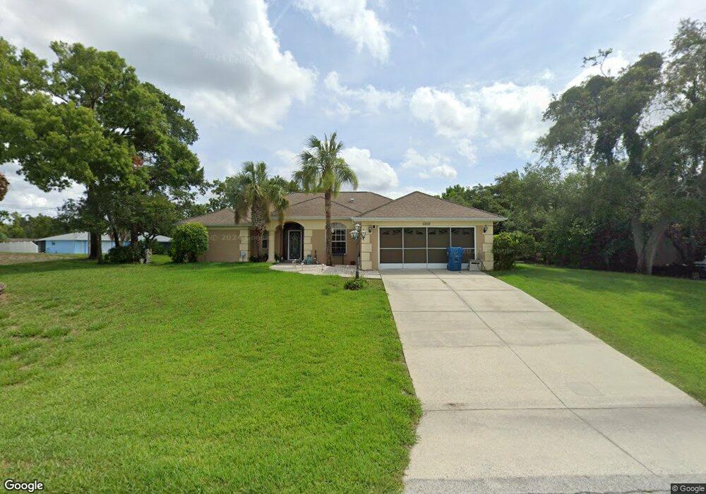
6859 Eastbrook Dr Spring Hill, FL 34606
Estimated Value: $332,016 - $362,000
3
Beds
2
Baths
1,921
Sq Ft
$181/Sq Ft
Est. Value
About This Home
This home is located at 6859 Eastbrook Dr, Spring Hill, FL 34606 and is currently estimated at $348,504, approximately $181 per square foot. 6859 Eastbrook Dr is a home located in Hernando County with nearby schools including Westside Elementary School, Fox Chapel Middle School, and Weeki Wachee High School.
Ownership History
Date
Name
Owned For
Owner Type
Purchase Details
Closed on
Jan 24, 2022
Sold by
Demontozon Maurice G and Lou Betty
Bought by
Demontozon Maurice G and Livi Betty
Current Estimated Value
Purchase Details
Closed on
Jun 1, 1999
Sold by
Harris Walter L and Harris Ruth E
Bought by
Demontozon Maurice G and Demontozon Betty L
Home Financials for this Owner
Home Financials are based on the most recent Mortgage that was taken out on this home.
Original Mortgage
$57,810
Interest Rate
6.9%
Create a Home Valuation Report for This Property
The Home Valuation Report is an in-depth analysis detailing your home's value as well as a comparison with similar homes in the area
Home Values in the Area
Average Home Value in this Area
Purchase History
| Date | Buyer | Sale Price | Title Company |
|---|---|---|---|
| Demontozon Maurice G | -- | Hengesbach & Hengesbach Pa | |
| Demontozon Maurice G | $105,000 | -- |
Source: Public Records
Mortgage History
| Date | Status | Borrower | Loan Amount |
|---|---|---|---|
| Previous Owner | Demontozon Maurice G | $57,810 |
Source: Public Records
Tax History Compared to Growth
Tax History
| Year | Tax Paid | Tax Assessment Tax Assessment Total Assessment is a certain percentage of the fair market value that is determined by local assessors to be the total taxable value of land and additions on the property. | Land | Improvement |
|---|---|---|---|---|
| 2024 | $1,734 | $115,987 | -- | -- |
| 2023 | $1,734 | $112,609 | $0 | $0 |
| 2022 | $1,641 | $109,329 | $0 | $0 |
| 2021 | $1,629 | $106,145 | $0 | $0 |
| 2020 | $1,517 | $104,679 | $0 | $0 |
| 2019 | $1,510 | $102,326 | $0 | $0 |
| 2018 | $933 | $100,418 | $0 | $0 |
| 2017 | $1,205 | $98,353 | $0 | $0 |
| 2016 | $1,164 | $96,330 | $0 | $0 |
| 2015 | $1,168 | $95,660 | $0 | $0 |
| 2014 | $1,145 | $94,901 | $0 | $0 |
Source: Public Records
Map
Nearby Homes
- 461 Swallow Ln
- 471 Swallow Ln
- 6985 Merrick Ln
- 7028 Merrick Ln
- 6819 Treehaven Dr
- 6766 Treehaven Dr
- 6513 Clearwater Dr
- 0 Clearwater Dr
- 124 Hallam Ct
- 6937 Treehaven Dr
- 7280 Pinehurst Dr
- 18923 Rolling Oak Dr
- 126 Canby Cir
- 118 Canby Cir
- 6236 Dalton St
- 6237 Dalton St
- 380 Cobblestone Dr
- 509 Savoy Ct
- 0 Landmark Dr Unit MFRW7878444
- 0 Landmark Dr Unit 2255300
- 6871 Eastbrook Dr
- 440 Swallow Ln
- 6412 Mayhill Ct
- 6858 Eastbrook Dr
- 441 Swallow Ln
- 6881 Eastbrook Dr
- 6835 Eastbrook Dr
- 6868 Eastbrook Dr
- 6420 Mayhill Ct
- 6878 Eastbrook Dr
- 451 Swallow Ln
- 6840 Eastbrook Dr
- 6891 Eastbrook Dr
- 458 Swallow Ln
- 6825 Eastbrook Dr
- 6428 Mayhill Ct
- 6830 Eastbrook Dr
- 399 Swallow Ln
- 6888 Eastbrook Dr
- 390 Swallow Ln