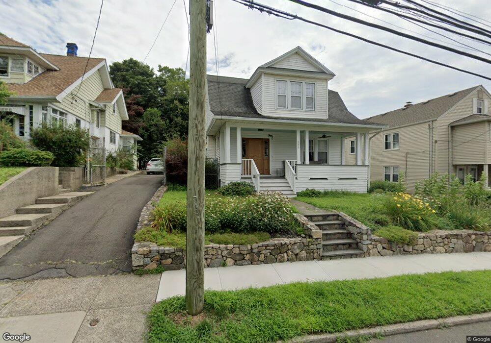
686 Courtland Ave Bridgeport, CT 06605
Black Rock NeighborhoodEstimated Value: $581,770 - $733,000
4
Beds
2
Baths
1,814
Sq Ft
$352/Sq Ft
Est. Value
About This Home
This home is located at 686 Courtland Ave, Bridgeport, CT 06605 and is currently estimated at $638,443, approximately $351 per square foot. 686 Courtland Ave is a home located in Fairfield County with nearby schools including Holland Hill Elementary, Fairfield Ludlowe High School, and St. Ann Campus - Catholic Academy of Bridgeport.
Ownership History
Date
Name
Owned For
Owner Type
Purchase Details
Closed on
May 15, 2002
Sold by
Sorto Leslie
Bought by
Washburn Thomas L and Washburn Deirdre J
Current Estimated Value
Home Financials for this Owner
Home Financials are based on the most recent Mortgage that was taken out on this home.
Original Mortgage
$200,700
Interest Rate
7.15%
Purchase Details
Closed on
Oct 14, 1999
Sold by
Twigg Steven W and Twigg Barbara A
Bought by
Porto Leslie
Create a Home Valuation Report for This Property
The Home Valuation Report is an in-depth analysis detailing your home's value as well as a comparison with similar homes in the area
Home Values in the Area
Average Home Value in this Area
Purchase History
| Date | Buyer | Sale Price | Title Company |
|---|---|---|---|
| Washburn Thomas L | $225,000 | -- | |
| Washburn Thomas L | $225,000 | -- | |
| Porto Leslie | $170,000 | -- | |
| Porto Leslie | $170,000 | -- |
Source: Public Records
Mortgage History
| Date | Status | Borrower | Loan Amount |
|---|---|---|---|
| Open | Porto Leslie | $206,000 | |
| Closed | Porto Leslie | $200,700 |
Source: Public Records
Tax History Compared to Growth
Tax History
| Year | Tax Paid | Tax Assessment Tax Assessment Total Assessment is a certain percentage of the fair market value that is determined by local assessors to be the total taxable value of land and additions on the property. | Land | Improvement |
|---|---|---|---|---|
| 2025 | $10,305 | $237,170 | $155,970 | $81,200 |
| 2024 | $10,305 | $237,170 | $155,970 | $81,200 |
| 2023 | $10,305 | $237,170 | $155,970 | $81,200 |
| 2022 | $10,305 | $237,170 | $155,970 | $81,200 |
| 2021 | $10,305 | $237,170 | $155,970 | $81,200 |
| 2020 | $10,163 | $188,230 | $114,200 | $74,030 |
| 2019 | $10,163 | $188,230 | $114,200 | $74,030 |
| 2018 | $10,234 | $188,230 | $114,200 | $74,030 |
| 2017 | $10,234 | $188,230 | $114,200 | $74,030 |
| 2016 | $10,234 | $188,230 | $114,200 | $74,030 |
| 2015 | $9,709 | $230,070 | $131,030 | $99,040 |
| 2014 | $9,709 | $230,070 | $131,030 | $99,040 |
Source: Public Records
Map
Nearby Homes
- 105 Fox St Unit 107
- 39 Jetland Place Unit 41
- 165 Bennett St
- 554 Brewster St Unit 4
- 855 Brewster St Unit 857
- 75 Homestead Ave Unit 77
- 26 Rowsley St Unit 3
- 37 Rowsley St Unit 6
- 166 Alfred St
- 317 Brewster St
- 361 Riverside Dr
- 167 Scofield Ave
- 2180 Kings Hwy Unit 1
- 188 Monroe St Unit 190
- 82 Waldorf Ave
- 0 Battery Park Dr
- 135 Whittier St
- 31 Whittier St
- 25 Whittier St
- 38 Edge Hill Rd
- 676 Courtland Ave
- 676 Courtland Ave Unit 2nd fl
- 674 Courtland Ave Unit 676
- 694 Courtland Ave
- 666 Courtland Ave
- 704 Courtland Ave
- 42 Clarkson St
- 40 Clarkson St
- 50 Clarkson St
- 60 Clarkson St
- 656 Courtland Ave
- 652 Courtland Ave Unit 656
- 675 Courtland Ave Unit 679
- 675 Courtland Ave Unit 675 Courtland Ave
- 671 Courtland Ave
- 70 Clarkson St
- 619 Courtland Ave
- 644 Courtland Ave Unit 646
- 661 Courtland Ave
- 8 Montgomery St Unit 10