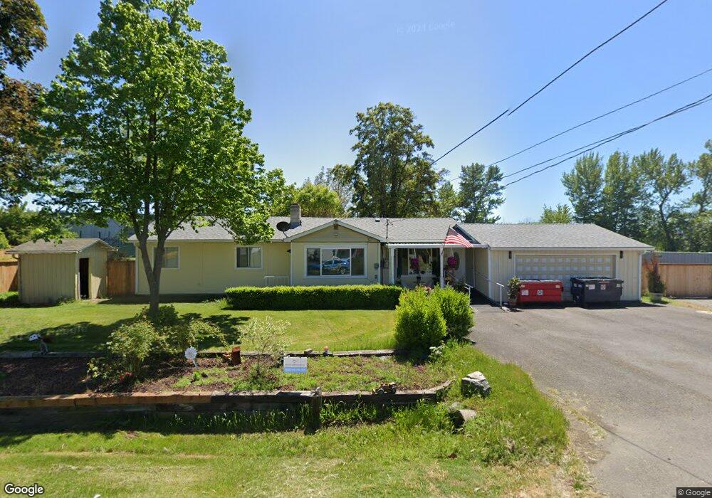
686 Lawnsdale Rd Medford, OR 97504
Northwest Medford NeighborhoodEstimated Value: $427,000 - $593,000
4
Beds
2
Baths
1,976
Sq Ft
$250/Sq Ft
Est. Value
About This Home
This home is located at 686 Lawnsdale Rd, Medford, OR 97504 and is currently estimated at $494,246, approximately $250 per square foot. 686 Lawnsdale Rd is a home located in Jackson County with nearby schools including Wilson Elementary School, Hedrick Middle School, and North Medford High School.
Ownership History
Date
Name
Owned For
Owner Type
Purchase Details
Closed on
Sep 2, 2022
Sold by
Janet Anderson
Bought by
Johnston Miranda Shantel and Johnston Shad
Current Estimated Value
Home Financials for this Owner
Home Financials are based on the most recent Mortgage that was taken out on this home.
Original Mortgage
$432,000
Outstanding Balance
$411,850
Interest Rate
4.99%
Mortgage Type
New Conventional
Estimated Equity
$82,396
Purchase Details
Closed on
Sep 29, 2011
Sold by
Anderson Dave J
Bought by
Anderson Janet
Purchase Details
Closed on
Aug 30, 1999
Sold by
Broomfield Robert F and Broomfield Donna M
Bought by
Anderson Dave J and Anderson Janet
Home Financials for this Owner
Home Financials are based on the most recent Mortgage that was taken out on this home.
Original Mortgage
$118,800
Interest Rate
9.5%
Create a Home Valuation Report for This Property
The Home Valuation Report is an in-depth analysis detailing your home's value as well as a comparison with similar homes in the area
Home Values in the Area
Average Home Value in this Area
Purchase History
| Date | Buyer | Sale Price | Title Company |
|---|---|---|---|
| Johnston Miranda Shantel | $480,000 | First American Title | |
| Anderson Janet | -- | None Available | |
| Anderson Dave J | $148,500 | Crater Title Insurance |
Source: Public Records
Mortgage History
| Date | Status | Borrower | Loan Amount |
|---|---|---|---|
| Open | Johnston Miranda Shantel | $432,000 | |
| Previous Owner | Anderson Dave J | $118,800 | |
| Closed | Anderson Dave J | $29,700 |
Source: Public Records
Tax History Compared to Growth
Tax History
| Year | Tax Paid | Tax Assessment Tax Assessment Total Assessment is a certain percentage of the fair market value that is determined by local assessors to be the total taxable value of land and additions on the property. | Land | Improvement |
|---|---|---|---|---|
| 2025 | $3,773 | $260,190 | $204,920 | $55,270 |
| 2024 | $3,773 | $252,620 | $198,960 | $53,660 |
| 2023 | $3,658 | $245,270 | $193,170 | $52,100 |
| 2022 | $3,569 | $245,270 | $193,170 | $52,100 |
| 2021 | $3,477 | $238,130 | $187,550 | $50,580 |
| 2020 | $3,403 | $231,200 | $182,090 | $49,110 |
| 2019 | $3,323 | $217,940 | $171,650 | $46,290 |
| 2018 | $3,238 | $211,600 | $166,660 | $44,940 |
| 2017 | $3,179 | $211,600 | $166,660 | $44,940 |
| 2016 | $3,186 | $199,460 | $157,100 | $42,360 |
| 2015 | $3,047 | $189,890 | $149,560 | $40,330 |
| 2014 | $2,625 | $164,100 | $126,760 | $37,340 |
Source: Public Records
Map
Nearby Homes
- 811 O'Hare Pkwy
- 246 Reanna Way
- 529 Black Bear Dr
- 2772 Merriman Rd
- 450 Midway Rd Unit 16
- 450 Midway Rd Unit 5
- 3119 Merriman Rd
- 2621 Merriman Rd Unit 3000
- 2587 Merriman Rd Unit 3200
- 2573 Merriman Rd Unit 3300
- 2605 Merriman Rd Unit 3101
- 1025 Fairfield Ave
- 191 Mellecker Way
- 199 Mellecker Way
- 1017 Fairfield Ave
- 460 Federal Way
- 2252 Table Rock Rd Unit 128
- 2252 Table Rock Rd Unit 97
- 2252 Table Rock Rd Unit SPC 102
- 2252 Table Rock Rd Unit SPC 228
- 3253 Cottonwood Ave
- 709 Lawnsdale Rd
- 740 Lawnsdale Rd
- 703 Lawnsdale Rd
- 717 Lawnsdale Rd
- 3277 Cottonwood Ave
- 742 Lawnsdale Rd
- 743 Lawnsdale Rd
- 686 Gilman Rd
- 752 Lawnsdale Rd
- 658 Gilman Rd
- 698 Gilman Rd
- 762 Lawnsdale Rd
- 763 Lawnsdale Rd
- 718 Gilman Rd
- 748 Gilman Rd
- 886 Chevy Way
- 770 Lawnsdale Rd
- 777 Lawnsdale Rd
- 762 Gilman Rd