Estimated Value: $229,125 - $254,000
3
Beds
1
Bath
1,160
Sq Ft
$206/Sq Ft
Est. Value
About This Home
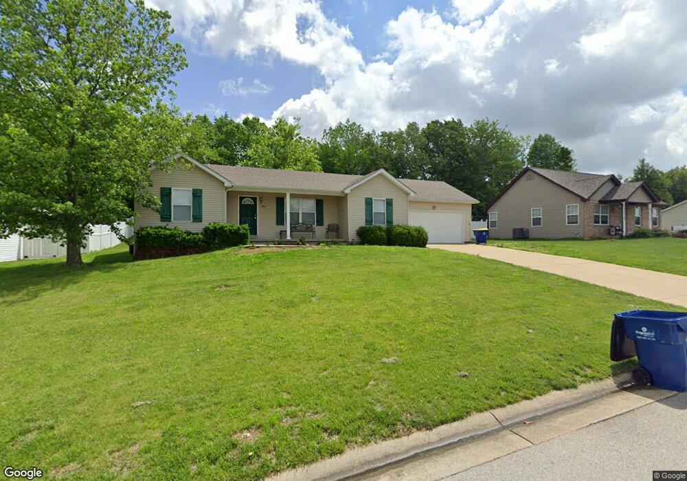
This home is located at 686 Lindsey Dr, Union, MO 63084 and is currently estimated at $239,042, approximately $206 per square foot. 686 Lindsey Dr is a home located in Franklin County with nearby schools including Union High School and Immaculate Conception School.
Ownership History
Date
Name
Owned For
Owner Type
Purchase Details
Closed on
Nov 26, 2007
Sold by
Beckmann Michelle and Bryan Michelle
Bought by
Beckmann Michelle and Beckmann Christopher
Current Estimated Value
Purchase Details
Closed on
Jun 15, 2007
Sold by
Rohrs Charles F
Bought by
Beckmann Christopher and Bryan Michelle
Home Financials for this Owner
Home Financials are based on the most recent Mortgage that was taken out on this home.
Original Mortgage
$149,500
Outstanding Balance
$91,035
Interest Rate
6.19%
Mortgage Type
New Conventional
Estimated Equity
$148,007
Create a Home Valuation Report for This Property
The Home Valuation Report is an in-depth analysis detailing your home's value as well as a comparison with similar homes in the area
Home Values in the Area
Average Home Value in this Area
Purchase History
| Date | Buyer | Sale Price | Title Company |
|---|---|---|---|
| Beckmann Michelle | -- | Title Partners Agency Llc | |
| Beckmann Christopher | $149,500 | None Available |
Source: Public Records
Mortgage History
| Date | Status | Borrower | Loan Amount |
|---|---|---|---|
| Open | Beckmann Christopher | $149,500 |
Source: Public Records
Tax History
| Year | Tax Paid | Tax Assessment Tax Assessment Total Assessment is a certain percentage of the fair market value that is determined by local assessors to be the total taxable value of land and additions on the property. | Land | Improvement |
|---|---|---|---|---|
| 2025 | $1,874 | $31,436 | $0 | $0 |
| 2024 | $1,874 | $26,606 | $0 | $0 |
| 2023 | $1,603 | $26,606 | $0 | $0 |
| 2022 | $1,644 | $27,223 | $0 | $0 |
| 2021 | $1,647 | $27,223 | $0 | $0 |
| 2020 | $1,512 | $24,599 | $0 | $0 |
| 2019 | $1,509 | $24,599 | $0 | $0 |
| 2018 | $1,403 | $24,012 | $0 | $0 |
| 2017 | $1,407 | $24,012 | $0 | $0 |
| 2016 | $1,433 | $23,913 | $0 | $0 |
| 2015 | $1,410 | $23,913 | $0 | $0 |
| 2014 | $1,423 | $24,109 | $0 | $0 |
Source: Public Records
Map
Nearby Homes
- 26 & 30 Ridge Point Meadows
- 626 Lindsey Dr
- 702 Clearview Dr Unit 1
- 154 Joel Ave
- 3 Hoffert St
- 914 W State St
- 408 Hall Ave
- 613 W State St
- 54 Hickory Cir
- 613 S Jefferson Ave
- 413 W State St
- 21 Forest Ln
- 0 Oak Grove School Rd
- 435 Water Tower Dr
- 1016 Westmoreland Blvd
- 000 Shawneetown Ford Spur 4` Unit Lot
- 000 Shawneetown Ford Spur Unit Lot 2
- 207 E Park Ave
- 614 E State St
- 1008 N Washington Ave
- 684 Lindsey Dr
- 690 Lindsey Dr
- 3 Brittany Dail Dr
- 7 Lindsey Dr
- 680 Lindsey Dr
- 5 Brittany Dail Dr
- 683 Lindsey Dr
- 687 Lindsey Dr
- 694 Lindsey Dr
- 1 Brittany Dail Dr
- 679 Lindsey Dr
- 691 Lindsey Dr
- 7 Brittany Dail Dr
- 676 Lindsey Dr
- 676 Lindsey Dr
- 0TBB Lindsey Dr
- 675 Lindsey Dr
- 695 Lindsey Dr
- 4 Brittany Dail Dr
Your Personal Tour Guide
Ask me questions while you tour the home.