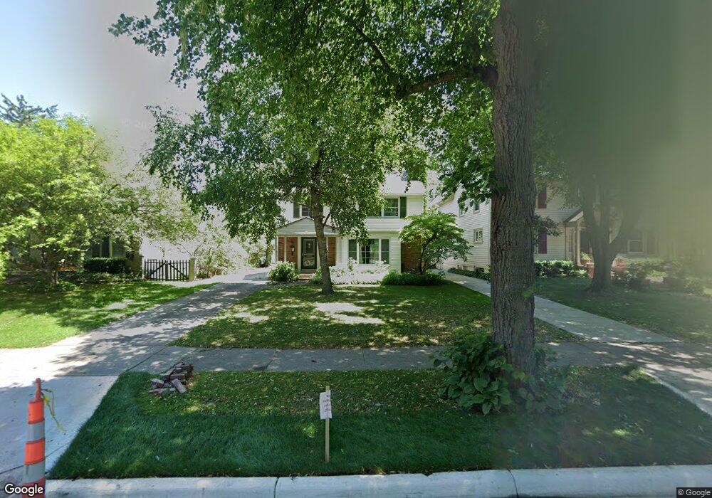
686 Rivard Blvd Grosse Pointe, MI 48230
Estimated Value: $297,817 - $465,000
Studio
1
Bath
1,602
Sq Ft
$249/Sq Ft
Est. Value
About This Home
This home is located at 686 Rivard Blvd, Grosse Pointe, MI 48230 and is currently estimated at $398,704, approximately $248 per square foot. 686 Rivard Blvd is a home located in Wayne County with nearby schools including Richard Elementary School, Brownell Middle School, and Grosse Pointe South High School.
Ownership History
Date
Name
Owned For
Owner Type
Purchase Details
Closed on
Mar 7, 2025
Sold by
Hendershot Robert M
Bought by
Mcloughlin Mark and Mcloughlin Sean
Current Estimated Value
Purchase Details
Closed on
Sep 30, 2013
Sold by
Hendershot Kathleen M
Bought by
Hendershot Robert M
Home Financials for this Owner
Home Financials are based on the most recent Mortgage that was taken out on this home.
Original Mortgage
$88,500
Interest Rate
4.56%
Mortgage Type
New Conventional
Create a Home Valuation Report for This Property
The Home Valuation Report is an in-depth analysis detailing your home's value as well as a comparison with similar homes in the area
Home Values in the Area
Average Home Value in this Area
Purchase History
| Date | Buyer | Sale Price | Title Company |
|---|---|---|---|
| Mcloughlin Mark | $235,000 | Chirco Title Agency | |
| Mcloughlin Mark | $235,000 | Chirco Title Agency | |
| Hendershot Robert M | -- | None Available |
Source: Public Records
Mortgage History
| Date | Status | Borrower | Loan Amount |
|---|---|---|---|
| Previous Owner | Hendershot Robert M | $88,500 |
Source: Public Records
Tax History
| Year | Tax Paid | Tax Assessment Tax Assessment Total Assessment is a certain percentage of the fair market value that is determined by local assessors to be the total taxable value of land and additions on the property. | Land | Improvement |
|---|---|---|---|---|
| 2025 | $4,533 | $201,100 | $0 | $0 |
| 2024 | $4,381 | $195,500 | $0 | $0 |
| 2023 | $4,178 | $179,300 | $0 | $0 |
| 2022 | $6,046 | $167,300 | $0 | $0 |
| 2021 | $5,733 | $165,500 | $0 | $0 |
| 2019 | $5,955 | $144,900 | $0 | $0 |
| 2018 | $3,626 | $146,400 | $0 | $0 |
| 2017 | $3,828 | $144,700 | $0 | $0 |
| 2016 | $5,457 | $138,600 | $0 | $0 |
| 2015 | $10,348 | $122,200 | $0 | $0 |
| 2013 | $10,025 | $104,800 | $0 | $0 |
| 2012 | -- | $97,900 | $0 | $0 |
Source: Public Records
Map
Nearby Homes
- 614 Rivard Blvd
- 180 Fisher Rd
- 256 Fisher Rd
- 201 Mcmillan Rd
- 213 Muir Rd
- 775 Notre Dame St
- 17540 Mack Ave Unit 10
- 781 Loraine St
- 17590 Mack Ave Unit 8
- 516 Neff Ln
- 341 Mcmillan Rd
- 355 Lincoln Rd
- 194 Charlevoix Ave
- 612 Cadieux Rd
- 25 Village Ln
- 379 Lakeland St
- 345 Roosevelt Place
- 3808 Cadieux Rd
- 4104 Woodhall St
- 4082 Hereford St
- 680 Rivard Blvd
- 690 Rivard Blvd
- 676 Rivard Blvd
- 696 Rivard Blvd
- 700 Rivard Blvd
- 670 Rivard Blvd
- 647 Washington Rd
- 675 Rivard Blvd
- 695 Rivard Blvd
- 706 Rivard Blvd
- 662 Rivard Blvd
- 685 Rivard Blvd
- 637 Washington Rd
- 689 Rivard Blvd
- 679 Rivard Blvd
- 660 Rivard Blvd
- 710 Rivard Blvd
- 665 Rivard Blvd
- 705 Rivard Blvd
- 673 Washington Rd
Your Personal Tour Guide
Ask me questions while you tour the home.