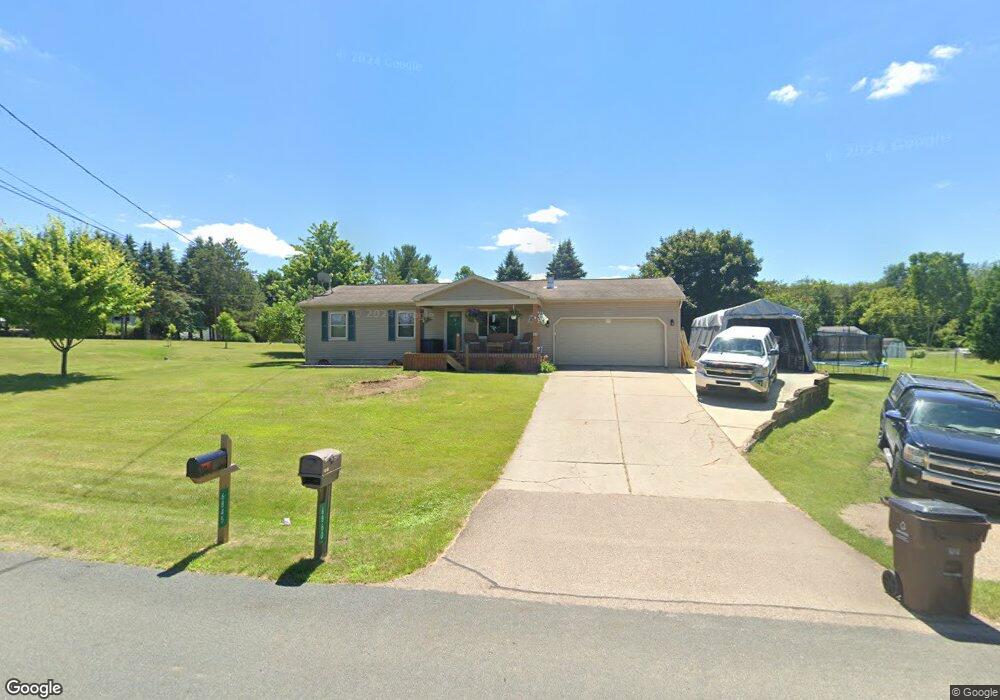
6860 Westgate Dr Laingsburg, MI 48848
Estimated Value: $246,436 - $291,000
3
Beds
1
Bath
960
Sq Ft
$282/Sq Ft
Est. Value
About This Home
This home is located at 6860 Westgate Dr, Laingsburg, MI 48848 and is currently estimated at $271,109, approximately $282 per square foot. 6860 Westgate Dr is a home located in Clinton County with nearby schools including Laingsburg Elementary School, Laingsburg Middle School, and Laingsburg High School.
Ownership History
Date
Name
Owned For
Owner Type
Purchase Details
Closed on
Aug 9, 2021
Sold by
Cody Karla J and Taylor Karla J
Bought by
Cody Karla J
Current Estimated Value
Home Financials for this Owner
Home Financials are based on the most recent Mortgage that was taken out on this home.
Original Mortgage
$144,000
Interest Rate
2.9%
Mortgage Type
New Conventional
Purchase Details
Closed on
Nov 13, 2003
Sold by
Taylor Christopher T and Taylor Karla J
Bought by
Taylor Karla J
Home Financials for this Owner
Home Financials are based on the most recent Mortgage that was taken out on this home.
Original Mortgage
$135,900
Interest Rate
8.55%
Mortgage Type
Purchase Money Mortgage
Create a Home Valuation Report for This Property
The Home Valuation Report is an in-depth analysis detailing your home's value as well as a comparison with similar homes in the area
Home Values in the Area
Average Home Value in this Area
Purchase History
| Date | Buyer | Sale Price | Title Company |
|---|---|---|---|
| Cody Karla J | -- | Liberty Title | |
| Taylor Karla J | -- | Fatic |
Source: Public Records
Mortgage History
| Date | Status | Borrower | Loan Amount |
|---|---|---|---|
| Closed | Cody Karla J | $144,000 | |
| Closed | Taylor Karla J | $135,900 |
Source: Public Records
Tax History Compared to Growth
Tax History
| Year | Tax Paid | Tax Assessment Tax Assessment Total Assessment is a certain percentage of the fair market value that is determined by local assessors to be the total taxable value of land and additions on the property. | Land | Improvement |
|---|---|---|---|---|
| 2025 | $2,635 | $102,600 | $26,000 | $76,600 |
| 2024 | $872 | $93,500 | $24,000 | $69,500 |
| 2023 | $826 | $87,200 | $0 | $0 |
| 2022 | $2,404 | $80,800 | $22,500 | $58,300 |
| 2021 | $2,132 | $76,800 | $21,300 | $55,500 |
| 2020 | $1,981 | $71,100 | $20,000 | $51,100 |
| 2019 | $1,999 | $68,300 | $20,000 | $48,300 |
| 2018 | $1,791 | $65,100 | $20,000 | $45,100 |
| 2017 | $1,770 | $65,800 | $20,000 | $45,800 |
| 2016 | $1,714 | $64,000 | $20,000 | $44,000 |
| 2015 | $1,700 | $63,800 | $0 | $0 |
| 2011 | -- | $57,300 | $0 | $0 |
Source: Public Records
Map
Nearby Homes
- 9195 Westchester Dr
- V/L Victoria Shore Dr
- 0 Peninsula Way
- Parcel B S Hollister Rd
- 9457 S Hollister Rd
- 702 N Oakland Dr
- 780 N West St
- 9550 Alward Rd
- V/L W 2nd St N
- 7599 Alward Rd
- 7047 S Upton
- 7370 Cross Creek Dr
- 8584 E Parker Rd
- 302 N Shiawassee St
- 407 S Woodhull Rd
- 0 Laingsburg Rd
- 6706 E Price Rd
- V/L S Shepardsville Rd
- 8150 Doyle Rd
- 3525 S Hollister Rd
- 6816 Westgate Dr
- 0 Westgate Dr
- 6845 Westgate Dr
- 9328 Highland View Dr
- 6859 Westgate Dr
- 6900 Westgate Dr
- 6804 Westgate Dr
- 6803 Westgate Dr
- 9300 Highland View Dr
- 0 Highland View Dr
- 9261 Highland View Dr
- 9313 Lancaster Rd
- 9347 Lancaster Rd
- 6789 Westgate Dr
- 6790 Westgate Dr
- 6914 Westgate Dr
- 6901 Westgate Dr
- 9381 Lancaster Rd
- 9285 Jason Rd