
Seller's Agent in 2025
David Fetterhoff
Berkshire Hathaway - Punxsutawney
(814) 590-3446
523 Total Sales
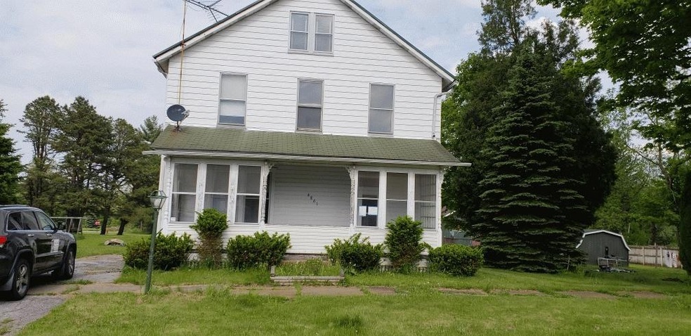
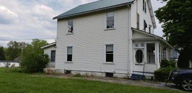


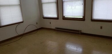
TWO LOTS with Level Yard. 4-Bedroom, 2.25 Baths. LARGE OPEN ATTIC. Fenced-In Rear Yard. Detached 2-Car Garage
Last Agent to Sell the Property
Berkshire Hathaway - Punxsutawney License #AB 067146 Listed on: 05/25/2018
| Date | Type | Sale Price | Title Company |
|---|---|---|---|
| Sheriffs Deed | $1,334 | None Available | |
| Deed | $58,000 | None Available | |
| Deed | $14,099 | None Available | |
| Deed | -- | None Available |
| Date | Status | Loan Amount | Loan Type |
|---|---|---|---|
| Previous Owner | $59,183 | New Conventional |
| Date | Event | Price | List to Sale | Price per Sq Ft | Prior Sale |
|---|---|---|---|---|---|
| 09/19/2025 09/19/25 | Sold | $15,000 | -76.9% | $8 / Sq Ft | |
| 08/20/2025 08/20/25 | Pending | -- | -- | -- | |
| 08/25/2024 08/25/24 | Sold | $65,000 | +333.3% | $31 / Sq Ft | View Prior Sale |
| 07/26/2024 07/26/24 | Pending | -- | -- | -- | |
| 05/25/2018 05/25/18 | For Sale | $15,000 | -76.9% | $8 / Sq Ft | |
| 09/15/2014 09/15/14 | For Sale | $65,000 | -- | $31 / Sq Ft |
| Year | Tax Paid | Tax Assessment Tax Assessment Total Assessment is a certain percentage of the fair market value that is determined by local assessors to be the total taxable value of land and additions on the property. | Land | Improvement |
|---|---|---|---|---|
| 2025 | $1,039 | $15,900 | $1,250 | $14,650 |
| 2024 | $199 | $7,950 | $625 | $7,325 |
| 2023 | $923 | $7,950 | $625 | $7,325 |
| 2022 | $877 | $7,950 | $625 | $7,325 |
| 2021 | $858 | $7,950 | $625 | $7,325 |
| 2020 | $858 | $7,950 | $625 | $7,325 |
| 2019 | $861 | $7,950 | $625 | $7,325 |
| 2018 | $806 | $7,950 | $625 | $7,325 |
| 2017 | $834 | $7,950 | $625 | $7,325 |
| 2016 | -- | $7,950 | $625 | $7,325 |
| 2015 | -- | $7,950 | $625 | $7,325 |
| 2014 | -- | $7,950 | $625 | $7,325 |
Seller's Agent in 2025
David Fetterhoff
Berkshire Hathaway - Punxsutawney
(814) 590-3446
523 Total Sales
C
Seller Co-Listing Agent in 2025
Carl Medsger
Berkshire Hathaway - Punxsutawney
(814) 938-3031
295 Total Sales
R
Buyer's Agent in 2025
RICHARD ELLENBERGER
HOWARD HANNA-ALLEMANG
(814) 952-6581
358 Total Sales
B
Seller's Agent in 2024
Brandy Hanley
LAUREL REALTY
Source: Clearfield Jefferson Association of REALTORS®
MLS Number: 17-76
APN: 0020A1330800014