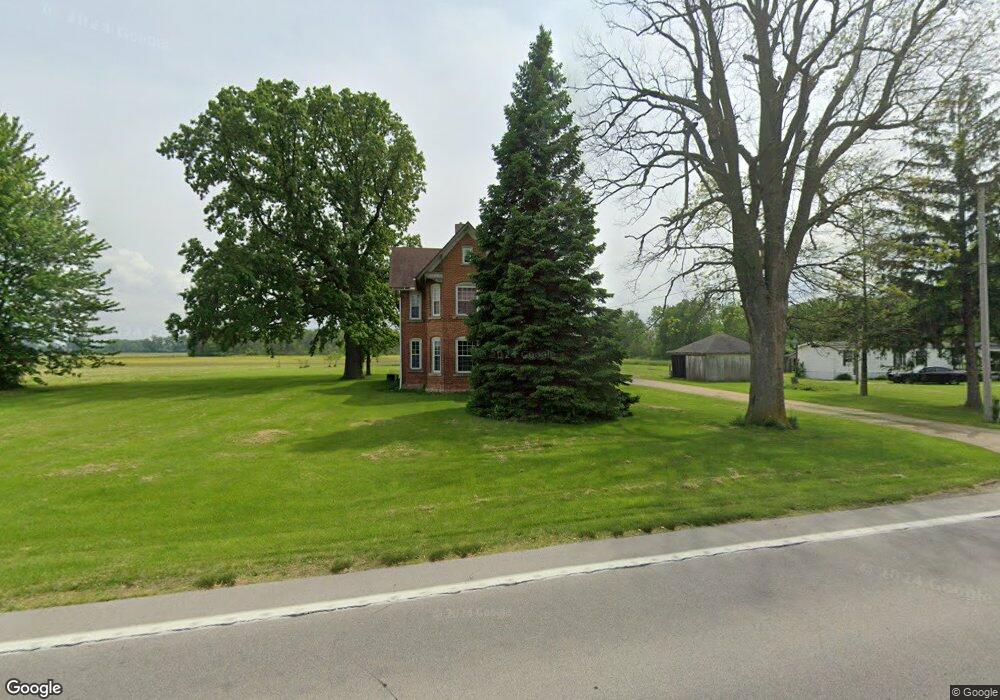
6862 West Harbor Rd Port Clinton, OH 43452
Estimated Value: $254,114 - $299,000
5
Beds
2
Baths
1,949
Sq Ft
$138/Sq Ft
Est. Value
About This Home
This home is located at 6862 West Harbor Rd, Port Clinton, OH 43452 and is currently estimated at $269,529, approximately $138 per square foot. 6862 West Harbor Rd is a home located in Ottawa County with nearby schools including Bataan Memorial Primary School, Bataan Memorial Intermediate School, and Port Clinton Middle School.
Ownership History
Date
Name
Owned For
Owner Type
Purchase Details
Closed on
Jun 17, 2011
Sold by
Provonsha Mary M and Provonsha Paul
Bought by
Provonsha Mary M and The Mary M Provonsha Living Trust
Current Estimated Value
Purchase Details
Closed on
Mar 23, 2007
Sold by
Skinner Steven C
Bought by
Provonsha Paul and Provonsha Mary M
Home Financials for this Owner
Home Financials are based on the most recent Mortgage that was taken out on this home.
Original Mortgage
$325,000
Outstanding Balance
$196,826
Interest Rate
6.27%
Mortgage Type
Purchase Money Mortgage
Estimated Equity
$72,704
Purchase Details
Closed on
Feb 4, 1993
Sold by
Minier Dorothy
Bought by
Skinner Jarrod L and Skinner Barbara J
Create a Home Valuation Report for This Property
The Home Valuation Report is an in-depth analysis detailing your home's value as well as a comparison with similar homes in the area
Home Values in the Area
Average Home Value in this Area
Purchase History
| Date | Buyer | Sale Price | Title Company |
|---|---|---|---|
| Provonsha Mary M | -- | Attorney | |
| Provonsha Paul W | -- | Attorney | |
| Provonsha Paul | $330,000 | Attorney | |
| Skinner Jarrod L | $25,000 | -- |
Source: Public Records
Mortgage History
| Date | Status | Borrower | Loan Amount |
|---|---|---|---|
| Open | Provonsha Paul | $325,000 |
Source: Public Records
Tax History Compared to Growth
Tax History
| Year | Tax Paid | Tax Assessment Tax Assessment Total Assessment is a certain percentage of the fair market value that is determined by local assessors to be the total taxable value of land and additions on the property. | Land | Improvement |
|---|---|---|---|---|
| 2024 | $2,560 | $76,325 | $12,089 | $64,236 |
| 2023 | $2,560 | $56,655 | $8,334 | $48,321 |
| 2022 | $2,108 | $56,655 | $8,334 | $48,321 |
| 2021 | $2,106 | $56,660 | $8,340 | $48,320 |
| 2020 | $1,933 | $49,920 | $7,190 | $42,730 |
| 2019 | $1,915 | $49,920 | $7,190 | $42,730 |
| 2018 | $1,918 | $49,920 | $7,190 | $42,730 |
| 2017 | $1,735 | $44,560 | $6,970 | $37,590 |
| 2016 | $1,742 | $44,560 | $6,970 | $37,590 |
| 2015 | $1,660 | $44,560 | $6,970 | $37,590 |
| 2014 | $829 | $42,680 | $6,970 | $35,710 |
| 2013 | $1,661 | $42,680 | $6,970 | $35,710 |
Source: Public Records
Map
Nearby Homes
- 141 N Wexford Dr E
- 295 Meachem Rd
- 265 S Meachem Rd
- 265 S Meachem Rd Unit 62
- 265 S Meachem Rd Unit 24
- 265 S Meachem Rd Unit 41
- 265 S Meachem Rd Unit 39
- 9238 W State Route 163
- 7723 W Little Portage Rd E
- 5225 W Lakeshore Dr
- 3800 W Lakeshore Dr
- 162 Oak Ridge Dr
- 2020 S Mud Creek Rd
- 328 E Water St
- 2915 W Rising Sun Rd
- 2915 W Risingsun Rd
- 2860 W Rising Sun Rd
- 147 E Water St
- 14328 W State Route 163
- 130 E Water St
- 6831 West Harbor Rd
- 6863 West Harbor Rd
- 6862 W Harbor Rd
- 6761 West Harbor Rd
- 6893 West Harbor Rd
- 6711 West Harbor Rd
- 6711 W Harbor Rd
- 6929 West Harbor Rd
- 6929 W Harbor Rd
- 6986 West Harbor Rd
- 6986 W Harbor Rd
- 6669 West Harbor Rd
- 6669 West Harbor Rd
- 6669 W Harbor Rd
- 37 N Carroll Erie Rd
- 1 N Carroll Erie Rd
- 6659 West Harbor Rd
- 7020 West Harbor Rd
- 6598 W Harbor Rd
- 100 N Rymers Rd