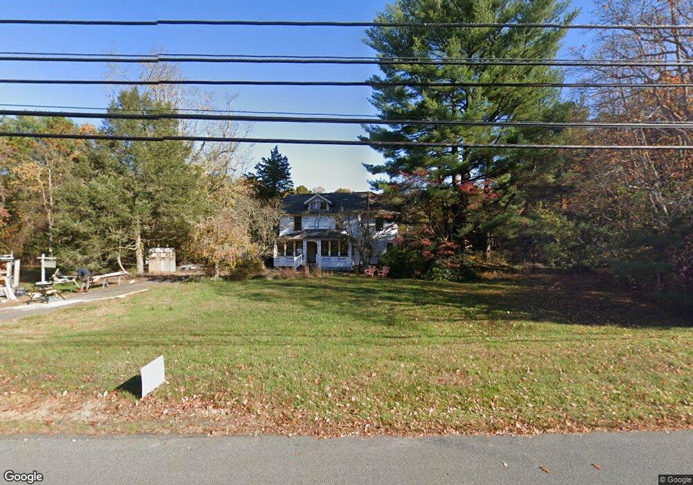
6863 Harding Hwy Mays Landing, NJ 08330
Estimated Value: $399,000 - $487,000
10
Beds
3
Baths
2,382
Sq Ft
$190/Sq Ft
Est. Value
About This Home
This home is located at 6863 Harding Hwy, Mays Landing, NJ 08330 and is currently estimated at $452,758, approximately $190 per square foot. 6863 Harding Hwy is a home located in Atlantic County with nearby schools including Joseph Shaner School, George L. Hess Educational Complex, and William Davies Middle School.
Ownership History
Date
Name
Owned For
Owner Type
Purchase Details
Closed on
Aug 3, 2017
Sold by
Hamilton Kenneth V and Schiavone Judy L
Bought by
Pfeifer Darin and Russell Joseph
Current Estimated Value
Home Financials for this Owner
Home Financials are based on the most recent Mortgage that was taken out on this home.
Original Mortgage
$199,428
Outstanding Balance
$166,047
Interest Rate
3.88%
Mortgage Type
New Conventional
Estimated Equity
$286,711
Purchase Details
Closed on
Apr 18, 2005
Sold by
Hamilton Kenneth V and Schiavone Judy L
Bought by
Hamilton Kenneth and Schiavone Judy L
Purchase Details
Closed on
Oct 10, 1990
Sold by
Hamilton Kenneth and Hamilton Schiavone,J
Bought by
Hamilton Kenneth and Hamilton Schiavone,J
Purchase Details
Closed on
Jan 4, 1989
Sold by
Gallerani Peter and Gallerani Theresa S
Bought by
Hamilton Kenneth and Hamilton Schiavone,J L
Create a Home Valuation Report for This Property
The Home Valuation Report is an in-depth analysis detailing your home's value as well as a comparison with similar homes in the area
Home Values in the Area
Average Home Value in this Area
Purchase History
| Date | Buyer | Sale Price | Title Company |
|---|---|---|---|
| Pfeifer Darin | $23,200 | Surety Title Co Llc | |
| Hamilton Kenneth | -- | -- | |
| Hamilton Kenneth | -- | -- | |
| Hamilton Kenneth | $110,000 | -- |
Source: Public Records
Mortgage History
| Date | Status | Borrower | Loan Amount |
|---|---|---|---|
| Open | Pfeifer Darin | $199,428 |
Source: Public Records
Tax History Compared to Growth
Tax History
| Year | Tax Paid | Tax Assessment Tax Assessment Total Assessment is a certain percentage of the fair market value that is determined by local assessors to be the total taxable value of land and additions on the property. | Land | Improvement |
|---|---|---|---|---|
| 2025 | $6,660 | $194,100 | $59,100 | $135,000 |
| 2024 | $6,660 | $194,100 | $59,100 | $135,000 |
| 2023 | $6,262 | $194,100 | $59,100 | $135,000 |
| 2022 | $6,262 | $194,100 | $59,100 | $135,000 |
| 2021 | $6,248 | $194,100 | $59,100 | $135,000 |
| 2020 | $6,248 | $194,100 | $59,100 | $135,000 |
| 2019 | $6,264 | $194,100 | $59,100 | $135,000 |
| 2018 | $6,044 | $194,100 | $59,100 | $135,000 |
| 2017 | $5,949 | $194,100 | $59,100 | $135,000 |
| 2016 | $5,782 | $194,100 | $59,100 | $135,000 |
| 2015 | $5,586 | $194,100 | $59,100 | $135,000 |
| 2014 | $5,640 | $214,700 | $69,400 | $145,300 |
Source: Public Records
Map
Nearby Homes
- 6414 Strand Ave
- 6422 Strand Ave
- 6839 Harding Hwy
- 6361 Beacon Ave
- 1368 Sitka Ave
- 0 Merton Ave Unit NJAC2020566
- 0 Railroad Blvd
- 1362 Annapolis Ave
- 0 South Ave
- 6917 Market St
- 6752 Harding Hwy
- 5485 Landis Ave
- 6141 Harley Ave
- 1516 Thirty Third St
- 328 Llewellyn Ave
- 0 San Francisco Ave
- 0 0 Strand Ave
- 0 St Petersburg Ave Unit NJAC2011842
- 0 St Petersburg Ave Unit NJAC2011840
- 0 Division Ave
- 6867 Harding Hwy
- 6862 Harding Hwy
- 6859 Harding Hwy
- 6868 Harding Hwy
- 6871 Harding Hwy
- 6872 Harding Hwy
- 6874 Harding Hwy
- 6858 Harding Hwy
- 6877 Harding Hwy
- 6880 Harding Hwy
- 6410 Strand Ave
- 6881 Harding Hwy
- 6849 Harding Hwy
- 6412 Strand Ave
- 6419 Strand Ave
- 6418 Strand Ave
- 6416 Strand Ave
- 6873 Old Landis Ave
- 6420 Strand Ave
- 6374 Klondyke Ave