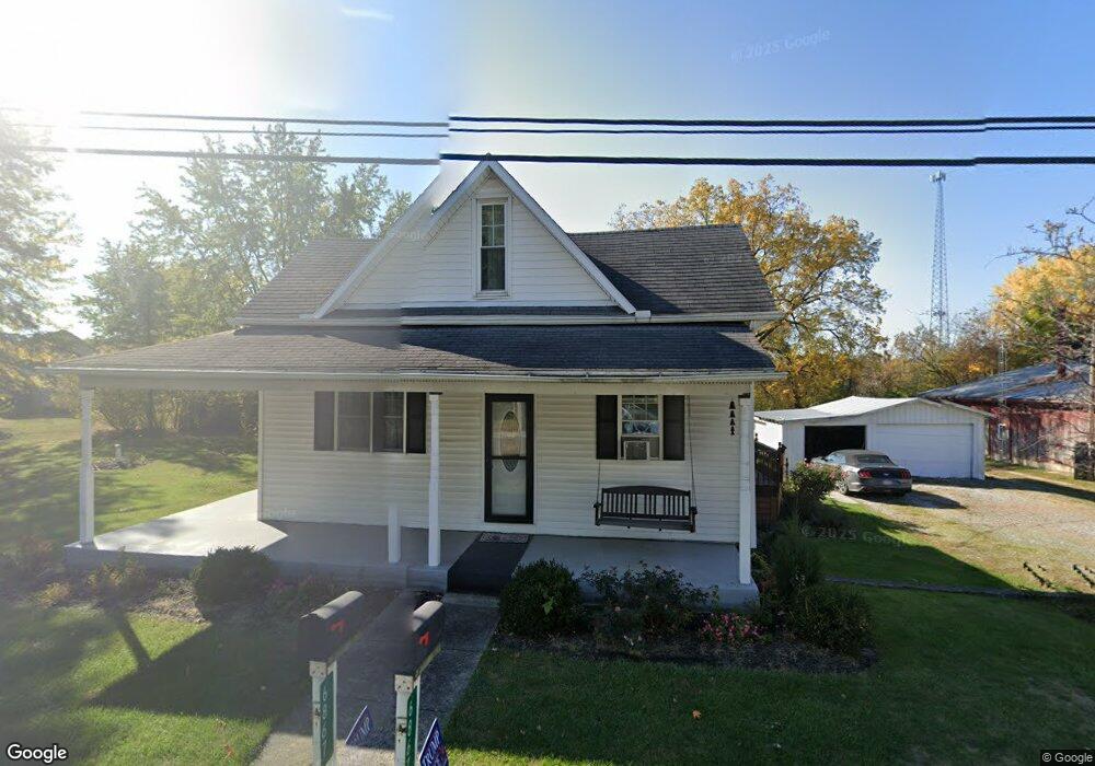
6867 State Route 66 Fort Loramie, OH 45845
Estimated Value: $135,000 - $290,000
3
Beds
2
Baths
1,740
Sq Ft
$138/Sq Ft
Est. Value
About This Home
This home is located at 6867 State Route 66, Fort Loramie, OH 45845 and is currently estimated at $240,232, approximately $138 per square foot. 6867 State Route 66 is a home located in Shelby County with nearby schools including Fort Loramie Elementary School and Fort Loramie Junior/Senior High School.
Ownership History
Date
Name
Owned For
Owner Type
Purchase Details
Closed on
Dec 8, 1998
Sold by
Westenheffer Thomas A
Bought by
Coverstone Danny C and Coverstone Theresa R
Current Estimated Value
Home Financials for this Owner
Home Financials are based on the most recent Mortgage that was taken out on this home.
Original Mortgage
$60,500
Outstanding Balance
$13,766
Interest Rate
6.8%
Mortgage Type
New Conventional
Estimated Equity
$226,466
Purchase Details
Closed on
Oct 10, 1997
Sold by
Kramer Joseph L
Bought by
Thomas A Westenheffer
Home Financials for this Owner
Home Financials are based on the most recent Mortgage that was taken out on this home.
Original Mortgage
$57,000
Interest Rate
7.7%
Mortgage Type
New Conventional
Create a Home Valuation Report for This Property
The Home Valuation Report is an in-depth analysis detailing your home's value as well as a comparison with similar homes in the area
Home Values in the Area
Average Home Value in this Area
Purchase History
| Date | Buyer | Sale Price | Title Company |
|---|---|---|---|
| Coverstone Danny C | $63,700 | -- | |
| Thomas A Westenheffer | $57,000 | -- |
Source: Public Records
Mortgage History
| Date | Status | Borrower | Loan Amount |
|---|---|---|---|
| Open | Coverstone Danny C | $60,500 | |
| Previous Owner | Thomas A Westenheffer | $57,000 |
Source: Public Records
Tax History Compared to Growth
Tax History
| Year | Tax Paid | Tax Assessment Tax Assessment Total Assessment is a certain percentage of the fair market value that is determined by local assessors to be the total taxable value of land and additions on the property. | Land | Improvement |
|---|---|---|---|---|
| 2024 | $1,703 | $49,000 | $10,730 | $38,270 |
| 2023 | $1,703 | $49,510 | $11,200 | $38,310 |
| 2022 | $1,425 | $37,740 | $9,100 | $28,640 |
| 2021 | $1,442 | $37,740 | $9,100 | $28,640 |
| 2020 | $1,440 | $37,740 | $9,100 | $28,640 |
| 2019 | $1,228 | $32,340 | $7,560 | $24,780 |
| 2018 | $1,198 | $32,340 | $7,560 | $24,780 |
| 2017 | $1,207 | $32,340 | $7,560 | $24,780 |
| 2016 | $1,119 | $29,980 | $6,300 | $23,680 |
| 2015 | $1,109 | $29,980 | $6,300 | $23,680 |
| 2014 | $1,109 | $29,980 | $6,300 | $23,680 |
| 2013 | $1,153 | $28,850 | $6,300 | $22,550 |
Source: Public Records
Map
Nearby Homes
- 5025 Walzer Rd
- 8381 Ohio 66
- 6388 Stoker Rd
- Tract 4 Rd
- 11519 Eilerman Rd
- Russia-Versailles Rd
- 2165 Stillwater Rd
- 12244 Short Dr Unit Condo Unit 10
- 7 E 2nd St
- 9900 Greenville Rd
- 8839 Murphy Rd
- 11968 Arling Rd
- 47 N Frankfort St
- 193 N Paris St
- 17 Stonegate Dr
- 0 Stonegate Dr Unit 21 10544857
- 0 Stonegate Dr Unit 14 10544847
- 36 Shania Place Unit 23
- 27 Shania Place Unit 26
- 19 Shania Place Unit 33
- 6825 Ohio 66
- 6825 State Route 66
- 6838 State Route 66
- 6875 State Route 66
- 6895 State Route 66
- 6850 State Route 66
- 6826 Canal St
- 6817 State Route 66
- 6809 State Route 66
- 3333 High St
- 6818 Canal St
- 3555 Mary St
- 6910 State Route 66
- 3321 High St
- 6915 State Route 66
- 6795 State Route 66
- 6789 State Route 66
- 6934 State Route 66
- 3330 High St
- 6811 Canal St