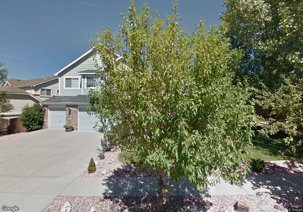
6869 Bitterroot Dr Colorado Springs, CO 80923
Norwood NeighborhoodEstimated Value: $649,663 - $706,000
5
Beds
4
Baths
3,138
Sq Ft
$218/Sq Ft
Est. Value
About This Home
This home is located at 6869 Bitterroot Dr, Colorado Springs, CO 80923 and is currently estimated at $683,166, approximately $217 per square foot. 6869 Bitterroot Dr is a home located in El Paso County with nearby schools including Martinez Elementary School, Jenkins Middle School, and Doherty High School.
Ownership History
Date
Name
Owned For
Owner Type
Purchase Details
Closed on
May 30, 2007
Sold by
Carrico Jeffrey N and Carrico Jennifer L
Bought by
Bagby Todd N and Bagby Alese L
Current Estimated Value
Home Financials for this Owner
Home Financials are based on the most recent Mortgage that was taken out on this home.
Original Mortgage
$276,000
Outstanding Balance
$168,608
Interest Rate
6.16%
Mortgage Type
Unknown
Estimated Equity
$514,558
Purchase Details
Closed on
Nov 30, 2001
Sold by
U S Home Corp
Bought by
Carrico Jeffrey N and Carrico Jennifer L
Home Financials for this Owner
Home Financials are based on the most recent Mortgage that was taken out on this home.
Original Mortgage
$285,874
Interest Rate
6.59%
Create a Home Valuation Report for This Property
The Home Valuation Report is an in-depth analysis detailing your home's value as well as a comparison with similar homes in the area
Home Values in the Area
Average Home Value in this Area
Purchase History
| Date | Buyer | Sale Price | Title Company |
|---|---|---|---|
| Bagby Todd N | $345,000 | Stewart Title Of Colorado | |
| Carrico Jeffrey N | $3,920 | North American Title |
Source: Public Records
Mortgage History
| Date | Status | Borrower | Loan Amount |
|---|---|---|---|
| Open | Bagby Todd N | $276,000 | |
| Previous Owner | Carrico Jeffrey N | $285,874 |
Source: Public Records
Tax History Compared to Growth
Tax History
| Year | Tax Paid | Tax Assessment Tax Assessment Total Assessment is a certain percentage of the fair market value that is determined by local assessors to be the total taxable value of land and additions on the property. | Land | Improvement |
|---|---|---|---|---|
| 2025 | $2,233 | $45,740 | -- | -- |
| 2024 | $2,112 | $41,940 | $5,530 | $36,410 |
| 2023 | $2,112 | $41,940 | $5,530 | $36,410 |
| 2022 | $2,054 | $34,300 | $4,900 | $29,400 |
| 2021 | $2,221 | $35,280 | $5,040 | $30,240 |
| 2020 | $2,128 | $29,630 | $4,380 | $25,250 |
| 2019 | $2,117 | $29,630 | $4,380 | $25,250 |
| 2018 | $2,050 | $26,520 | $4,410 | $22,110 |
| 2017 | $1,947 | $26,520 | $4,410 | $22,110 |
| 2016 | $1,659 | $26,800 | $4,480 | $22,320 |
| 2015 | $1,653 | $26,800 | $4,480 | $22,320 |
| 2014 | $1,562 | $24,370 | $4,480 | $19,890 |
Source: Public Records
Map
Nearby Homes
- 6565 Baytree Grove
- 4229 High Timberline View
- 4217 High Timberline View
- 4224 Mesa Overlook Point
- 6463 Bluffmont Point
- 6515 Medicine Springs Dr
- 6662 Barrel Race Dr
- 6557 Many Moon Dr
- 4431 Flat Top Place
- 3928 Diamond Ridge View
- 4543 Clark Fork Place
- 6706 Dream Weaver Dr
- 4265 Dolphin Cir
- 5745 Doe Skin Ct
- 3887 Point of the Rocks Dr
- 6030 Barnacle Ct
- 7060 Cotton Dr
- 4718 Rowland Heights
- 7127 Vasalias Heights
- 6315 Andersen Mill Heights Unit 206
- 6887 Bitterroot Dr
- 7057 Oasis Butte Dr
- 4332 Team Roper Place
- 4316 Team Roper Place
- 6905 Bitterroot Dr
- 6834 Bitterroot Dr
- 7086 Oasis Butte Dr
- 4348 Team Roper Place
- 7001 Oasis Butte Dr
- 6923 Bitterroot Dr
- 6816 Bitterroot Dr
- 7058 Oasis Butte Dr
- 4315 Team Roper Place
- 6906 Bitterroot Dr
- 6917 Oasis Butte Dr
- 7030 Oasis Butte Dr
- 6941 Bitterroot Dr
- 6798 Bitterroot Dr
- 4331 Team Roper Place
- 6889 Oasis Butte Dr