Estimated Value: $728,000 - $948,000
3
Beds
4
Baths
2,755
Sq Ft
$310/Sq Ft
Est. Value
About This Home
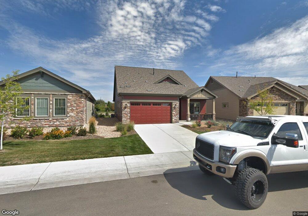
This home is located at 687 Brennan Cir, Erie, CO 80516 and is currently estimated at $853,927, approximately $309 per square foot. 687 Brennan Cir is a home located in Boulder County with nearby schools including Red Hawk Elementary School, Erie Middle School, and Erie High School.
Ownership History
Date
Name
Owned For
Owner Type
Purchase Details
Closed on
Mar 22, 2020
Sold by
Mds Properties Llc
Bought by
Diane Carter Revocable Trust
Current Estimated Value
Create a Home Valuation Report for This Property
The Home Valuation Report is an in-depth analysis detailing your home's value as well as a comparison with similar homes in the area
Home Values in the Area
Average Home Value in this Area
Purchase History
| Date | Buyer | Sale Price | Title Company |
|---|---|---|---|
| Diane Carter Revocable Trust | $591,000 | Land Title Guarantee |
Source: Public Records
Tax History Compared to Growth
Tax History
| Year | Tax Paid | Tax Assessment Tax Assessment Total Assessment is a certain percentage of the fair market value that is determined by local assessors to be the total taxable value of land and additions on the property. | Land | Improvement |
|---|---|---|---|---|
| 2025 | $8,467 | $53,413 | $10,525 | $42,888 |
| 2024 | $8,467 | $53,413 | $10,525 | $42,888 |
| 2023 | $8,423 | $56,809 | $14,016 | $46,478 |
| 2022 | $6,770 | $42,215 | $8,827 | $33,388 |
| 2021 | $6,909 | $43,430 | $9,081 | $34,349 |
| 2020 | $6,935 | $40,204 | $6,006 | $34,198 |
| 2019 | $6,922 | $40,204 | $6,006 | $34,198 |
| 2018 | $6,373 | $37,051 | $6,912 | $30,139 |
| 2017 | $2,707 | $16,240 | $16,240 | $0 |
| 2016 | $1,904 | $0 | $0 | $0 |
Source: Public Records
Map
Nearby Homes
- 688 Brennan Cir
- 671 Brennan Cir
- 549 Brennan Cir
- 1673 Bain Dr
- 1665 Bain Dr
- 375 Tynan Dr
- 717 Mcclure Ct
- 1600 Bain Dr
- 873 Mcclure Way
- 644 N Beshear Ct
- 936 Weston Cir
- 1600 Brimble Dr
- 700 S Beshear Ct
- 159 Summerfield Ct
- 1386 Avgare Way
- 993 Stanley Ct
- 602 Mathews Way
- 1416 Stockton Dr
- 1517 Stanley Dr
- 634 Apex St
- 687 Brennan Cir
- 689 Brennan Cir
- 685 Brennan Ct
- 685 Brennan Cir
- 691 Brennan Cir
- 683 Brennan Cir
- 681 Brennan Cir
- 684 Brennan Cir
- 692 Brennan Cir
- 503 Brennan Cir
- 501 Brennan Cir
- 679 Brennan Cir
- 505 Brennan Cir Unit 3
- 505 Brennan Cir
- 505 Brennan Cir Unit 3
- 505 Brennan Cir
- 507 Brennan Cir
- 507 Brennan Cir
- 678 Brennan Cir
- 502 Brennan Cir