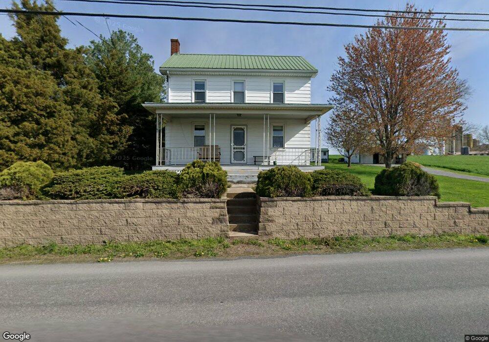
687 Lancaster Ave New Holland, PA 17557
Estimated Value: $254,000 - $438,000
5
Beds
1
Bath
1,144
Sq Ft
$273/Sq Ft
Est. Value
About This Home
This home is located at 687 Lancaster Ave, New Holland, PA 17557 and is currently estimated at $312,772, approximately $273 per square foot. 687 Lancaster Ave is a home located in Lancaster County with nearby schools including Garden Spot Middle School, Garden Spot Senior High School, and Hinkletown Mennonite School.
Ownership History
Date
Name
Owned For
Owner Type
Purchase Details
Closed on
Jan 24, 2024
Sold by
Nolt Eli M and Nolt Ellen S
Bought by
Stauffer Anne
Current Estimated Value
Purchase Details
Closed on
Oct 1, 2020
Sold by
Nolt Eli M and Nolt Ellen S
Bought by
Nolt Eli M and Nolt Ellen S
Purchase Details
Closed on
Jun 9, 2020
Sold by
Eby Elton Z and Eby Lena Mae
Bought by
Nolt Eli M
Purchase Details
Closed on
Oct 20, 2014
Bought by
Eby Elton Z
Purchase Details
Closed on
Jul 25, 2002
Sold by
Burkholder Nancy J
Bought by
Burkholder Alma S
Create a Home Valuation Report for This Property
The Home Valuation Report is an in-depth analysis detailing your home's value as well as a comparison with similar homes in the area
Home Values in the Area
Average Home Value in this Area
Purchase History
| Date | Buyer | Sale Price | Title Company |
|---|---|---|---|
| Stauffer Anne | $225,000 | None Listed On Document | |
| Nolt Eli M | -- | None Available | |
| Nolt Eli M | $185,000 | None Available | |
| Eby Elton Z | $160,000 | -- | |
| Burkholder Alma S | $58,000 | -- |
Source: Public Records
Tax History Compared to Growth
Tax History
| Year | Tax Paid | Tax Assessment Tax Assessment Total Assessment is a certain percentage of the fair market value that is determined by local assessors to be the total taxable value of land and additions on the property. | Land | Improvement |
|---|---|---|---|---|
| 2025 | $2,255 | $125,900 | $53,500 | $72,400 |
| 2024 | $2,255 | $125,900 | $53,500 | $72,400 |
| 2023 | $2,222 | $125,900 | $53,500 | $72,400 |
| 2022 | $2,198 | $125,900 | $53,500 | $72,400 |
| 2021 | $2,163 | $125,900 | $53,500 | $72,400 |
| 2020 | $2,163 | $125,900 | $53,500 | $72,400 |
| 2019 | $2,140 | $125,900 | $53,500 | $72,400 |
| 2018 | $3,119 | $125,900 | $53,500 | $72,400 |
| 2017 | $2,905 | $139,500 | $54,600 | $84,900 |
| 2016 | $2,905 | $139,500 | $54,600 | $84,900 |
| 2015 | $807 | $139,500 | $54,600 | $84,900 |
| 2014 | $2,011 | $139,500 | $54,600 | $84,900 |
Source: Public Records
Map
Nearby Homes
- 575 Red Run Rd
- 61 Gentle Dr
- 232 New St
- 200 E Main St
- 205 E Main St
- 412 Linden St
- 420 Linden St
- 133 Millstone Dr
- 111 Oatfield Dr
- 1258 Main St
- 210 Musser Rd
- 20 N Kinzer Ave
- 3 Whitetail Dr
- 148 E Broad St
- 322 Wissler Rd
- 391 E Jackson St
- 220 Sycamore Ln
- 144 W Conestoga St
- 385 Valley View Dr
- 117 Hawk Valley Ln Unit 105
- 685 Lancaster Ave
- 681 Lancaster Ave
- 684 Lancaster Ave
- 675 Lancaster Ave
- 680 Lancaster Ave
- 674 Lancaster Ave
- 672 Lancaster Ave
- 670 Lancaster Ave
- 578 White Oak Rd
- 668 Lancaster Ave
- 525 White Oak Rd
- 517 White Oak Rd
- 992 Lancaster Ave
- 528 White Oak Rd
- 515 White Oak Rd
- 622 White Oak Rd
- 628 White Oak Rd
- 576 Blue Rock Rd
- 1027 Lancaster Ave
- 698 Twin Hill Rd