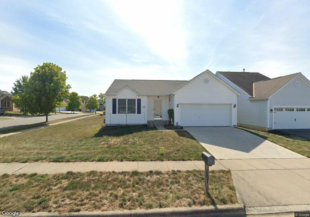
687 Orwell St Lithopolis, OH 43136
Bloom NeighborhoodEstimated Value: $282,171 - $363,000
3
Beds
2
Baths
1,254
Sq Ft
$265/Sq Ft
Est. Value
About This Home
This home is located at 687 Orwell St, Lithopolis, OH 43136 and is currently estimated at $332,793, approximately $265 per square foot. 687 Orwell St is a home located in Fairfield County with nearby schools including Bloom Carroll Primary School, Bloom Carroll Intermediate School, and Bloom-Carroll Middle School.
Ownership History
Date
Name
Owned For
Owner Type
Purchase Details
Closed on
Jul 30, 2004
Sold by
Dominion Homes Inc
Bought by
Waishnora John P
Current Estimated Value
Home Financials for this Owner
Home Financials are based on the most recent Mortgage that was taken out on this home.
Original Mortgage
$163,766
Outstanding Balance
$80,109
Interest Rate
6.34%
Mortgage Type
FHA
Estimated Equity
$252,684
Create a Home Valuation Report for This Property
The Home Valuation Report is an in-depth analysis detailing your home's value as well as a comparison with similar homes in the area
Home Values in the Area
Average Home Value in this Area
Purchase History
| Date | Buyer | Sale Price | Title Company |
|---|---|---|---|
| Waishnora John P | $165,500 | -- |
Source: Public Records
Mortgage History
| Date | Status | Borrower | Loan Amount |
|---|---|---|---|
| Open | Waishnora John P | $163,766 |
Source: Public Records
Tax History
| Year | Tax Paid | Tax Assessment Tax Assessment Total Assessment is a certain percentage of the fair market value that is determined by local assessors to be the total taxable value of land and additions on the property. | Land | Improvement |
|---|---|---|---|---|
| 2025 | $5,496 | $88,490 | $36,710 | $51,780 |
| 2024 | $5,496 | $69,220 | $11,140 | $58,080 |
| 2023 | $2,088 | $69,220 | $11,140 | $58,080 |
| 2022 | $2,137 | $69,220 | $11,140 | $58,080 |
| 2021 | $1,707 | $55,040 | $8,300 | $46,740 |
| 2020 | $1,726 | $55,040 | $8,300 | $46,740 |
| 2019 | $1,732 | $55,040 | $8,300 | $46,740 |
| 2018 | $1,672 | $44,610 | $8,300 | $36,310 |
| 2017 | $1,571 | $45,700 | $6,990 | $38,710 |
| 2016 | $1,546 | $45,700 | $6,990 | $38,710 |
| 2015 | $1,512 | $43,940 | $6,990 | $36,950 |
| 2014 | $1,460 | $43,940 | $6,990 | $36,950 |
| 2013 | $1,460 | $43,940 | $6,990 | $36,950 |
Source: Public Records
Map
Nearby Homes
- 146 Poe Ave
- 94 Sandburg Dr
- 248 Faulkner Dr
- 197 Faulkner Dr
- 891 Orwell St
- 1375 Hansberry Dr
- 89 Wheatley St
- 557 Eastman Ave
- 607 Eastman Ave
- 777 Faulkner Dr
- 0 Columbus St Unit 225023784
- 290 Jonathan Trail
- 5225 Lithopolis Winchester Nw Rd
- 6495 Saylor St
- 5795 Lithopolis Winchester Rd NW
- 19 W Columbus St
- 678 Green Forest Place
- 680 Crestview Dr
- 631 Rolling Acre Dr
- 0 Sycamore Bluff Way
- 701 Orwell St
- 684 Salinger Dr
- 684 Salinger Dr Unit 33
- 711 Orwell St
- 700 Salinger Dr
- 110 Salinger Dr
- 100 Salinger Dr
- 133 Salinger Dr
- 133 Salinger Dr Unit 31
- 120 Salinger Dr
- 721 Orwell St
- 710 Salinger Dr
- 90 Salinger Dr
- 90 Salinger Dr Unit 24
- 130 Salinger Dr
- 80 Salinger Dr
- 708 Orwell St
- 143 Salinger Dr
- 720 Salinger Dr
- 720 Salinger Dr Unit 36
Your Personal Tour Guide
Ask me questions while you tour the home.