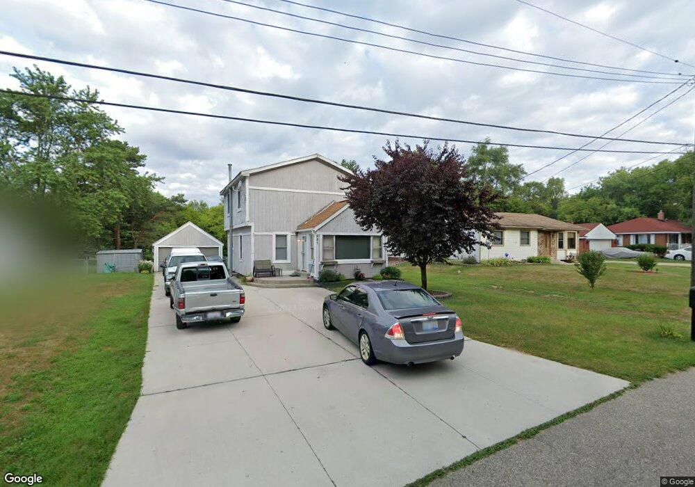
687 Reynolds Dr Waterford, MI 48328
Waterford Township NeighborhoodEstimated Value: $216,000 - $272,000
5
Beds
2
Baths
1,326
Sq Ft
$180/Sq Ft
Est. Value
About This Home
This home is located at 687 Reynolds Dr, Waterford, MI 48328 and is currently estimated at $238,336, approximately $179 per square foot. 687 Reynolds Dr is a home located in Oakland County with nearby schools including Knudsen Elementary School, Pierce Middle School, and Waterford Mott High School.
Ownership History
Date
Name
Owned For
Owner Type
Purchase Details
Closed on
Dec 8, 2021
Sold by
Kiefling Wyatt K
Bought by
Kiefling Karen Ruth
Current Estimated Value
Home Financials for this Owner
Home Financials are based on the most recent Mortgage that was taken out on this home.
Original Mortgage
$118,000
Outstanding Balance
$100,873
Interest Rate
2.98%
Mortgage Type
New Conventional
Estimated Equity
$137,463
Purchase Details
Closed on
Apr 12, 2000
Sold by
Kiefling Kyle D
Bought by
Kiefling Wyatt K
Create a Home Valuation Report for This Property
The Home Valuation Report is an in-depth analysis detailing your home's value as well as a comparison with similar homes in the area
Home Values in the Area
Average Home Value in this Area
Purchase History
| Date | Buyer | Sale Price | Title Company |
|---|---|---|---|
| Kiefling Karen Ruth | -- | None Listed On Document | |
| Kiefling Wyatt K | -- | -- |
Source: Public Records
Mortgage History
| Date | Status | Borrower | Loan Amount |
|---|---|---|---|
| Open | Kiefling Karen Ruth | $118,000 |
Source: Public Records
Tax History Compared to Growth
Tax History
| Year | Tax Paid | Tax Assessment Tax Assessment Total Assessment is a certain percentage of the fair market value that is determined by local assessors to be the total taxable value of land and additions on the property. | Land | Improvement |
|---|---|---|---|---|
| 2024 | $934 | $83,470 | $0 | $0 |
| 2023 | $891 | $73,200 | $0 | $0 |
| 2022 | $1,434 | $69,200 | $0 | $0 |
| 2021 | $1,357 | $61,780 | $0 | $0 |
| 2020 | $816 | $60,290 | $0 | $0 |
| 2019 | $1,960 | $56,220 | $0 | $0 |
| 2018 | $1,315 | $53,020 | $0 | $0 |
| 2017 | $1,209 | $53,020 | $0 | $0 |
| 2016 | $1,878 | $49,310 | $0 | $0 |
| 2015 | -- | $42,080 | $0 | $0 |
| 2014 | -- | $37,970 | $0 | $0 |
| 2011 | -- | $30,850 | $0 | $0 |
Source: Public Records
Map
Nearby Homes
- 571 Cristy Ave
- 4840 Hobson Ave
- 001 Hobson Ave
- 5184 Denwood St
- 867 Saybrook Dr
- 4935 Pontiac Lake Rd
- 00 Gilbo Ave
- 4882 Elizabeth Lake Rd
- 4875 Fenmore Ave
- 261 Hershey Blvd
- 5251 Pontiac Lake Rd
- 241 Reymont Rd
- 5357 Farm Rd
- 89 Clive Ave
- 4700 Siebert Rd
- 85 Doremus Ave
- 5510 Berkley Dr
- 5667 Brunswick Blvd
- 1360 Nancywood Dr
- 1727 Crescent Lake Rd
- 697 Reynolds Dr
- 675 Reynolds Dr
- 665 Reynolds Dr
- 711 Reynolds Dr
- 694 Reynolds Dr
- 655 Reynolds Dr
- 682 Reynolds Dr
- 714 Reynolds Dr
- 727 Reynolds Dr
- 670 Reynolds Dr
- 656 Reynolds Dr
- 686 Crescent Lake Rd
- 696 Crescent Lake Rd
- 664 Crescent Lake Rd
- 704 Crescent Lake Rd
- 740 Reynolds Dr
- 716 Crescent Lake Rd
- 640 Reynolds Dr
- 654 Crescent Lake Rd Unit Bldg-Unit
- 654 Crescent Lake Rd