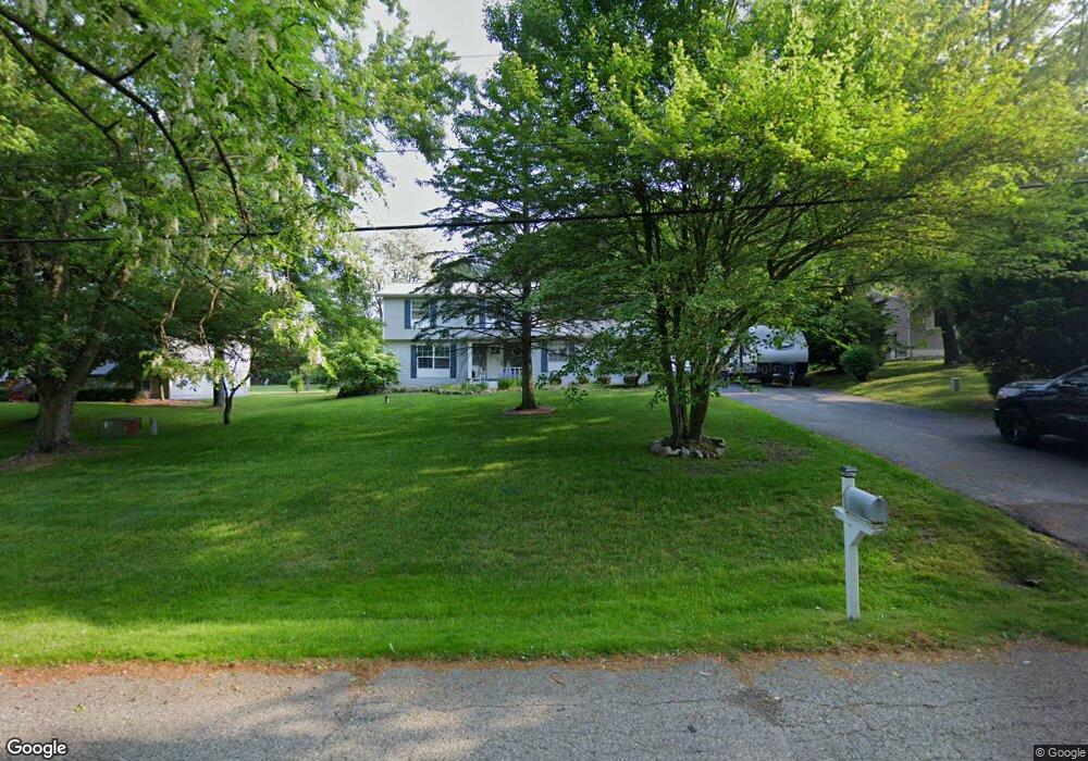
687 S Newman Rd Lake Orion, MI 48362
Estimated Value: $326,691 - $400,000
3
Beds
2
Baths
1,500
Sq Ft
$243/Sq Ft
Est. Value
About This Home
This home is located at 687 S Newman Rd, Lake Orion, MI 48362 and is currently estimated at $364,423, approximately $242 per square foot. 687 S Newman Rd is a home located in Oakland County with nearby schools including Paint Creek Elementary School, Scripps Middle School, and Lake Orion Community High School.
Ownership History
Date
Name
Owned For
Owner Type
Purchase Details
Closed on
Jun 21, 2004
Sold by
Arnold Matthew D and Arnold Natalie A
Bought by
Persinger Guy and Persinger Heidi
Current Estimated Value
Home Financials for this Owner
Home Financials are based on the most recent Mortgage that was taken out on this home.
Original Mortgage
$182,400
Outstanding Balance
$86,884
Interest Rate
5.62%
Mortgage Type
Purchase Money Mortgage
Estimated Equity
$277,539
Purchase Details
Closed on
Mar 21, 2000
Sold by
Meyer Ronald E
Bought by
Arnold Matthew D
Purchase Details
Closed on
Mar 10, 1997
Sold by
Silverman Building Co In
Bought by
Hartman William M
Purchase Details
Closed on
Sep 14, 1995
Sold by
Mcmorris Allan Kemp
Bought by
Meyer Ronald E
Home Financials for this Owner
Home Financials are based on the most recent Mortgage that was taken out on this home.
Original Mortgage
$112,800
Interest Rate
8%
Create a Home Valuation Report for This Property
The Home Valuation Report is an in-depth analysis detailing your home's value as well as a comparison with similar homes in the area
Home Values in the Area
Average Home Value in this Area
Purchase History
| Date | Buyer | Sale Price | Title Company |
|---|---|---|---|
| Persinger Guy | $228,000 | Metropolitan Title Company | |
| Arnold Matthew D | $184,000 | -- | |
| Hartman William M | $239,990 | -- | |
| Meyer Ronald E | $141,000 | -- |
Source: Public Records
Mortgage History
| Date | Status | Borrower | Loan Amount |
|---|---|---|---|
| Open | Persinger Guy | $182,400 | |
| Previous Owner | Meyer Ronald E | $112,800 |
Source: Public Records
Tax History Compared to Growth
Tax History
| Year | Tax Paid | Tax Assessment Tax Assessment Total Assessment is a certain percentage of the fair market value that is determined by local assessors to be the total taxable value of land and additions on the property. | Land | Improvement |
|---|---|---|---|---|
| 2024 | $1,656 | $120,050 | $0 | $0 |
| 2023 | $1,580 | $108,410 | $0 | $0 |
| 2022 | $2,229 | $103,350 | $0 | $0 |
| 2021 | $2,127 | $101,250 | $0 | $0 |
| 2020 | $1,448 | $90,630 | $0 | $0 |
| 2019 | $1,970 | $86,100 | $0 | $0 |
| 2018 | $1,965 | $78,800 | $0 | $0 |
| 2017 | $1,876 | $78,800 | $0 | $0 |
| 2016 | $1,869 | $70,800 | $0 | $0 |
| 2015 | -- | $67,270 | $0 | $0 |
| 2014 | -- | $64,740 | $0 | $0 |
| 2011 | -- | $51,710 | $0 | $0 |
Source: Public Records
Map
Nearby Homes
- 656 Lawson Dr
- 1859 Lonesome Lake Ct
- 468 Orchard Ridge Dr
- 449 Joslyn Rd
- 271 Greenan Ln
- 302 Kirksway Ln
- 1412 Marina Pointe Blvd
- 1075 Beach Dr
- 35 N Broadway St
- 1772 Berwick Ln
- 84 Greenan Ln
- 840 Laird St
- 2999 Buckner Rd
- 1906 Indianwood Rd
- 816 Vernita Dr
- 101 N Newman Rd
- 239 Pine Tree Rd
- 2480 Indianwood Rd
- 3230 Park Meadow Dr
- 850 W Clarkston Rd
- 675 S Newman Rd
- 699 S Newman Rd
- 688 Bosco Dr
- 663 S Newman Rd
- 676 Bosco Dr
- 700 Bosco Dr
- 700 S Newman Rd
- 664 Bosco Dr Unit 34
- 710 Bosco Dr
- 725 S Newman Rd
- 649 S Newman Rd
- 720 S Newman Rd
- 635 S Newman Rd
- 724 Bosco Dr
- 652 Bosco Dr
- 660 S Newman Rd
- 638 Kentwood Ct Unit 32
- 741 S Newman Rd
- 646 S Newman Rd
- 687 Bosco Dr