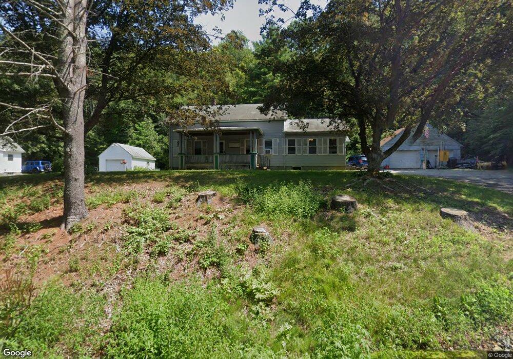
687 South St Southbridge, MA 01550
Estimated Value: $253,000 - $350,000
3
Beds
2
Baths
1,443
Sq Ft
$216/Sq Ft
Est. Value
About This Home
This home is located at 687 South St, Southbridge, MA 01550 and is currently estimated at $312,096, approximately $216 per square foot. 687 South St is a home located in Worcester County with nearby schools including Trinity Catholic Academy.
Ownership History
Date
Name
Owned For
Owner Type
Purchase Details
Closed on
Jul 9, 2024
Sold by
Hutchinson Arlene Z
Bought by
Silveira Courtney and Silveira Luiz
Current Estimated Value
Home Financials for this Owner
Home Financials are based on the most recent Mortgage that was taken out on this home.
Original Mortgage
$250,000
Outstanding Balance
$247,037
Interest Rate
7.03%
Mortgage Type
Purchase Money Mortgage
Estimated Equity
$65,059
Purchase Details
Closed on
Jan 5, 2011
Sold by
Hutchinson William W and Roberts Gay C
Bought by
Hutchinson William W and Hutchinson Arlene Z
Create a Home Valuation Report for This Property
The Home Valuation Report is an in-depth analysis detailing your home's value as well as a comparison with similar homes in the area
Home Values in the Area
Average Home Value in this Area
Purchase History
| Date | Buyer | Sale Price | Title Company |
|---|---|---|---|
| Silveira Courtney | $250,000 | None Available | |
| Silveira Courtney | $250,000 | None Available | |
| Silveira Courtney | $250,000 | None Available | |
| Hutchinson William W | -- | -- | |
| Hutchinson William W | -- | -- |
Source: Public Records
Mortgage History
| Date | Status | Borrower | Loan Amount |
|---|---|---|---|
| Open | Silveira Courtney | $250,000 | |
| Closed | Silveira Courtney | $250,000 |
Source: Public Records
Tax History Compared to Growth
Tax History
| Year | Tax Paid | Tax Assessment Tax Assessment Total Assessment is a certain percentage of the fair market value that is determined by local assessors to be the total taxable value of land and additions on the property. | Land | Improvement |
|---|---|---|---|---|
| 2025 | $4,336 | $295,800 | $59,000 | $236,800 |
| 2024 | $4,206 | $275,600 | $49,700 | $225,900 |
| 2023 | $4,014 | $253,400 | $49,700 | $203,700 |
| 2022 | $3,850 | $215,100 | $42,500 | $172,600 |
| 2021 | $3,550 | $182,600 | $42,500 | $140,100 |
| 2020 | $3,263 | $167,500 | $42,500 | $125,000 |
| 2018 | $3,187 | $153,600 | $42,500 | $111,100 |
| 2017 | $2,987 | $145,200 | $42,500 | $102,700 |
| 2016 | $2,934 | $145,200 | $42,500 | $102,700 |
| 2015 | $2,907 | $142,800 | $42,500 | $100,300 |
| 2014 | $2,779 | $141,500 | $42,500 | $99,000 |
Source: Public Records
Map
Nearby Homes
- 444 Dennison Dr
- 467 Durfee St
- 36 Litchfield Ave
- 691 Dennison Dr
- 48 Dennison Hill Rd
- 170 Shepard Rd
- 77 Westwood Pkwy
- 28 Servant Way
- 20 Glover St
- 72 High St
- 22 Jacobs Rd
- Lots 25-27 Dennison Ln
- 389 Breakneck Rd
- 21 Orchard St
- 38 Glenwood Ave
- 14 Harding Ct
- 209 Marcy St
- 172 Marcy St
- 10 Orchard Rd
- Lot 1 Berry Farms Road-2 Acre
- 679 South St
- 106 Harwood Farm Rd
- 102 Harwood Farm Rd
- 92 Harwood Farm Rd
- 120 Harwood Farm Rd
- 733 South St
- 86 Harwood Farm Rd
- 95 Harwood Farm Rd
- 77 Pine Ridge Rd
- 741 South St
- 63 Pine Ridge Rd
- 87 Harwood Farm Rd
- 47 Pine Ridge Rd
- 134 Harwood Farm Rd
- 143 Harwood Farm Rd
- 77 Harwood Farm Rd
- 35 Pine Ridge Rd
- 72 Pine Ridge Rd
- 151 Harwood Farm Rd
- 62 Pine Ridge Rd