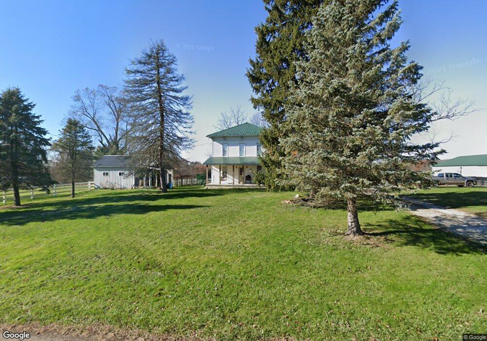
6870 Follin Rd Bellville, OH 44813
Estimated Value: $249,000 - $361,671
3
Beds
2
Baths
2,736
Sq Ft
$112/Sq Ft
Est. Value
About This Home
This home is located at 6870 Follin Rd, Bellville, OH 44813 and is currently estimated at $306,418, approximately $111 per square foot. 6870 Follin Rd is a home located in Richland County with nearby schools including Clear Fork High School.
Ownership History
Date
Name
Owned For
Owner Type
Purchase Details
Closed on
Dec 14, 1995
Sold by
Musilli Dale M
Bought by
Byler Paul A and Byler Polly E
Current Estimated Value
Home Financials for this Owner
Home Financials are based on the most recent Mortgage that was taken out on this home.
Original Mortgage
$47,000
Interest Rate
7.25%
Mortgage Type
New Conventional
Create a Home Valuation Report for This Property
The Home Valuation Report is an in-depth analysis detailing your home's value as well as a comparison with similar homes in the area
Home Values in the Area
Average Home Value in this Area
Purchase History
| Date | Buyer | Sale Price | Title Company |
|---|---|---|---|
| Byler Paul A | $59,500 | -- |
Source: Public Records
Mortgage History
| Date | Status | Borrower | Loan Amount |
|---|---|---|---|
| Closed | Byler Paul A | $47,000 |
Source: Public Records
Tax History Compared to Growth
Tax History
| Year | Tax Paid | Tax Assessment Tax Assessment Total Assessment is a certain percentage of the fair market value that is determined by local assessors to be the total taxable value of land and additions on the property. | Land | Improvement |
|---|---|---|---|---|
| 2024 | $1,412 | $53,300 | $12,990 | $40,310 |
| 2023 | $1,412 | $53,300 | $12,990 | $40,310 |
| 2022 | $1,371 | $46,740 | $11,070 | $35,670 |
| 2021 | $1,524 | $46,740 | $11,070 | $35,670 |
| 2020 | $1,438 | $46,740 | $11,070 | $35,670 |
| 2019 | $1,284 | $39,910 | $9,380 | $30,530 |
| 2018 | $1,271 | $39,910 | $9,380 | $30,530 |
| 2017 | $1,250 | $39,910 | $9,380 | $30,530 |
| 2016 | $1,266 | $38,720 | $7,770 | $30,950 |
| 2015 | $1,266 | $38,720 | $7,770 | $30,950 |
| 2014 | $1,262 | $38,720 | $7,770 | $30,950 |
| 2012 | $583 | $38,720 | $7,770 | $30,950 |
Source: Public Records
Map
Nearby Homes
- 6334 Black Rd
- 7086 State Route 546
- 1261 Honey Creek Rd W
- 7230 State Route 13
- 644 Ross Rd
- 479 Ross Rd
- 76 Smith Rd
- 598 Bollinger Rd
- 559 Poorman Rd
- 11936 Yankee St
- 5643 Yankee St
- 5800 Ankneytown Rd
- 343 W Durbin Ave
- 6533 Durbin Rd
- 4502 Mill Run Rd
- 7000 Township Road 85
- 2785 Rd
- 32 Betty Dr
- 70 Betty Dr
- 18245 Waterford Rd