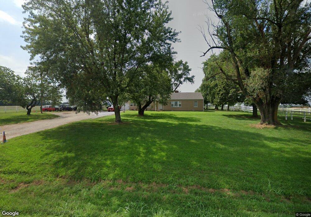
6870 W State Highway 266 Springfield, MO 65802
West Springfield NeighborhoodEstimated Value: $250,000 - $290,514
3
Beds
1
Bath
1,324
Sq Ft
$203/Sq Ft
Est. Value
About This Home
This home is located at 6870 W State Highway 266, Springfield, MO 65802 and is currently estimated at $269,129, approximately $203 per square foot. 6870 W State Highway 266 is a home located in Greene County with nearby schools including Willard Central Elementary School, Willard Intermediate School North, and Willard High School.
Ownership History
Date
Name
Owned For
Owner Type
Purchase Details
Closed on
Aug 17, 2018
Sold by
Killingsworth Roscoe and Killingsworth Barbara
Bought by
Hancock Randy Willaim
Current Estimated Value
Home Financials for this Owner
Home Financials are based on the most recent Mortgage that was taken out on this home.
Original Mortgage
$161,519
Outstanding Balance
$142,121
Interest Rate
5.12%
Mortgage Type
FHA
Estimated Equity
$127,008
Purchase Details
Closed on
Feb 21, 2018
Sold by
Longan Gladys Fern
Bought by
Killingsworth Roscoe and Killingsworth Barbara
Purchase Details
Closed on
Oct 9, 2012
Sold by
Longan Gladys Fern
Bought by
Rippee Linda Kay and Tandy Angela Lea
Create a Home Valuation Report for This Property
The Home Valuation Report is an in-depth analysis detailing your home's value as well as a comparison with similar homes in the area
Home Values in the Area
Average Home Value in this Area
Purchase History
| Date | Buyer | Sale Price | Title Company |
|---|---|---|---|
| Hancock Randy Willaim | -- | Continental Title | |
| Killingsworth Roscoe | $74,100 | None Available | |
| Rippee Linda Kay | -- | None Available |
Source: Public Records
Mortgage History
| Date | Status | Borrower | Loan Amount |
|---|---|---|---|
| Open | Hancock Randy Willaim | $161,519 |
Source: Public Records
Tax History Compared to Growth
Tax History
| Year | Tax Paid | Tax Assessment Tax Assessment Total Assessment is a certain percentage of the fair market value that is determined by local assessors to be the total taxable value of land and additions on the property. | Land | Improvement |
|---|---|---|---|---|
| 2025 | $1,458 | $30,730 | $9,500 | $21,230 |
| 2024 | $1,458 | $26,000 | $6,650 | $19,350 |
| 2023 | $1,451 | $26,000 | $6,650 | $19,350 |
| 2022 | $1,427 | $25,330 | $6,650 | $18,680 |
| 2021 | $1,427 | $25,330 | $6,650 | $18,680 |
| 2020 | $1,157 | $22,310 | $6,650 | $15,660 |
| 2019 | $1,153 | $22,310 | $6,650 | $15,660 |
| 2018 | $866 | $16,660 | $6,650 | $10,010 |
| 2017 | $859 | $16,600 | $6,650 | $9,950 |
| 2016 | $851 | $16,600 | $6,650 | $9,950 |
| 2015 | $845 | $16,600 | $6,650 | $9,950 |
| 2014 | $850 | $16,590 | $6,650 | $9,940 |
Source: Public Records
Map
Nearby Homes
- 000 W Independence Dr
- 7593 W Farm Road 124
- 6789 W Farm Road 144
- 768 S Long Dr
- 226 N Sunrise Ln
- 5721 W Alexa Ln
- 923 S Natalie Ave
- 995 S Natalie Ave
- 489 N Farm Road 89
- 636 S Farm Road 89
- 5640 W Sunflower Dr
- 000 S Farm Road 97
- 5590 W Sunflower Dr
- 5610 W Sugar Pine Dr
- 1069 S Red Cedar Ave
- 834 S Lester Rd
- 5441 Basswood Ct W
- 000-Trct 4 N Farm Road 89
- 000-Trct 3 N Farm Road 89
- 2548 Arrow Ln N
- 000 S Farm Road 99
- 6724 W State Highway 266
- 297 N State Highway B
- 7049 W State Highway 266
- 6675 W State Highway 266
- 6612 W State Highway 266
- 520 N Hawk Ln
- 285 S Farm Road 99
- 702 N State Highway Ab
- 376 S State Highway B
- 329 S Farm Road 99
- 367 S Farm Road 99
- 1311 Kentucky St
- 0 N State Hwy B Unit 11001545
- 0 N State Hwy B Unit 11305152
- 0 N State Hwy B Unit 11304959
- 0 N State Hwy B Unit 11305099
- 0 N State Hwy B Unit 11307190
- 0 N State Hwy B Unit 11307184
- 0 N State Hwy B Unit 11311231