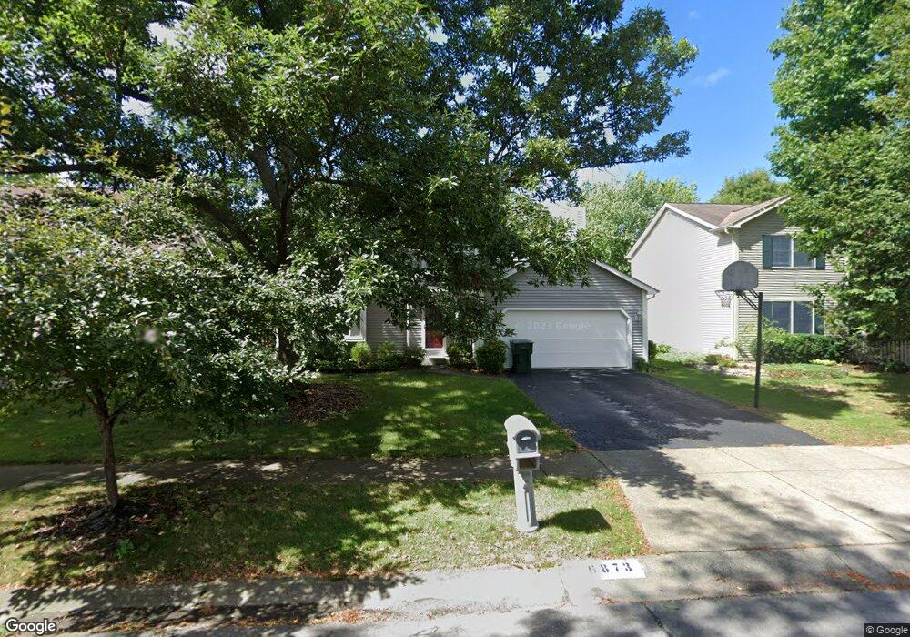
6873 Spruce Pine Dr Columbus, OH 43235
Brookside Colony NeighborhoodEstimated Value: $393,451 - $447,000
4
Beds
3
Baths
1,918
Sq Ft
$218/Sq Ft
Est. Value
About This Home
This home is located at 6873 Spruce Pine Dr, Columbus, OH 43235 and is currently estimated at $418,113, approximately $217 per square foot. 6873 Spruce Pine Dr is a home located in Franklin County with nearby schools including Indian Run Elementary School, Ann Simpson Davis Middle School, and Dublin Scioto High School.
Ownership History
Date
Name
Owned For
Owner Type
Purchase Details
Closed on
Jul 3, 1995
Sold by
Harris Jeffrey W
Bought by
Pinto T Donald and Pinto Kathleen
Current Estimated Value
Purchase Details
Closed on
Sep 26, 1990
Purchase Details
Closed on
Jun 30, 1988
Create a Home Valuation Report for This Property
The Home Valuation Report is an in-depth analysis detailing your home's value as well as a comparison with similar homes in the area
Home Values in the Area
Average Home Value in this Area
Purchase History
| Date | Buyer | Sale Price | Title Company |
|---|---|---|---|
| Pinto T Donald | $141,000 | -- | |
| -- | $121,900 | -- | |
| -- | $95,200 | -- |
Source: Public Records
Mortgage History
| Date | Status | Borrower | Loan Amount |
|---|---|---|---|
| Closed | Pinto T Donald | -- |
Source: Public Records
Tax History
| Year | Tax Paid | Tax Assessment Tax Assessment Total Assessment is a certain percentage of the fair market value that is determined by local assessors to be the total taxable value of land and additions on the property. | Land | Improvement |
|---|---|---|---|---|
| 2025 | $6,937 | $114,700 | $34,650 | $80,050 |
| 2024 | $6,937 | $114,700 | $34,650 | $80,050 |
| 2023 | $6,840 | $114,700 | $34,650 | $80,050 |
| 2022 | $5,878 | $91,600 | $17,010 | $74,590 |
| 2021 | $5,973 | $91,600 | $17,010 | $74,590 |
| 2020 | $5,937 | $91,600 | $17,010 | $74,590 |
| 2019 | $5,471 | $74,730 | $14,180 | $60,550 |
| 2018 | $5,086 | $74,730 | $14,180 | $60,550 |
| 2017 | $5,051 | $74,730 | $14,180 | $60,550 |
| 2016 | $4,650 | $64,620 | $17,750 | $46,870 |
| 2015 | $4,679 | $64,620 | $17,750 | $46,870 |
| 2014 | $4,683 | $64,620 | $17,750 | $46,870 |
| 2013 | $2,323 | $63,140 | $17,745 | $45,395 |
Source: Public Records
Map
Nearby Homes
- 6924 Spruce Pine Dr
- 2062 Decker Ct
- 7155 Asheville Park Dr
- 6747 Merwin Rd
- 2001 Sawbury Blvd Unit 2001
- 2026 Sawbury Blvd
- 2024 Sawbury Blvd
- 6829 Merwood St
- 6637 Merwin Rd
- 2074 Hard Rd
- 7164 Durness Place
- 7641 Old Foxe Ct
- 2487 Timbers Edge Ln Unit 2487
- 2279 Fernleaf Ln
- 1354 Lorine Place
- 7735 Schoolway Ct
- 2546 Timberside Dr Unit 2546
- 7755 Tripoli Ct
- 2469 Sandstrom Dr
- 6789 Meadow Creek Dr Unit 101
- 6865 Spruce Pine Dr
- 6881 Spruce Pine Dr
- 6857 Spruce Pine Dr
- 6889 Spruce Pine Dr
- 6872 Pine Bark Ln
- 6888 Pine Bark Ln
- 6849 Spruce Pine Dr
- 6864 Pine Bark Ln
- 6868 Spruce Pine Dr
- 6897 Spruce Pine Dr
- 6884 Spruce Pine Dr
- 6894 Pine Bark Ln
- 6860 Spruce Pine Dr
- 6892 Spruce Pine Dr
- 6841 Spruce Pine Dr
- 6900 Spruce Pine Dr
- 6852 Spruce Pine Dr
- 6844 Spruce Pine Dr
- 6900 Pine Bark Ln
- 6848 Pine Bark Ln
Your Personal Tour Guide
Ask me questions while you tour the home.