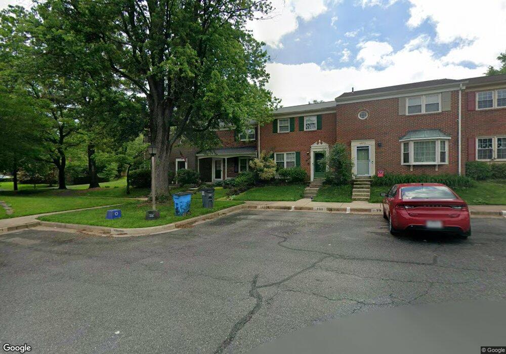
6876 Brian Michael Ct Springfield, VA 22153
Estimated Value: $541,000 - $615,000
3
Beds
4
Baths
2,012
Sq Ft
$290/Sq Ft
Est. Value
About This Home
This home is located at 6876 Brian Michael Ct, Springfield, VA 22153 and is currently estimated at $583,897, approximately $290 per square foot. 6876 Brian Michael Ct is a home located in Fairfax County with nearby schools including Orange Hunt Elementary School, Irving Middle School, and West Springfield High School.
Ownership History
Date
Name
Owned For
Owner Type
Purchase Details
Closed on
Jul 29, 2010
Sold by
Byland Robert N and Pritz Anne F
Bought by
Eadie V Robert W
Current Estimated Value
Home Financials for this Owner
Home Financials are based on the most recent Mortgage that was taken out on this home.
Original Mortgage
$291,315
Outstanding Balance
$194,911
Interest Rate
4.78%
Mortgage Type
FHA
Estimated Equity
$388,986
Create a Home Valuation Report for This Property
The Home Valuation Report is an in-depth analysis detailing your home's value as well as a comparison with similar homes in the area
Home Values in the Area
Average Home Value in this Area
Purchase History
| Date | Buyer | Sale Price | Title Company |
|---|---|---|---|
| Eadie V Robert W | $299,900 | -- |
Source: Public Records
Mortgage History
| Date | Status | Borrower | Loan Amount |
|---|---|---|---|
| Open | Eadie V Robert W | $291,315 |
Source: Public Records
Tax History
| Year | Tax Paid | Tax Assessment Tax Assessment Total Assessment is a certain percentage of the fair market value that is determined by local assessors to be the total taxable value of land and additions on the property. | Land | Improvement |
|---|---|---|---|---|
| 2025 | $5,962 | $533,010 | $165,000 | $368,010 |
| 2024 | $5,962 | $514,670 | $150,000 | $364,670 |
| 2023 | $5,505 | $487,850 | $150,000 | $337,850 |
| 2022 | $5,346 | $467,550 | $145,000 | $322,550 |
| 2021 | $5,013 | $427,200 | $130,000 | $297,200 |
| 2020 | $4,790 | $404,730 | $110,000 | $294,730 |
| 2019 | $4,603 | $388,940 | $110,000 | $278,940 |
| 2018 | $4,288 | $372,900 | $100,000 | $272,900 |
| 2017 | $4,329 | $372,900 | $100,000 | $272,900 |
| 2016 | $4,148 | $358,030 | $90,000 | $268,030 |
Source: Public Records
Map
Nearby Homes
- 8905 Side Saddle Rd
- 7121 Red Horse Tavern Ln
- 8967 Omega Ct
- 6360 Draco St
- 7200 Beachway Ct
- 9202 Rockefeller Ln
- 6606 Huntsman Blvd
- 6319 Fenestra Ct Unit 138A
- 6622 Crayford St
- 7149 Game Lord Dr
- 6352 Shaundale Dr
- 9712 Klimt Ct
- 9512 Meadow Grove Ct
- 6819 Lavant Dr
- 8826 Surveyors Place
- 9075 Andromeda Dr
- 8615 Kerry Ln
- 6410 Wyngate Dr
- 8600 Kentford Dr
- 8868 Winding Hollow Way
- 6874 Brian Michael Ct
- 6878 Brian Michael Ct
- 6872 Brian Michael Ct
- 6870 Brian Michael Ct
- 6880 Brian Michael Ct
- 6868 Brian Michael Ct
- 9120 Conservation Way
- 9118 Conservation Way
- 9124 Conservation Way
- 9116 Conservation Way
- 6866 Brian Michael Ct
- 9114 Conservation Way
- 9126 Conservation Way
- 6882 Brian Michael Ct
- 9112 Conservation Way
- 6884 Brian Michael Ct
- 6864 Brian Michael Ct
- 9110 Conservation Way
- 6886 Brian Michael Ct
- 9128 Conservation Way
Your Personal Tour Guide
Ask me questions while you tour the home.