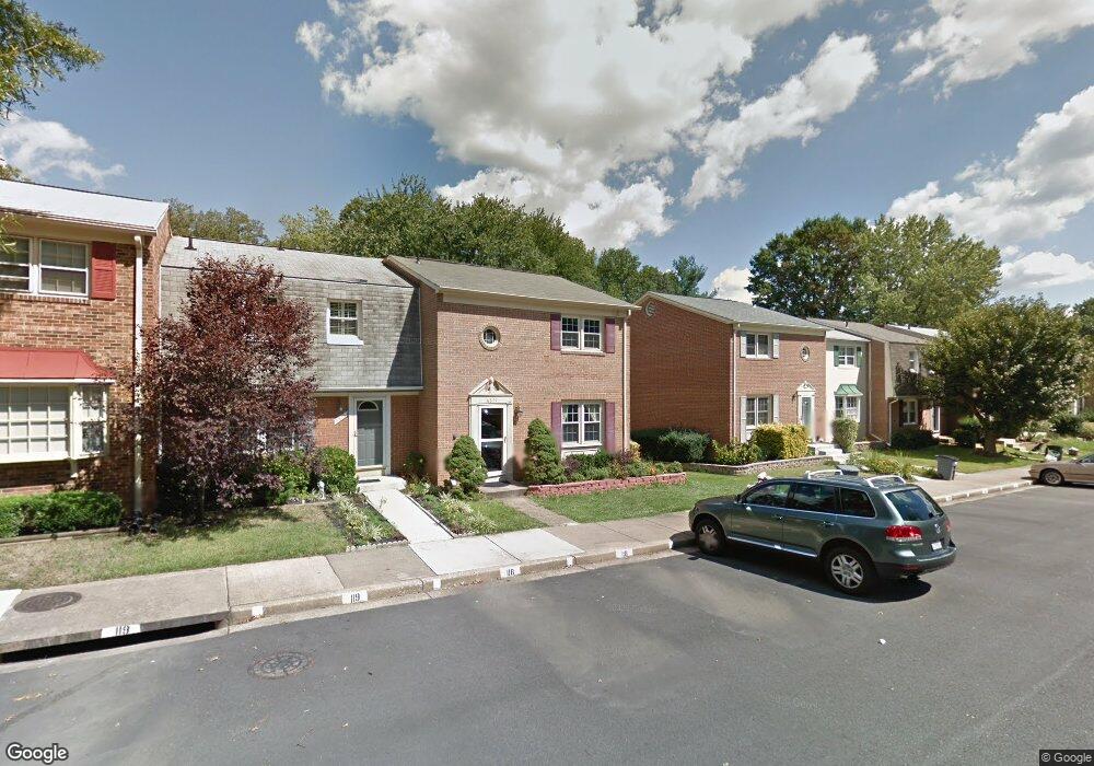
6877 Brian Michael Ct Springfield, VA 22153
Estimated Value: $605,000 - $623,000
3
Beds
4
Baths
1,408
Sq Ft
$436/Sq Ft
Est. Value
About This Home
This home is located at 6877 Brian Michael Ct, Springfield, VA 22153 and is currently estimated at $614,110, approximately $436 per square foot. 6877 Brian Michael Ct is a home located in Fairfax County with nearby schools including Orange Hunt Elementary School, Irving Middle School, and West Springfield High School.
Ownership History
Date
Name
Owned For
Owner Type
Purchase Details
Closed on
Apr 27, 2024
Sold by
Abdulrazak Asma
Bought by
Abdulrazak Asma and Hassan Ali
Current Estimated Value
Purchase Details
Closed on
Sep 7, 2023
Sold by
Dhumed Husam and Abdulrazak Asma
Bought by
Abdulrazak Asma
Purchase Details
Closed on
Aug 30, 2005
Sold by
Gandhi Ujwal R
Bought by
Dhumed Husam and Abdulrazak,Asma A
Home Financials for this Owner
Home Financials are based on the most recent Mortgage that was taken out on this home.
Original Mortgage
$326,400
Interest Rate
5.81%
Mortgage Type
New Conventional
Purchase Details
Closed on
Sep 14, 2000
Sold by
Mcnair Michael S
Bought by
Gandhi Juwal R
Home Financials for this Owner
Home Financials are based on the most recent Mortgage that was taken out on this home.
Original Mortgage
$130,400
Interest Rate
8.07%
Create a Home Valuation Report for This Property
The Home Valuation Report is an in-depth analysis detailing your home's value as well as a comparison with similar homes in the area
Home Values in the Area
Average Home Value in this Area
Purchase History
| Date | Buyer | Sale Price | Title Company |
|---|---|---|---|
| Abdulrazak Asma | -- | None Listed On Document | |
| Abdulrazak Asma | -- | None Listed On Document | |
| Dhumed Husam | $408,000 | -- | |
| Gandhi Juwal R | $163,000 | -- |
Source: Public Records
Mortgage History
| Date | Status | Borrower | Loan Amount |
|---|---|---|---|
| Previous Owner | Dhumed Husam | $326,400 | |
| Previous Owner | Gandhi Juwal R | $130,400 |
Source: Public Records
Tax History
| Year | Tax Paid | Tax Assessment Tax Assessment Total Assessment is a certain percentage of the fair market value that is determined by local assessors to be the total taxable value of land and additions on the property. | Land | Improvement |
|---|---|---|---|---|
| 2025 | $5,954 | $532,130 | $170,000 | $362,130 |
| 2024 | $5,954 | $513,980 | $155,000 | $358,980 |
| 2023 | $5,502 | $487,580 | $155,000 | $332,580 |
| 2022 | $5,347 | $467,560 | $150,000 | $317,560 |
| 2021 | $5,021 | $427,830 | $135,000 | $292,830 |
| 2020 | $4,799 | $405,470 | $115,000 | $290,470 |
| 2019 | $4,615 | $389,940 | $115,000 | $274,940 |
| 2018 | $4,302 | $374,080 | $105,000 | $269,080 |
| 2017 | $4,343 | $374,080 | $105,000 | $269,080 |
| 2016 | $4,128 | $356,280 | $92,000 | $264,280 |
| 2015 | $3,713 | $332,670 | $82,000 | $250,670 |
| 2014 | $3,250 | $291,890 | $72,000 | $219,890 |
Source: Public Records
Map
Nearby Homes
- 6360 Draco St
- 8905 Side Saddle Rd
- 7121 Red Horse Tavern Ln
- 6319 Fenestra Ct Unit 138A
- 6606 Huntsman Blvd
- 6622 Crayford St
- 6352 Shaundale Dr
- 7200 Beachway Ct
- 9512 Meadow Grove Ct
- 9202 Rockefeller Ln
- 7149 Game Lord Dr
- 9712 Klimt Ct
- 9075 Andromeda Dr
- 8826 Surveyors Place
- 6819 Lavant Dr
- 8868 Winding Hollow Way
- 6410 Wyngate Dr
- 8615 Kerry Ln
- 8600 Kentford Dr
- 6143 Green Hollow Ct
- 6875 Brian Michael Ct
- 6879 Brian Michael Ct
- 6873 Brian Michael Ct
- 6881 Brian Michael Ct
- 6871 Brian Michael Ct
- 6885 Brian Michael Ct
- 6887 Brian Michael Ct
- 6852 Brian Michael Ct
- 6889 Brian Michael Ct
- 6869 Brian Michael Ct
- 6854 Brian Michael Ct
- 6850 Brian Michael Ct
- 6891 Brian Michael Ct
- 6867 Brian Michael Ct
- 6856 Brian Michael Ct
- 6846 Brian Michael Ct
- 6865 Brian Michael Ct
- 6858 Brian Michael Ct
- 6629 Keene Dr
- 6863 Brian Michael Ct
Your Personal Tour Guide
Ask me questions while you tour the home.